

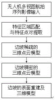
Unmanned aerial vehicle aerial photography sequence image-based slope three-dimension reconstruction method
A 3D reconstruction and slope technology, applied in 3D modeling, image data processing, instruments, etc., can solve the problems of high cost and poor flexibility, and achieve the effect of low cost, easy portability and high imaging resolution
- Summary
- Abstract
- Description
- Claims
- Application Information
AI Technical Summary
Problems solved by technology
Method used
Image

Examples
Embodiment 1
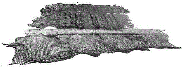
[0027] Example 1: 3D terrain reconstruction of a certain slope
[0028] Select a certain slope, the width of the front edge is about 75m, the width of the rear edge is about 50m, the height difference between the front and back edges is about 20m, and the length of the slope is about 40m. There is no vegetation coverage on the slope surface.
[0029] (1) After preliminary lens correction of the captured images, 20 clear and highly overlapping multi-view images were selected. The algorithm based on feature matching refers to the algorithm based on Scale Invariant Feature Transform (SIFT) to perform feature Region matching and feature point pair extraction, 6000-7000 feature point information can be extracted from each single image, including RGB information of feature image points, the specific steps are as follows:
[0030] By comparing the sampling point with all adjacent points, detect the extreme points of the scale space, and preliminarily determine the position and scale...
PUM
 Abstract
Description
Claims
Application Information