Calculating method for optimal route of unmanned aerial vehicle used for positioning object in threat environment

A technology of target positioning and calculation method, applied in the field of target positioning and tracking, UAV route planning, can solve problems that are difficult to meet the actual application requirements, and achieve the effect of improving survival efficiency

Inactive Publication Date: 2016-08-10
UNIV OF ELECTRONICS SCI & TECH OF CHINA
View PDF7 Cites 17 Cited by
  • Summary
  • Abstract
  • Description
  • Claims
  • Application Information

AI Technical Summary

Problems solved by technology

The air defense technology in modern warfare is becoming more and more perfect, and it is difficult to meet the actual application requirements of modern complex tasks simply relying on manual operation planning and evaluation route

Method used


Image

  • Calculating method for optimal route of unmanned aerial vehicle used for positioning object in threat environment
  • Calculating method for optimal route of unmanned aerial vehicle used for positioning object in threat environment
  • Calculating method for optimal route of unmanned aerial vehicle used for positioning object in threat environment

Examples


Embodiment Construction

[0021] 1. Establish an azimuth-only positioning model for a single UAV.

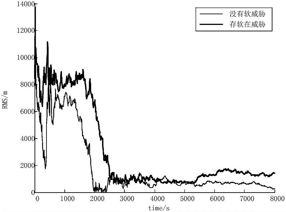
[0022] 2. The self-adaptive motion of the UAV is used to locate and track stationary targets and low-speed moving targets respectively. The criterion for the self-adaptive motion of the UAV is to maximize the accuracy of target positioning.

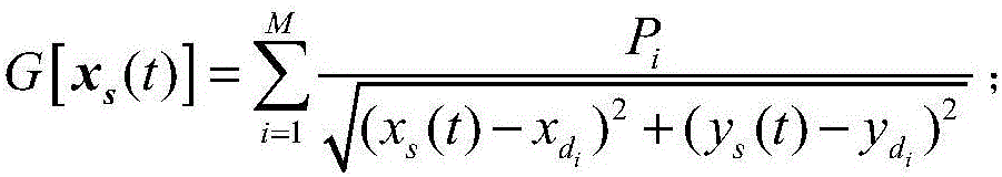
[0023] 3. Establish a mathematical model of the enemy's threat and evaluate the degree of threat.

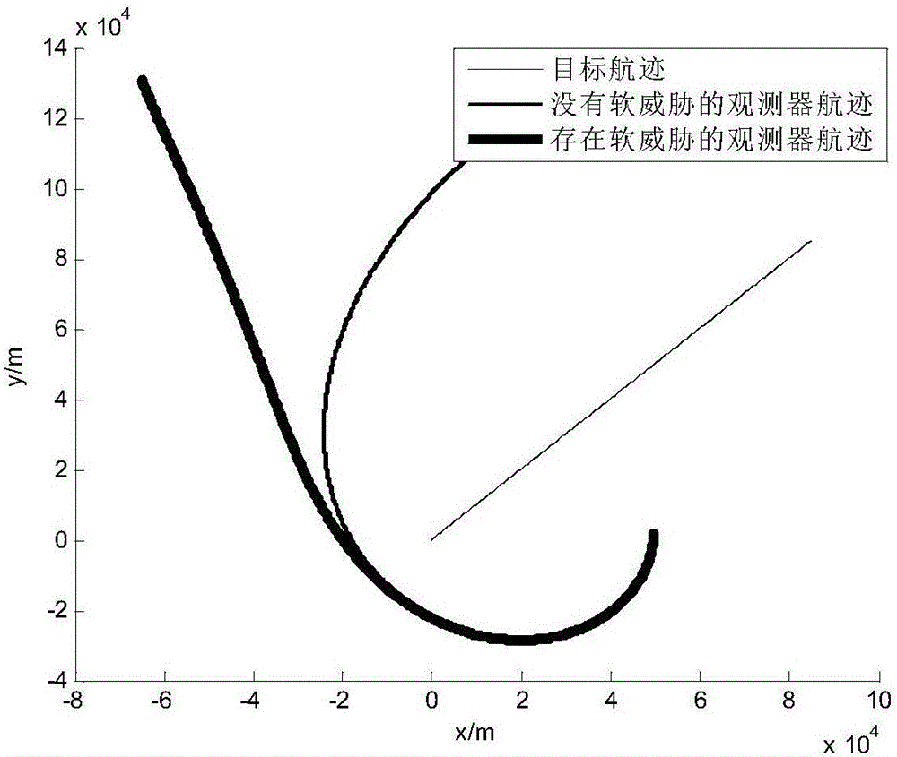
[0024] 4. Combining with the simulation scene examples, considering the threat of the enemy and the accuracy of target positioning, plan an optimal UAV trajectory.

[0025] The detailed implementation methods of the above-mentioned process steps are described as follows:

[0026] 1. Establish an azimuth-only positioning model for a single UAV.

[0027] A moving UAV conducts direction finding on the target signal multiple times at different positions, and performs rendezvous positioning through the results of multiple direction finding.

[0028] Assuming that both t...


PUM


Abstract

The invention discloses a calculating method for an optimal route of an unmanned aerial vehicle used for positioning an object in a threat environment, which belongs to the technical field of electronic countermeasures and relates to object positioning and tracking technology and route planning of the unmanned aerial vehicle. The method comprises the following steps: establishing an azimuth positioning model of a single unmanned aerial vehicle; carrying out self-adaptive motion of the unmanned aerial vehicle, wherein positioning and tracking are carried out on stationary objects and low-speed moving object separately, and the criterion of the self-adaptive motion of the unmanned aerial vehicle is maximization of positioning precision of the objects; establishing a mathematic model for enemy threats and evaluating the degree of threat; planning an optimal route of the unmanned aerial vehicle in combination with a simulation scene and consideration of the enemy threats and object positioning precision. According to the invention, through predication of the flight trajectory of the object and evaluation of the degree of each threat, the route of the unmanned aerial vehicle is integrally planned, so the survival efficiency of the unmanned aerial vehicle and positioning precision of the object can be greatly improved.

Description

technical field [0001] The invention belongs to the technical field of electronic countermeasures, and relates to target positioning and tracking technology and unmanned aerial vehicle route planning. Background technique [0002] Electronic warfare refers to the interception of electromagnetic information of the enemy's radio electronic equipment in electronic warfare, through analysis and processing to obtain military and technical intelligence, and to prevent the enemy's radio electronic equipment from obtaining useful and correct information, weakening or destroying the enemy's weapon system The general term for all technical and tactical means of effectiveness and power. The electronic positioning system, which measures the parameters of electromagnetic waves radiated by radar and determines its position, has also become a very important part of electronic countermeasures and support systems. Because it provides an important and effective means for precise strikes and ...

Claims


Application Information

Patent Timeline
Patent Type & Authority Applications(China)
IPC IPC(8): G01C21/20
CPCG01C21/20
Inventor 李万春黄成峰唐遒周俊
Owner UNIV OF ELECTRONICS SCI & TECH OF CHINA
Why Eureka
Try Eureka