Open space periphery building form optimization control method based on sky visible range evaluation

An open space, optimized control technology, applied in 3D modeling, CAD numerical modeling, details involving processing steps, etc., can solve problems such as disorder in open spaces, lack of human eye sight space experience, and lack of quantifiable indicators

Active Publication Date: 2016-08-24
SOUTHEAST UNIV
View PDF2 Cites 12 Cited by
  • Summary
  • Abstract
  • Description
  • Claims
  • Application Information

AI Technical Summary

Problems solved by technology

[0003] The existing urban planning scheme design often ignores the spatial perception of the human eye, which often leads to disorder in the open space in the urban space, and some open spaces are too congested, resulting in a decrease in the quality of the open space;
[0004] 1) There is a lack of quantifiable indicators to reflect the spatial perception of human eyes; it causes a gap in public visual psychological expectations, and does not reflect the people-oriented principle of urban construction and development;
[0005] 2) There is a lack of global simulation and evaluation of...

Method used


Image

  • Open space periphery building form optimization control method based on sky visible range evaluation
  • Open space periphery building form optimization control method based on sky visible range evaluation
  • Open space periphery building form optimization control method based on sky visible range evaluation

Examples


Embodiment Construction

[0019] Further describe the technical scheme of the present invention below in conjunction with accompanying drawing;

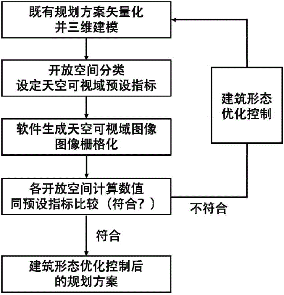
[0020] figure 1 is a flowchart of the entire embodiment of the present application.

[0021] A method for optimizing the form of surrounding buildings in an open space based on the evaluation of sky visibility, the method comprising the following steps:

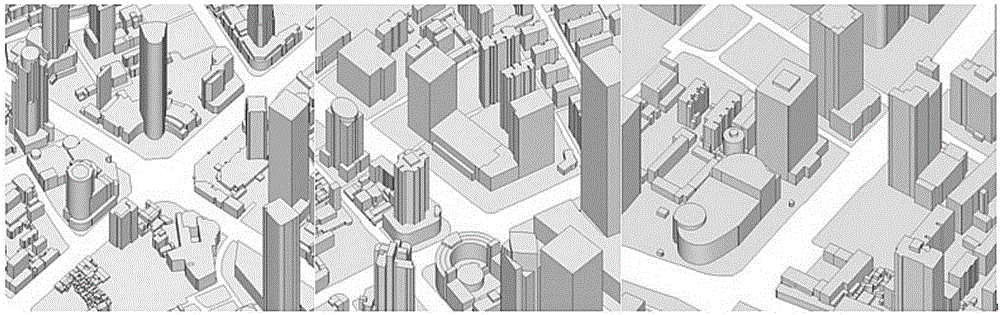
[0022] 1) Carry out vectorization on the existing planning scheme, and three-dimensional modeling, step 1) specifically includes:

[0023] 1.1) Insert the raster image of the existing planning general plan (for example, insert in AutoCAD software), and perform image scaling (by "Scale" command), and adjust it to the actual size;

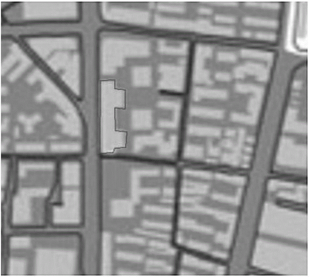
[0024] 1.2) Outline the outlines of all blocks and all buildings inside each block (for example, use the "Polyline" command to outline), and mark the number of floors of each building inside the corresponding building outline (see image 3 );

[0025] 1.3) Pull the building wit...


PUM


Abstract

The invention provides an open space periphery building form optimization control method based on sky visible range evaluation. The method includes the following steps that an existing planning scheme is subjected to vectorization, and three-dimensional modeling is conducted; open spaces in a model are classified, the mean elevation is scanned in a 360-degree mode, the sky visible range of the whole area is calculated and simulated, a three-dimensional contour diagram is generated, and the three-dimensional contour diagram is subjected to rasterization, so that each grid can have a classification attribute of an open space and a sky visible range value; the peripheral area of the corresponding open space where the sky visible range value is not consistent with the corresponding sky visible range preset index in the whole area range is subjected to building form optimization adjustment, the adjusted scheme is introduced into a model for calculation till each sky visible range value is consistent with the corresponding sky visible range preset index. The open space periphery buildings form optimization control method is people oriented, guidance is provided for optimization control over the peripheral building form of a corresponding open space from the aspect of quantitative sky visible range preset index, and a scientific basis is provided for creating a three-dimensional urban physical space which is humanized.

Description

technical field [0001] The invention belongs to the field of urban planning methods, in particular to a control method for optimizing the form of surrounding buildings in an open space based on the evaluation of the visible area of ​​the sky. Background technique [0002] Sky visibility is also known as sky visibility range, sky visibility, sky openness, sky visibility factor, sky dome visibility or terrain openness, etc. The proportion of the sky that can be seen directly depends on the development and layout of urban construction, and is directly related to multiple factors such as the comfort level of urban public activities and visual psychological expectations. important content of spatial quality. [0003] The existing urban planning scheme design often ignores the spatial perception of the human eye, which often leads to disorder in the open space in the urban space, and some open spaces are too congested, resulting in a decrease in the quality of the open space; ...

Claims


Application Information

Patent Timeline
IPC IPC(8): G06F17/50
CPCG06F30/13G06F30/12G06T17/05G06F30/00G06F2111/10G06T2200/04G06T2200/08
Inventor 杨俊宴曹俊
Owner SOUTHEAST UNIV
Why Eureka
Try Eureka