Water-power engineering earthwork filling-digging feature monitoring method based on laser scanner
A laser scanner, hydropower engineering technology, applied in infrastructure engineering, infrastructure testing, excavation, etc., to achieve the effect of improving construction efficiency, improving construction level, and ensuring construction quality and safety
- Summary
- Abstract
- Description
- Claims
- Application Information
AI Technical Summary
Problems solved by technology
Method used
Image
Examples
Embodiment approach
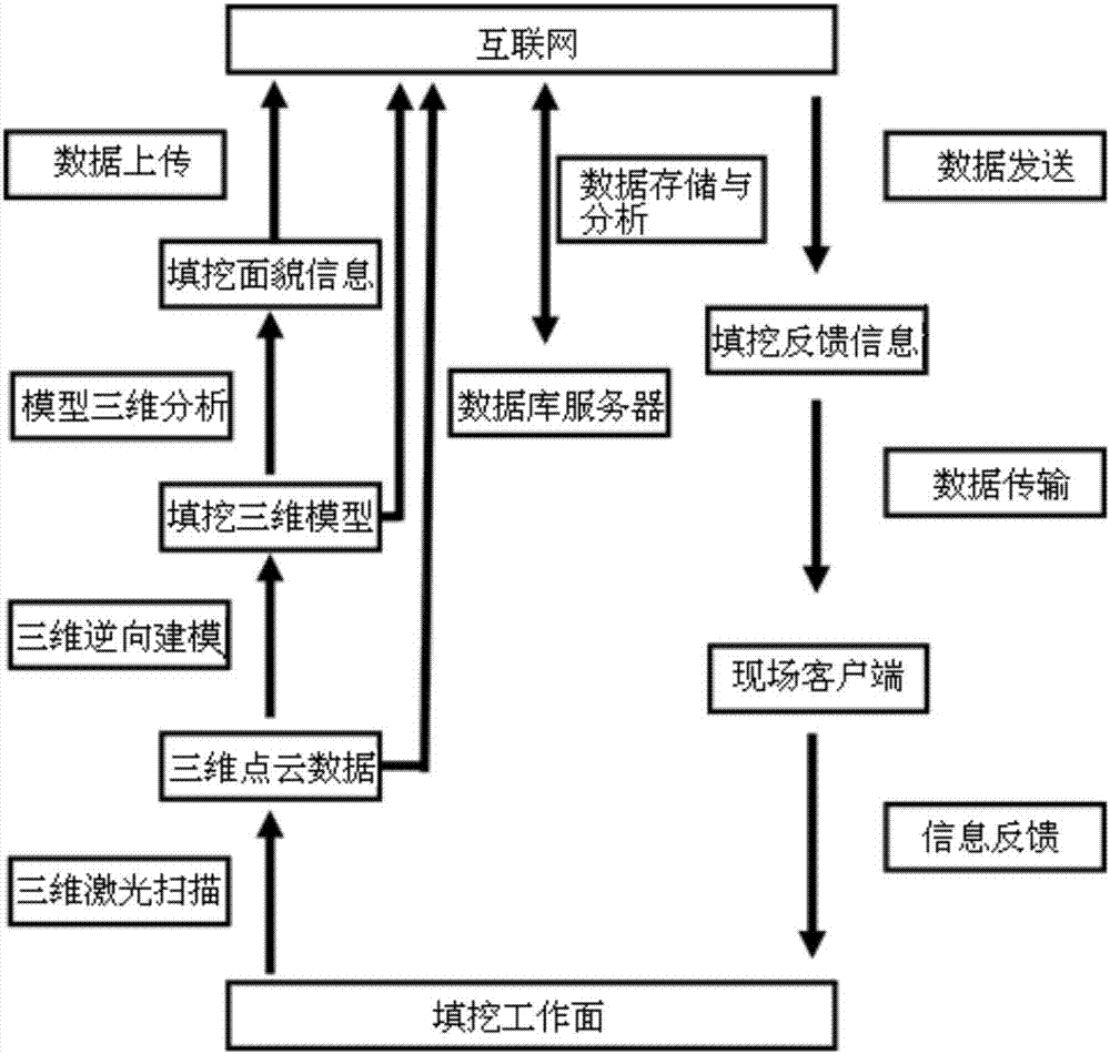
[0024] The invention proposes a laser scanner-based method for monitoring the appearance of earthwork filling and excavation in hydropower projects, which is used to monitor the three-dimensional appearance of the working face and provide construction information feedback during backfilling and excavation construction operations. The method includes the following steps.
[0025] ① During the construction process, use a 3D laser scanner to perform 3D laser scanning on the filling and excavation face to obtain the 3D point cloud data of the filling and excavation face;
[0026] ②Using point cloud data based on reverse modeling technology to realize 3D modeling and real scene replication of filling and excavation working face;
[0027] ③ Perform 3D analysis on the 3D model information of the filling and excavation face to obtain the information of the filling and excavation appearance;
[0028] ④ On the basis of filling and excavation appearance information, further feedback anal...
PUM
 Abstract
Description
Claims
Application Information
 - R&D
- Intellectual Property
- Life Sciences
- Materials
- Tech Scout
- Unparalleled Data Quality
- Higher Quality Content
- 60% Fewer Hallucinations
Browse by: Latest US Patents, China's latest patents, Technical Efficacy Thesaurus, Application Domain, Technology Topic, Popular Technical Reports.
© 2025 PatSnap. All rights reserved.Legal|Privacy policy|Modern Slavery Act Transparency Statement|Sitemap|About US| Contact US: help@patsnap.com

