Intelligent driving local track fault tolerance planning method based on lane lines and GPS following

A technology of intelligent driving and lane line, applied in traffic control system of road vehicles, surveying and navigation, road network navigator and other directions, can solve the problems of GPS/IMU positioning distortion, lane misidentification, lane discontinuity, etc.

Active Publication Date: 2017-08-22
CENT SOUTH UNIV
View PDF7 Cites 19 Cited by
  • Summary
  • Abstract
  • Description
  • Claims
  • Application Information

AI Technical Summary

Problems solved by technology

There are sudden abnormalities in the navigation process in a semi-structured environment, in

Method used


Image

  • Intelligent driving local track fault tolerance planning method based on lane lines and GPS following
  • Intelligent driving local track fault tolerance planning method based on lane lines and GPS following
  • Intelligent driving local track fault tolerance planning method based on lane lines and GPS following

Examples


Embodiment Construction

[0093] The present invention will be further described below in conjunction with the accompanying drawings and embodiments.

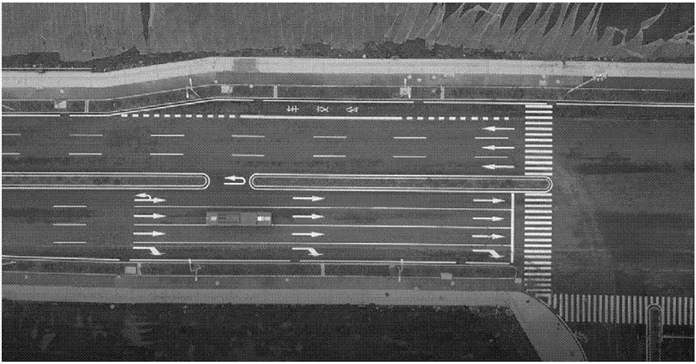
[0094] In this embodiment, a 12m-long, 2.5m-wide bus modified intelligent driving vehicle is equipped with laser radar, millimeter-wave radar, camera and GPS / IMU system, and a local trajectory fault-tolerant planning experiment is carried out on a standard straight road, such as figure 2 As shown, the aerial photograph of the experimental site of the present embodiment.

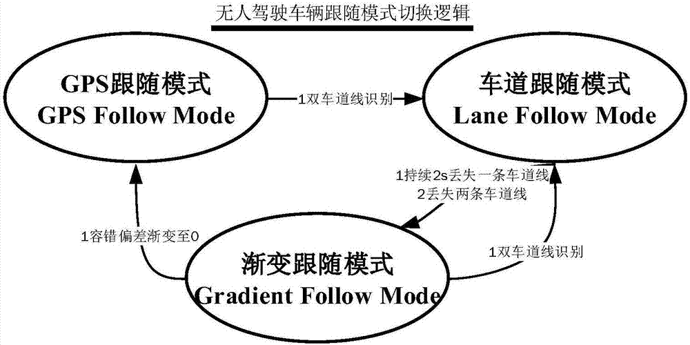
[0095] Such as figure 1 As shown, the present invention is used in the following mode transition chain diagram for local trajectory fault-tolerant planning.

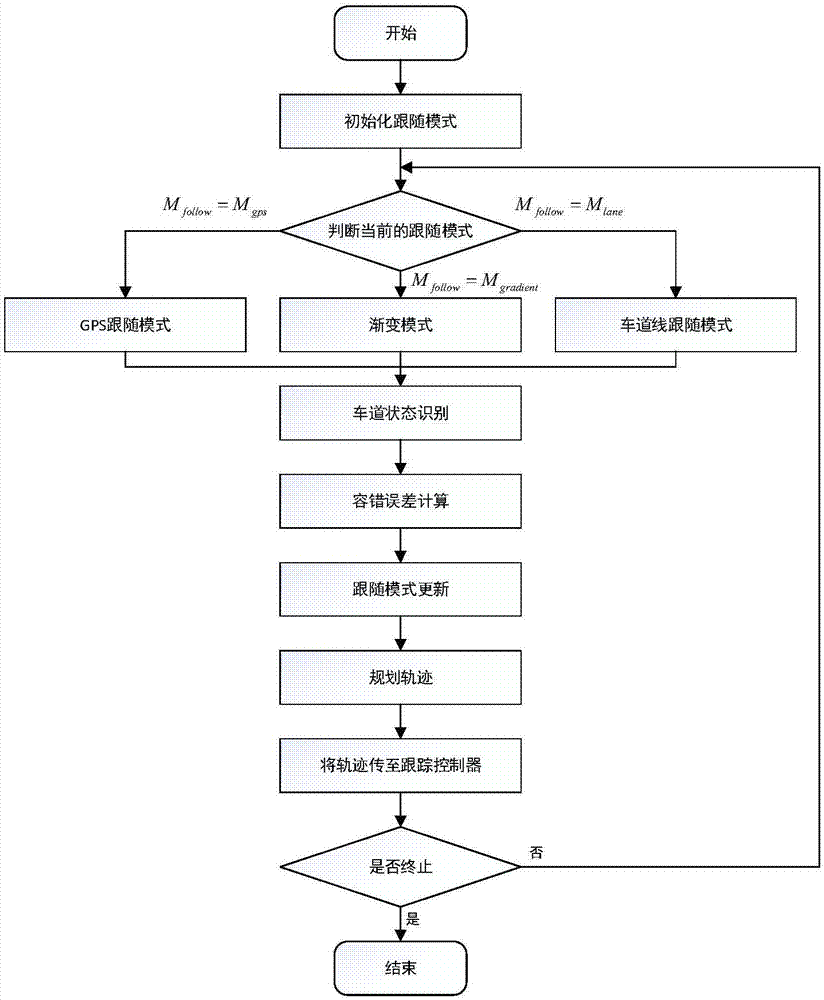
[0096] Such as image 3The flow chart of the local trajectory fault-tolerant planning method shown is a local trajectory fault-tolerant planning method for intelligent driving based on lane lines and GPS following. The local planning cycle is 50ms, and each planning cycle specifically includes the following steps:

[0097] A ...


PUM


Abstract

The invention discloses an intelligent driving local track fault tolerance planning method based on lane lines and GPS following. The method includes steps: firstly initializing a following mode and establishing an intelligent driving vehicle coordinate system; secondly discriminating the recognition states of GPS data and the lane lines according to GPS and lane line information; then calculating a fault tolerance deviation according to the discriminated recognition states, and updating the following mode; and finally performing local path and track planning based on the new following mode. According to the method, the validity of various data is determined, the accuracy of subsequent calculation is improved, the fault tolerance deviation is designed based on various data states, the fault tolerance deviation is dynamically updated in real time, the system complexity is simplified, the practical application is easy, and the robustness of data processing is improved; and real-time state transition of the following mode is performed according to multi-sensing data including the GPS and the lane lines, continuous and smooth control of multiple following states is realized, and the comfort and the stability of intelligent-driving vehicles are improved.

Description

technical field [0001] The invention belongs to the technical field of unmanned driving and path planning, and in particular relates to a fault-tolerant planning method for local trajectory of intelligent driving based on lane lines and GPS following. Background technique [0002] Intelligent driving vehicles are intelligent vehicles that can perceive the road environment through the on-board sensor system, automatically plan the driving route and control the vehicle to reach the predetermined target. Path trajectory planning in intelligent driving technology is one of the key technologies in the field of intelligent driving. In the process of intelligent driving in a semi-structured environment, it is easy to encounter complex emergencies such as unstable GPS / IMU interference, unclear or discontinuous lane lines, or misidentified lane lines. The local trajectory planning is a dynamic planning in a non-specific scenario, which requires accurate lane following and quick resp...

Claims


Application Information

Patent Timeline
IPC IPC(8): G08G1/00G01C21/34
CPCG01C21/3446G08G1/22
Inventor 余伶俐邵玄雅周开军龙子威夏旭梅
Owner CENT SOUTH UNIV
Why Eureka
Try Eureka