

An underground illegal mining identification method and system integrating d-insar and gis technology
An identification system and illegal technology, applied in the radio wave measurement system, radio wave reflection/re-radiation, instruments, etc., can solve the problems of lack of time-sequence analysis of mining subsidence and the inability to fully reflect the advantages of spatial analysis and visual expression
- Summary
- Abstract
- Description
- Claims
- Application Information
AI Technical Summary
Problems solved by technology
Method used
Image

Examples
Embodiment
[0071] The embodiment of the present invention provides an underground illegal mining identification system integrating D-InSAR and GIS technology, including
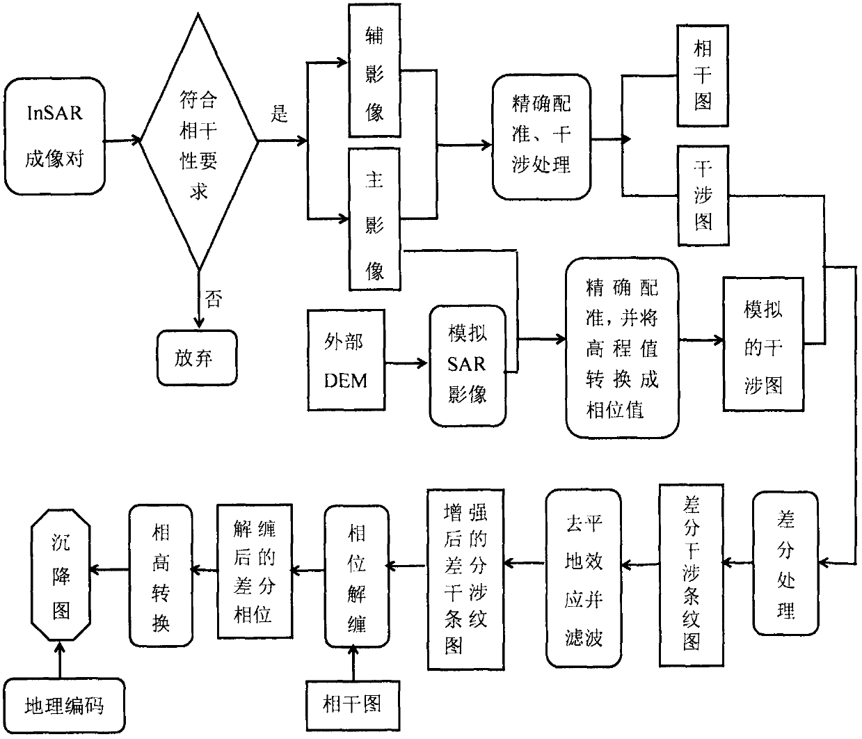
[0072] The data acquisition module is used to acquire land subsidence information in the mining area through dual-track D-InSAR technology, and accurately conducts key steps and methods such as image pair registration, filtering, phase unwrapping, baseline parameter calculation, and multi-view processing coefficient selection. to obtain more accurate land subsidence information in mining areas;
[0073] The spatio-temporal database includes three levels of concept, logic and physics. Conceptually, the information contained in the spatio-temporal database is fully described. Logically, geographic modeling theory is used to establish a spatio-temporal data of mining subsidence that includes spatio-temporal process, geometry, scale, and semantics. Model, which fully describes and expresses the time, space and attribute inf...
PUM
 Abstract
Description
Claims
Application Information