Airborne laser point cloud urban road recognition method

A technology of road recognition and airborne laser, applied in character and pattern recognition, computer components, instruments, etc., can solve the problems of many steps, complexity, low efficiency of road network recognition, etc., and achieve the effect of improving recognition accuracy and reducing interference

Inactive Publication Date: 2018-02-09
INST OF DISASTER PREVENTION
View PDF2 Cites 16 Cited by
  • Summary
  • Abstract
  • Description
  • Claims
  • Application Information

AI Technical Summary

Problems solved by technology

The method of identifying road networks from satellite images draws on the intelligent recognition algorithms in the computer field. Many methods have successfully extracted road networks from satellite remote sensing images. disconnection [1] , therefore, the use of meter-level or even sub-meter-level satellite images for road identification research has strong practical significance [2,3] However, related studies also found that due to the influence of tall buildings and street trees in the city, the accuracy of roads extracted from high-resolution remote sensing images in urban areas is poor, but in rural areas it has better results [4]
With the emergence of airborne laser scanning technology, the combination of high-resolution aerial images and laser point clouds can more accurately identify urban roads [5-8] , the fusion method of the two not only has many steps but also is very complicated, which leads to low efficiency of road network recognition

Method used


Image

  • Airborne laser point cloud urban road recognition method
  • Airborne laser point cloud urban road recognition method
  • Airborne laser point cloud urban road recognition method

Examples


Embodiment Construction

[0056] The present invention will be further described below through specific embodiments and accompanying drawings. The embodiments of the present invention are for better understanding of the present invention by those skilled in the art, and do not limit the present invention in any way.

[0057] An airborne laser point cloud urban road identification method, the specific steps are as follows:

[0058] 1) Convert 3D laser point cloud to 2D image mode:

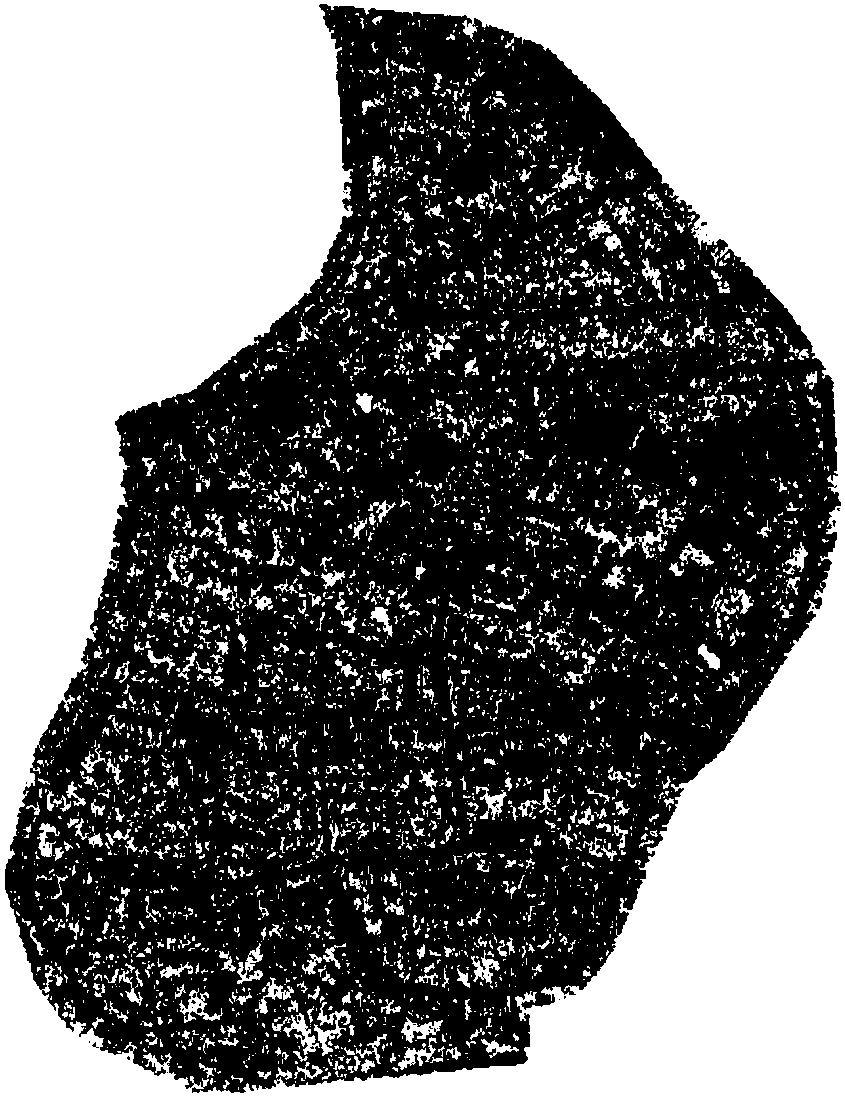
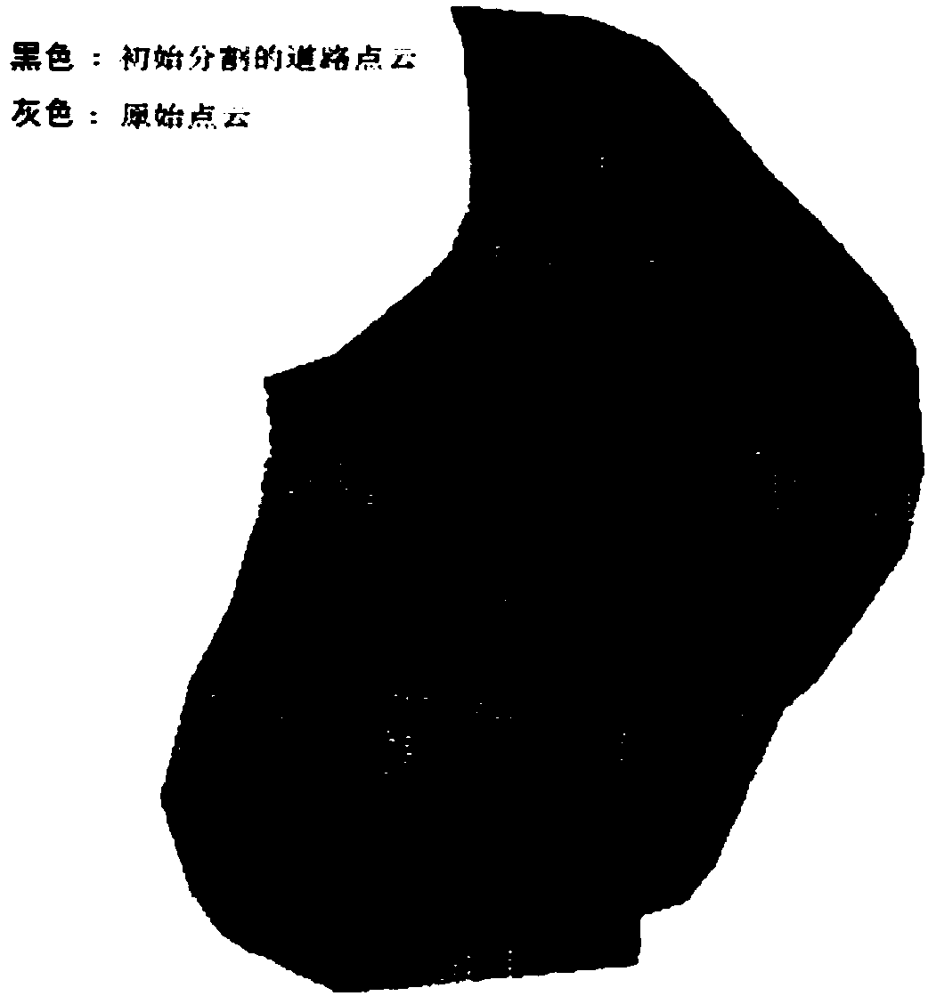
[0059] According to the original laser point cloud (such as figure 1 Shown) the elevation distribution histogram, use the height difference threshold to remove high and low noise, and convert the 3D laser point cloud into a 2D image mode. Set the point cloud data into a uniform regular grid according to the size of the point cloud data. Select the elevation and brightness values ​​of the nearest laser point of the grid as the elevation value and brightness value of the grid.

[0060] 2) Manually select road feature point...


PUM


Abstract

The invention discloses an airborne laser point cloud urban road recognition method. The method comprises the following main steps that: a 3D laser point cloud is converted into a 2D image mode; roadfeature points are selected as seed points; a regional growth method is adopted to classify initial roads on the basis of the height difference and brightness attribute of the laser point cloud; roadblanks are filled, and road boundaries are smoothed; a skeletonization algorithm is adopted to identify an urban road centerline; and by means of road centerline de-noising, road centerline points aretracked and connected, so that a vector road line can be obtained, and a rarefaction method is adopted to delete points with small curvature, and a road network is smoothed through curve fitting. With the method of the invention adopted, the high-precision identification of the urban road network under a complicated scene can be realized.

Description

technical field [0001] The invention relates to the field of airborne laser scanning, in particular to an airborne laser point cloud urban road identification method. Background technique [0002] With the development of geographic information system technology, the demand for automatic identification of urban roads from remote sensing images is increasing. Different from manual digitalization, the method of automatically identifying roads using programs can improve the automation level of remote sensing image processing and save processing costs. Greatly improve the efficiency of data processing. Urban road network can be widely used in urban planning and design, urban road automatic driving and navigation, analysis of urban traffic conditions, urban road management and operation, etc. The method of identifying road networks from satellite images draws on the intelligent recognition algorithms in the computer field. Many methods have successfully extracted road networks fr...

Claims


Application Information

Patent Timeline
Patent Type & Authority Applications(China)
IPC IPC(8): G06K9/00G06K9/40
CPCG06V20/182G06V10/30
Inventor 李峰卫爱霞
Owner INST OF DISASTER PREVENTION
Why Eureka
Try Eureka