Time-division ground-based MIMO landslide radar imaging method based on ifft and mixed-matching pursuit
A matching tracking and radar imaging technology, applied in radio wave measurement systems, instruments, etc., can solve the problems of large number of antennas and high data processing complexity
- Summary
- Abstract
- Description
- Claims
- Application Information
AI Technical Summary
Problems solved by technology
Method used
Image
Examples
Embodiment
[0074] Time-division ground-based MIMO landslide radar imaging method based on IFFT and hybrid matching tracking:
[0075] Step 1, constructing an equivalent random sparse transceiver array,
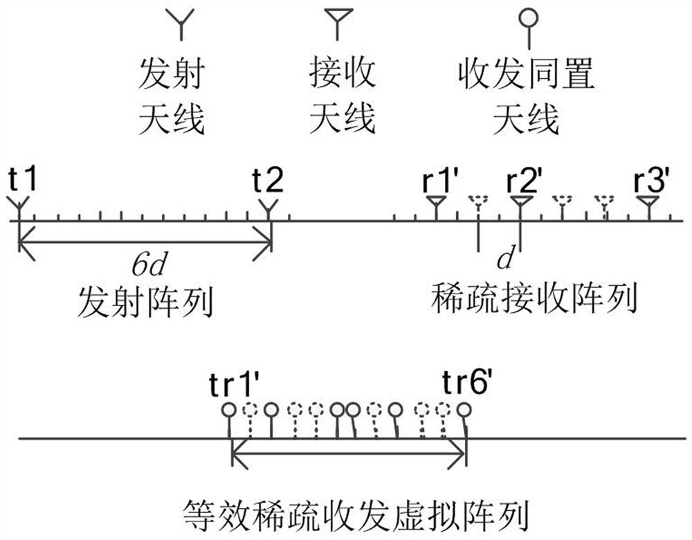
[0076] According to the landslide monitoring scenario, the transceiver array that meets the requirements is designed. The traditional MIMO radar is a uniform array with M transmitting and N receiving. The original receiving antenna spacing is λ / 2, and the transmitting antenna spacing is N(λ / 2), where λ is the wavelength of the transmitting wave. And specify the sparse arrangement of receiving arrays, randomly select N' receiving arrays from the original N receiving arrays, in order to ensure that the array aperture length is large enough, the positions of the first and last receiving antennas remain unchanged. According to the obtained N' sparse receiving array elements and M uniform transmitting array elements, MN' virtual array elements are obtained by using polynomial theory. Taking t...
PUM
 Abstract
Description
Claims
Application Information
 - R&D
- Intellectual Property
- Life Sciences
- Materials
- Tech Scout
- Unparalleled Data Quality
- Higher Quality Content
- 60% Fewer Hallucinations
Browse by: Latest US Patents, China's latest patents, Technical Efficacy Thesaurus, Application Domain, Technology Topic, Popular Technical Reports.
© 2025 PatSnap. All rights reserved.Legal|Privacy policy|Modern Slavery Act Transparency Statement|Sitemap|About US| Contact US: help@patsnap.com


