
A tomographic processing method for physical properties of airborne gravity data based on big data calculation

An aviation gravity and processing method technology, applied in the field of gravity exploration, can solve problems such as large amount of calculation, low precision of calculation results, unstable solution, etc., and achieve the effects of stable calculation process, high accuracy of calculation results, and reduced time.

Active Publication Date: 2019-02-22
CHINA AERO GEOPHYSICAL SURVEY & REMOTE SENSING CENT FOR LAND & RESOURCES
View PDF0 Cites 0 Cited by
  • Summary
  • Abstract
  • Description
  • Claims
  • Application Information

AI Technical Summary

Problems solved by technology

This method usually faces the problem of solving underdetermined equations. The solution is unstable, the amount of calculation is huge, and the precision of the calculation results is low. It is difficult to perform inversion calculation on large-scale airborne gravity data collected in large areas.

Method used


Image

  • A tomographic processing method for physical properties of airborne gravity data based on big data calculation
  • A tomographic processing method for physical properties of airborne gravity data based on big data calculation
  • A tomographic processing method for physical properties of airborne gravity data based on big data calculation

Examples


Embodiment 1

[0028] This embodiment presents the calculation principle and steps of a method for calculating physical property tomography of airborne gravity data applied to big data calculation.

[0029] The basic principle of gravity tomography inversion is to divide the underground inversion space into small cubes of equal size, and in each cube, the density is considered constant. The derivation of the gravity tomography inversion formula should start from the gravity forward calculation formula, and the gravity forward calculation formula is:

[0030]

[0031] Among them, Δg(x, y, z) is the gravity anomaly at (x, y, z) on the surface, G is the gravitational constant, (x q ,y q ,z q ) is the coordinates of the center point of a small cube formed by underground grid division, Δρ q is the density of the small cube, Δv q is the volume of the small cube, Q is the number of small cubes formed by underground grid division, and this formula represents the sum of the contribution of Q s...

Embodiment 2

[0054] This embodiment provides a specific implementation method of using the big data computing framework Spark to perform the tomographic calculation method of airborne gravity data physical properties described in Example 1.

[0055] Apache Spark is a fast and general computing engine designed for large-scale data processing. Spark is a general-purpose parallel framework similar to Hadoop MapReduce open sourced by UCBerkeley AMP lab (AMP Lab of the University of California, Berkeley). Spark can use DAG for scheduling execution planning, can handle multi-step complex jobs, and starts a thread for each task instead of starting a process, which greatly shortens the task startup time. The tomographic calculation method of airborne gravity data described in Example 1 can be accelerated by the big data framework Spark, and the iterative calculation is very suitable for processing by the Spark framework, so a very good acceleration effect can be obtained. Specific steps are as fo...

Embodiment 3

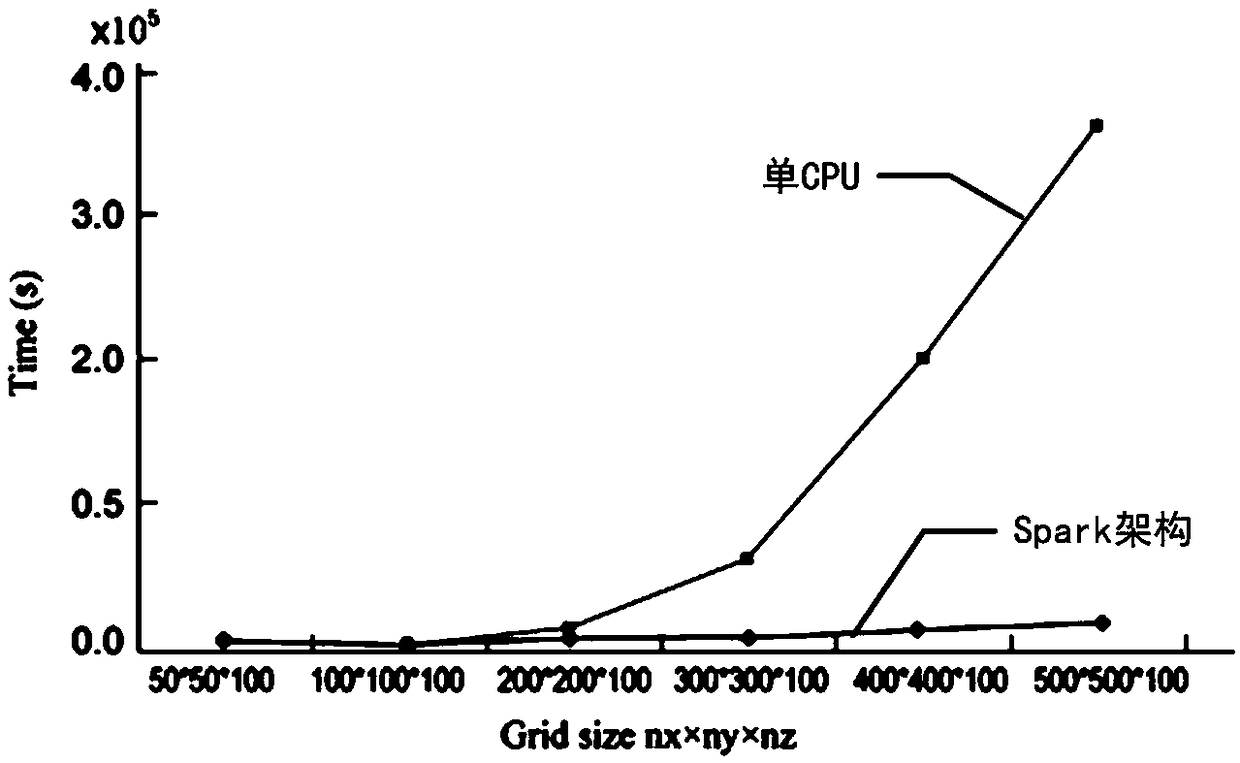
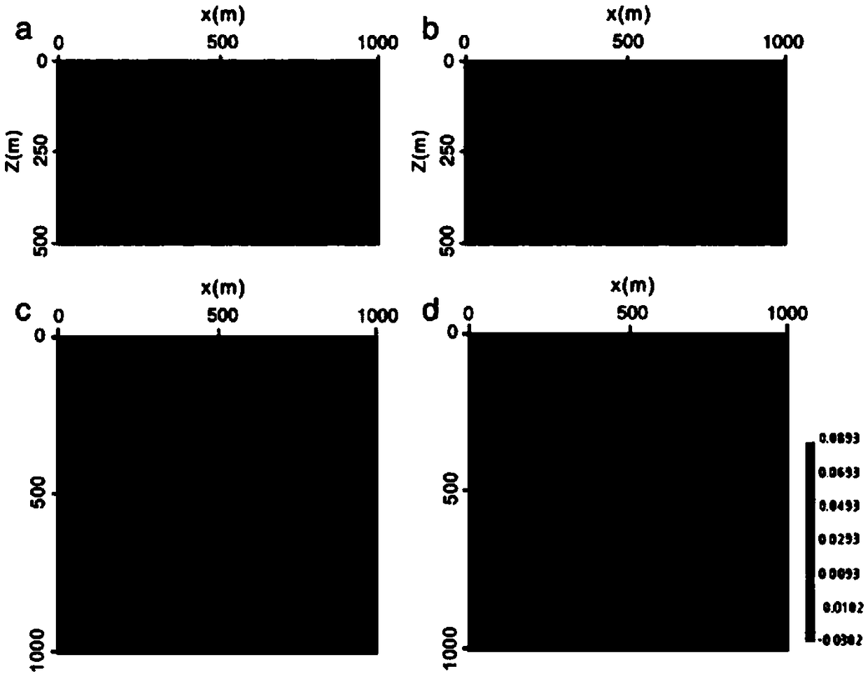
[0074] This example provides the simulation results of the calculation efficiency of the implementation manner described in Example 2.


PUM


Abstract

The invention discloses a big data calculation based physical property chromatographic processing method for aerial gravity data. The big data calculation based physical property chromatographic processing method comprises the following steps: slitting total number of small cubes formed by subsurface grid subdivision to construct RDD, persisting RDD to an internal storage; calculating a probability function; calculating density of a subsurface grid; performing iterative computation on surface grid gravity forward modeling data and subsurface grid density; and outputting the subsurface grid density. Gravity tomography inversion problem is converted to a forward modeling iterative computation method from a conventional underdetermined equation solving method, so that computation steps are simple, a computation process is stable, and computation results are high in accuracy; a large data distribution type parallel computation framework Spark is adopted, so that the iterative computation process and a complex multi-path processing process can be realized by sufficiently depending on internal storage data, and therefore, the nearly real-time processing effect is achieved.

Description

technical field [0001] The invention belongs to the technical field of gravity exploration, and relates to a tomographic inversion calculation method of airborne gravity data, in particular to a tomographic processing method of airborne gravity data based on big data calculation. Background technique [0002] Gravity prospecting is a traditional geophysical prospecting method and the main technical means for the study of mineral resources and geological structures. For example, "Gravity Prospecting and Its Application" (Science and Technology Innovation Herald, 2013.08, p. 240) discloses a gravity prospecting method, through mathematical calculation of the gravity anomaly data collected on the surface, the distribution of rock density at different depths underground can be inverted . The traditional gravity inversion method is to establish an objective function by minimizing the difference between the collected data and the model-calculated data in the sense of least square...

Claims


Application Information

Patent Timeline
Patent Type & Authority Patents(China)
IPC IPC(8): G01V7/00G01V7/16G06F17/18
CPCG01V7/00G01V7/16G06F17/18
Inventor 熊盛青王林飞刘国峰薛典军李芳何辉闫浩飞
Owner CHINA AERO GEOPHYSICAL SURVEY & REMOTE SENSING CENT FOR LAND & RESOURCES
Learn More