
A road extraction method for UAV aerial images based on deep learning

A technology of deep learning and road extraction, applied in neural learning methods, computer components, instruments, etc., can solve problems such as weak robustness and inability to apply to complex scenes, and achieve the goal of enhanced robustness and improved detection speed Effect

Active Publication Date: 2020-07-31
西安因诺航空科技有限公司
View PDF2 Cites 0 Cited by
  • Summary
  • Abstract
  • Description
  • Claims
  • Application Information

AI Technical Summary

Problems solved by technology

These methods only use simple artificial features, are not robust, and cannot be applied to complex scenes

Method used


Image

  • A road extraction method for UAV aerial images based on deep learning
  • A road extraction method for UAV aerial images based on deep learning
  • A road extraction method for UAV aerial images based on deep learning

Examples


Embodiment Construction

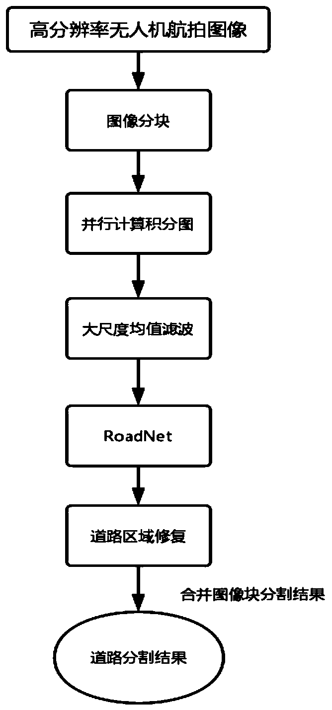
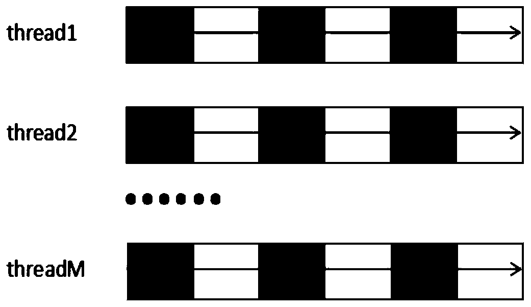
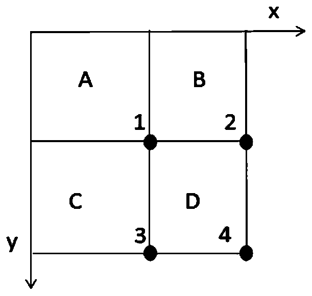
[0043] see figure 1As shown, the present invention is a method for extracting roads from UAV aerial images based on deep learning. First, the high-resolution UAV aerial images are divided into blocks, and then the divided images are quickly calculated using a multi-threaded parallel computing method. The graph model, followed by large-scale mean filtering based on the integral graph model, and then the road segmentation model is obtained through the fully convolutional neural network, and finally the road area is repaired to complete the road detection. The specific steps are as follows:

[0044] S1, block the high-resolution UAV aerial image;

[0045] For the UAV aerial image with a resolution of 6000*4000, the image is divided into 48 small blocks of 1000*500. For each image, the road segmentation result is obtained separately, and finally the image blocks are merged to obtain the final road segmentation result. When calculating the integral graph model of the divided imag...


PUM


Abstract

The invention discloses a method for extracting roads from UAV aerial photography images based on deep learning. Firstly, the high-resolution UAV aerial photography images are divided into blocks, and then the divided images are calculated by using a multi-threaded parallel computing method to calculate the integral map. model, and then perform large-scale mean filtering based on the integral graph model, and then obtain a road segmentation model through a fully convolutional neural network, and finally repair the road area to complete road detection. The detection speed of this method is fast, and it has certain robustness to the change of road scale, and the detection accuracy is higher than that of the traditional method.

Description

technical field [0001] The invention belongs to the technical field of image segmentation, and in particular relates to a method for extracting roads from UAV aerial images based on deep learning. Background technique [0002] In recent years, drone technology has developed rapidly. The UAV aerial photography system uses unmanned aerial vehicles as the carrier, equipped with modern digital cameras to quickly acquire low-altitude high-resolution images, and transmits the image data to the control platform in real time through the wireless network. The aerial photography system can photograph areas of interest, avoiding the blindness and ineffective work of conventional surveys, and has high mobility and flexible shooting time. It is widely used in territorial monitoring, disaster monitoring, resource exploration and other fields. One of the current main research directions of UAV is to use visual sensors to improve its autonomous navigation ability and scene understanding ab...

Claims


Application Information

Patent Timeline
Patent Type & Authority Patents(China)
IPC IPC(8): G06K9/00G06K9/34G06N3/04G06N3/08
CPCG06N3/08G06V20/182G06V10/267G06N3/045
Inventor 胡耀辉白霖抒成凯华韩姣姣马泳潮韦兴旺
Owner 西安因诺航空科技有限公司
Learn More