Topographic special point positioning method for three-antenna interference delay Doppler radar altimeter
A technology of Doppler radar and positioning method, which is applied in the field of locating prominent points of terrain of delayed Doppler radar altimeter. Achieve the effects of reducing the number of flights, improving resolution, and improving positioning accuracy
- Summary
- Abstract
- Description
- Claims
- Application Information
AI Technical Summary
Problems solved by technology
Method used
Image
Examples
Embodiment Construction
[0028] refer to figure 1 , the specific implementation steps of the present invention are as follows:
[0029] Step 1. Establish the echo signal model of the three-antenna interferometric delay Doppler radar altimeter.
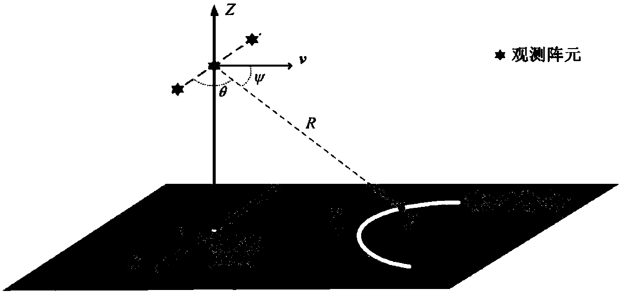
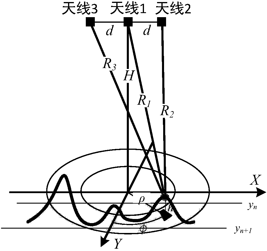
[0030] refer to image 3 , arrange three antennas at the same interval along the vertical course direction, and record the distance between the antennas, that is, the length of the baseline as d, where d>0, the height of the antenna from the ground is H meters, H>100, and point A is any One ground unit, the distance from the first antenna 1 to point A is R 1 , the distance from the second antenna 2 to point A is R 2 , the distance from the third antenna 3 to point A is R 3 , the angle between the antenna array normal and point A is θ, the distance between the coordinate origin and point A is ρ, the angle between the aircraft heading and point A is Φ, the pulse signal is sent by the first antenna 1, and the first antenna 1. The second antenna 2 and the thi...
PUM
 Abstract
Description
Claims
Application Information
 - R&D
- Intellectual Property
- Life Sciences
- Materials
- Tech Scout
- Unparalleled Data Quality
- Higher Quality Content
- 60% Fewer Hallucinations
Browse by: Latest US Patents, China's latest patents, Technical Efficacy Thesaurus, Application Domain, Technology Topic, Popular Technical Reports.
© 2025 PatSnap. All rights reserved.Legal|Privacy policy|Modern Slavery Act Transparency Statement|Sitemap|About US| Contact US: help@patsnap.com


