Mountainous area reservoir area riverway water surface width estimation method

A mountain and river channel technology, which is applied in the estimation of the water surface width of the river channel in the mountain reservoir area, can solve the problems of unfavorable distributed hydrological model development, estimation limitation, and water level rise.

Active Publication Date: 2018-10-12
HOHAI UNIV
View PDF2 Cites 19 Cited by
  • Summary
  • Abstract
  • Description
  • Claims
  • Application Information

AI Technical Summary

Problems solved by technology

[0004] Reservoirs are often built upstream in small and medium-sized watersheds in mountainous areas, and the water level rises significantly during the impoundment period, resulting in an increase in the width of the river channel in the reservoir area, which does not meet the river phase relationship under natural conditions. The inaccurate estimation of the channel width in the mountainous reservoir area limits the channel The application of the width parameter in distributed modeling is not conducive to the development of domestic distributed hydrological models

Method used


Image

  • Mountainous area reservoir area riverway water surface width estimation method
  • Mountainous area reservoir area riverway water surface width estimation method
  • Mountainous area reservoir area riverway water surface width estimation method

Examples


Embodiment 1

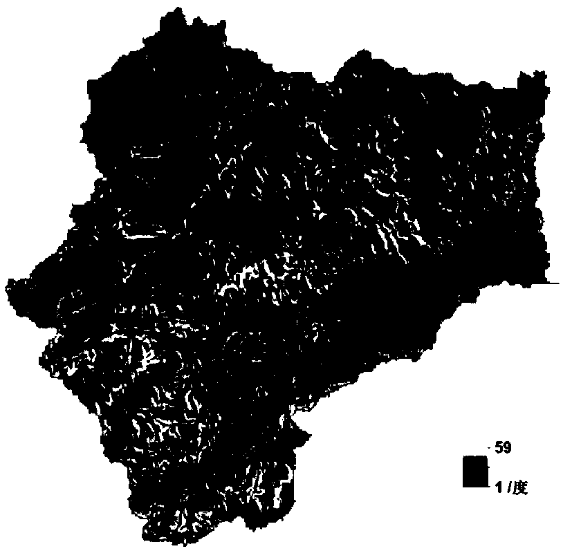
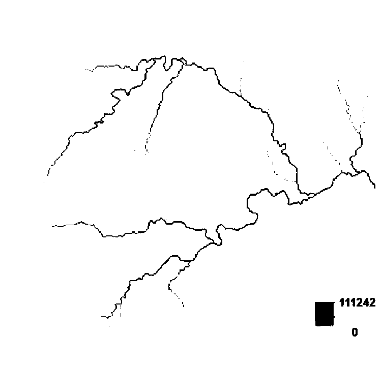
[0150] Taking the Changhua Watershed in Zhejiang Province as an example, the Changhua Watershed is located in the northwest of Zhejiang Province, with a watershed area of ​​905km 2, belongs to the hilly area in western Zhejiang. The water system of the river basin is developed. There are many rocks and large boulders at the bends of the rapids. The basin climate is a typical subtropical monsoon climate, with abundant rainfall throughout the year and obvious seasonal changes. The average annual rainfall in the basin is 1638.2 mm. The digital elevation data (DEM) in the study area of ​​this example adopts the 90m resolution STRIM (Shuttle RadarTopography Mission) data jointly provided by the National Space Administration (NASA) and the National Mapping Agency (NIMA) of the Department of Defense.

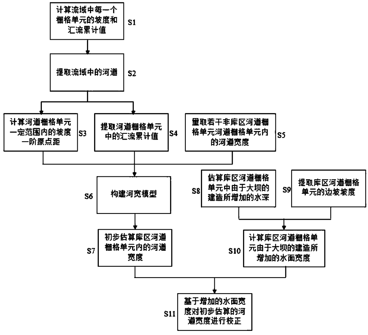
[0151] Step S1, use the DEM data of the watershed to calculate the slope and the cumulative value A of each grid cell in the watershed, and draw according to the slope of all the grid ...


PUM


Abstract

The invention relates to a mountainous area reservoir area riverway water surface width estimation method. Further development is made on the basis of a river width model constructed under the naturalcondition, the relative reasonable and reliable mountainous area reservoir area riverway width estimation method is provided, the distributed model confluence calculation accuracy is improved, the problem about estimation of the small and medium-sized basin mountainous area reservoir area riverway width lake of observational data is solved, important essential data are provided for reservoir flood control regulation, hydraulic power generation, channel improvement and the like, the reservoir regulation scientificity is improved, and safety of downstream zones can be better and practically protected. The mountainous area reservoir area riverway water surface width estimation method is mainly applied to a drainage basin digital elevation model, data sources are stable and reliable, the computational efficiency is high, the result is objective and reasonable, automation generation of drainage basin riverway width and direct calling of a distributed hydrologic forecasting model are facilitated, and the development of digital hydrology, the distributed hydrologic forecasting model and reservoir scientific management is promoted.

Description

technical field [0001] The invention relates to the technical field of hydrology, in particular to a method for estimating the water surface width of a mountainous reservoir area. Background technique [0002] The drainage area of ​​our country is 200 to 3000km 2 There are nearly 9,000 small and medium-sized watersheds in China. Most of these small and medium-sized watersheds are located in mountainous areas. The water and soil conditions along the coast of the watershed are good, with a lot of cultivated land and dense population. Once a flood occurs, it will seriously threaten the safety of people's lives and property. Under the new historical conditions, carrying out the management of small and medium-sized rivers and improving the flood control capacity of small and medium-sized rivers has become a major problem that needs to be solved urgently. The construction of reservoirs is an important method to improve the flood control capacity of small and medium-sized rivers. ...

Claims


Application Information

Patent Timeline
Patent Type & Authority Applications(China)
IPC IPC(8): E02B1/00G06T17/05
Inventor 姚成童冰星李致家
Owner HOHAI UNIV
Why Eureka
Try Eureka