

Stationary satellite imaging yaw guidance angle calculating method
A technology of geostationary satellites and calculation methods, which is applied to space navigation equipment, space navigation equipment, and space navigation vehicles, etc., to achieve the effect of improving imaging accuracy and stability
- Summary
- Abstract
- Description
- Claims
- Application Information
AI Technical Summary
Problems solved by technology
Method used
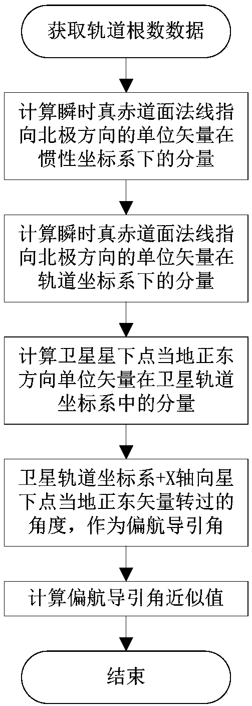
Image

Examples
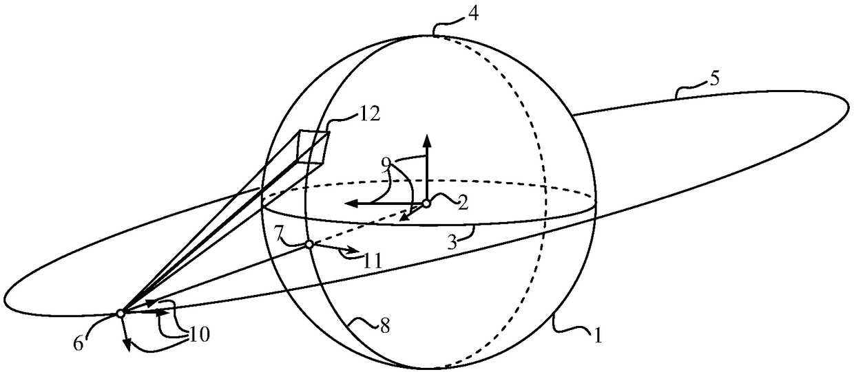
Embodiment
[0069] T 0 The time satellite orbit parameters are as follows:
[0070] Number of orbital elements
letter code
value
unit
Epoch time
T 0
August 29, 2017 13:34:18.5
date
semi-major axis
a
42168
km
Eccentricity
e
0.001
-
i
0.3
deg
ascending node right ascension
Ω
90
deg
Argument of perigee
ω
60
deg
mean anomaly
M 0
131
deg
[0071] Regardless of orbital perturbation, it is considered that the five parameters of semi-major axis, eccentricity, orbital inclination, right ascension of ascending node, and argument of perigee remain unchanged during the 48-hour simulation period. The true anomaly will change with time, so it needs to be calculated as follows.
[0072] The orbital period of the satellite is:
[0073]
[0074] For any time t, the calculation formula of the instantaneous mean anomaly M(t) is:
[007...
PUM
 Abstract
Description
Claims
Application Information