Detection and tracking method of moving object in satellite video

A moving target, video technology, applied in image data processing, instrument, character and pattern recognition, etc., can solve the problems of UAV application range compression, video range reduction, limited aerial photography height, etc.

Active Publication Date: 2018-11-02
FUDAN UNIV
View PDF5 Cites 17 Cited by
  • Summary
  • Abstract
  • Description
  • Claims
  • Application Information

AI Technical Summary

Problems solved by technology

The height of aerial photography is limited, and according to the new civil aviation regulations, the scope of application of drones is compressed, which greatly reduces the range of video acquired by aerial photography

Method used


Image

  • Detection and tracking method of moving object in satellite video
  • Detection and tracking method of moving object in satellite video
  • Detection and tracking method of moving object in satellite video

Examples


Embodiment Construction

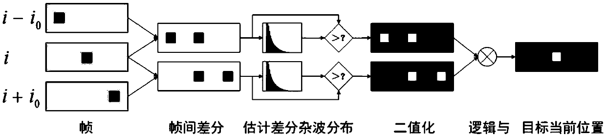
[0076] First, detect the moving target in the satellite video, using the method based on motion and local clutter modeling, the specific implementation method is as follows:

[0077] Step 1: In each frame, divide the image into two-dimensional grids along the vertical and horizontal directions, and each grid unit contains several pixels;

[0078] Step 2: The image is regarded as the sum of the original image signal and the noise signal, and an exponential distribution is selected to fit the distribution of the noise signal;

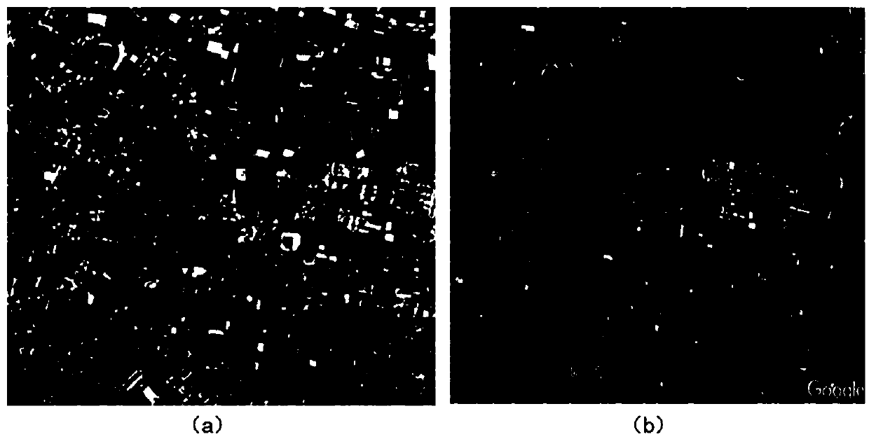
[0079] Step 3: Find the area with large grayscale changes as the target, and set the false alarm rate to 1×10 in advance. -2 , calculate the threshold value of binarization, and use this threshold value to classify the pixels, that is: the pixel amplitude value greater than the threshold value is the foreground, anyway it is the background (in the binary image, '1' is the foreground, '0' is the background) ;

[0080] Step 4: Take the intersection map of...


PUM


Abstract

The invention belongs to the technical field of the image and video processing, specifically a detection and tracking method of a moving object in a satellite video. The method comprises the followingsteps: detecting a moving target-vehicle in the city in the satellite video by adopting the detection technology based on movement and local clutter modelling; identifying the detected moving objectby adopting the identification technology based on region growing and multi-thread; and further tracking the ground moving object by adopting the target tracking technology based on a Kalman filter and associating multiple detected vehicle targets with multiple trajectories being tracked. The method disclosed by the invention is strong in practicability, and can be used for traffic monitoring, city monitoring, military monitoring and like fields, and is extensive in application prospect.

Description

field of invention [0001] The invention belongs to the technical field of image processing and video processing, and in particular relates to a method for detecting and tracking a moving target in satellite video. Background technique [0002] Earth Observation (EO) has a wide field of view and can reach the observation range of the size of a city. It is a current research hotspot and a future research trend. It plays a vital role in civil and military fields such as urban traffic systems, maritime surveillance, aerial espionage, and battlefield surveillance. At present, many observation technologies, including optical satellite images, spaceborne synthetic aperture radar and aerial images, have gradually developed and are of great significance. Both optical satellite imagery and spaceborne SAR can observe a wide field of view with high resolution. However, optical satellite images and SAR images are static images, which cannot observe the dynamic changes of objects, which...

Claims


Application Information

Patent Timeline
Patent Type & Authority Applications(China)
IPC IPC(8): G06K9/00G06T7/207
CPCG06T7/207G06T2207/10016G06V20/584G06V2201/08
Inventor 徐丰敖巍钱昱彤施燕清
Owner FUDAN UNIV
Why Eureka
Try Eureka