Remote-sensing monitoring method for infrastructure in boundary
An infrastructure and remote sensing monitoring technology, applied in the field of remote sensing monitoring, can solve the problems of lack of pertinence and systematicness of remote sensing monitoring models, and achieve the effect of promoting national cooperation and common development, wide detection range and strong timeliness
- Summary
- Abstract
- Description
- Claims
- Application Information
AI Technical Summary
Problems solved by technology
Method used
Image
Examples
Embodiment Construction
[0023] Hereinafter, the present invention will be described in detail based on the drawings.
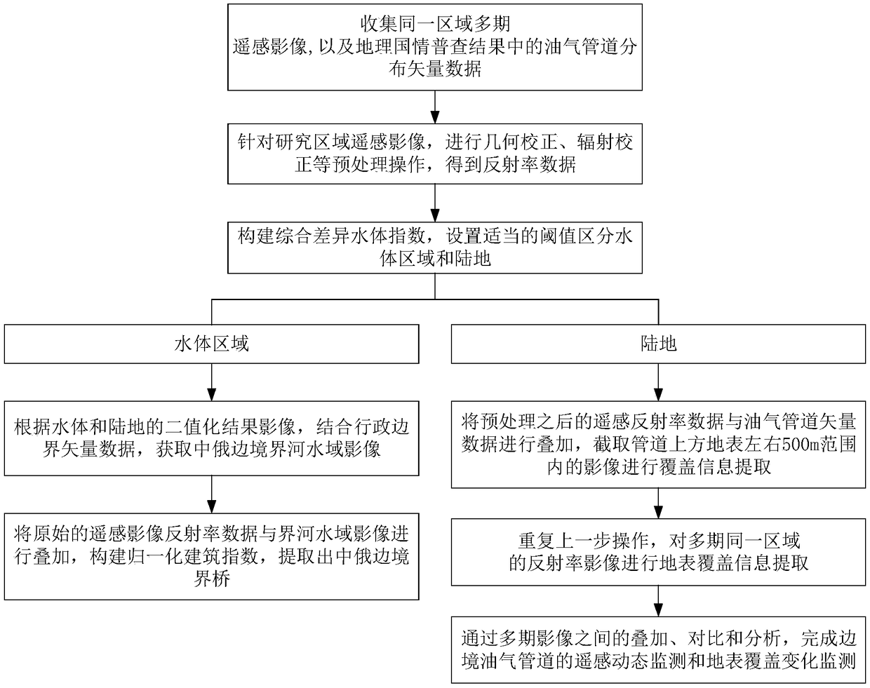
[0024] Such as figure 1 As shown, the present invention designs a remote sensing monitoring method for border infrastructure. The method uses remote sensing images as a data source, comprehensively uses remote sensing monitoring technology, geographic national conditions monitoring technology, and geographic information space analysis technology to realize border bridges, Remote sensing monitoring of infrastructure such as oil and gas pipelines, the method mainly includes the following steps:
[0025] S101. Collect multi-period remote sensing image data of the same research area, and the distribution vector data of oil and gas pipelines in the results of geographic national conditions survey;
[0026] S102. Perform necessary preprocessing on the remote sensing image data of the research area, so as to obtain remote sensing albedo data. The preprocessing implementation process is as...
PUM
 Abstract
Description
Claims
Application Information
 - R&D
- Intellectual Property
- Life Sciences
- Materials
- Tech Scout
- Unparalleled Data Quality
- Higher Quality Content
- 60% Fewer Hallucinations
Browse by: Latest US Patents, China's latest patents, Technical Efficacy Thesaurus, Application Domain, Technology Topic, Popular Technical Reports.
© 2025 PatSnap. All rights reserved.Legal|Privacy policy|Modern Slavery Act Transparency Statement|Sitemap|About US| Contact US: help@patsnap.com


