

A UAV image segmentation method considering the three-dimensional and edge shape features of buildings
A shape feature and image segmentation technology, applied in image analysis, image enhancement, image data processing, etc., can solve the problems of wrong merging of building areas, difficult selection of scale parameters, and no definite physical meaning, etc., to achieve strong operability, The clear effect of the processing method
- Summary
- Abstract
- Description
- Claims
- Application Information
AI Technical Summary
Problems solved by technology
Method used
Image

Examples
Embodiment Construction
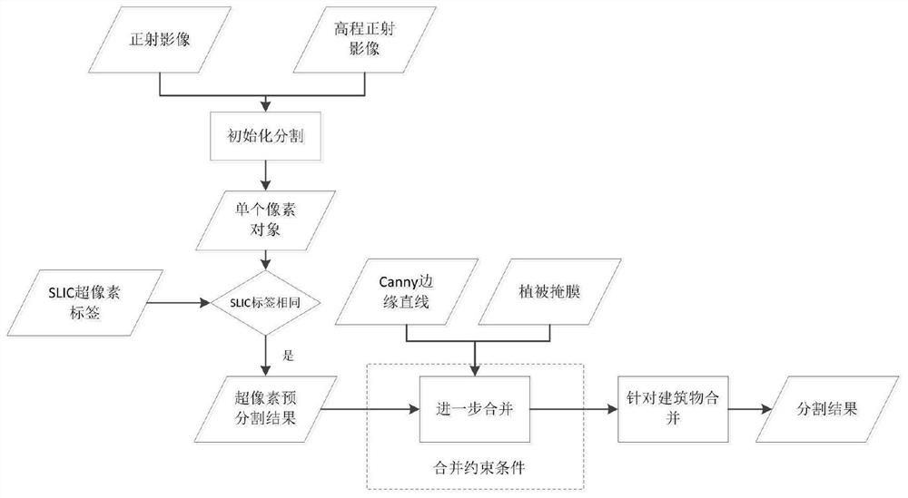
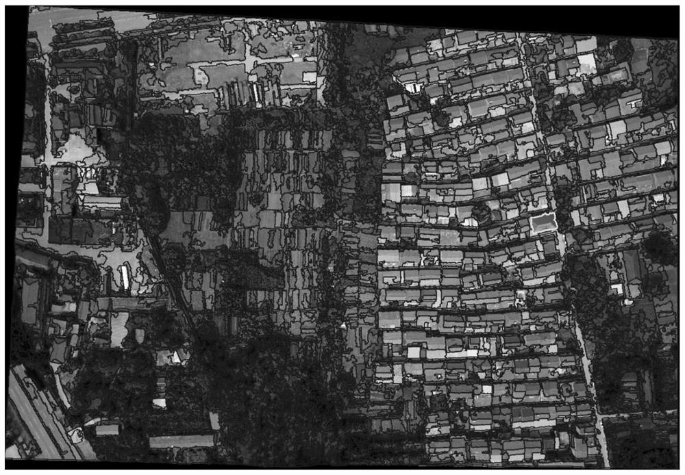
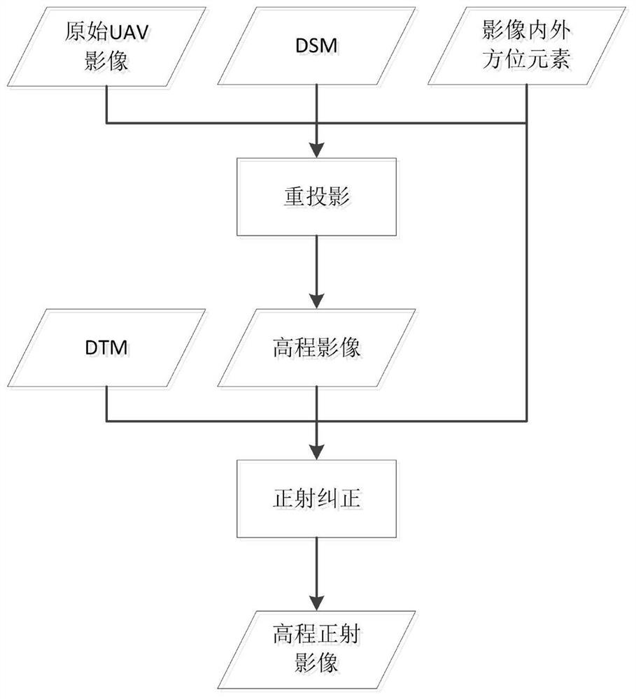
[0051] A UAV image segmentation method that takes into account the three-dimensional and edge shape characteristics of the building provided by the present invention is to set the segmentation scale parameter for the maximum object area to be extracted, perform mask processing on the invalid area, and convert the input orthophoto A single pixel of the corrected image, elevation orthophoto, and SLIC label image is regarded as an object, and the segmentation process is initialized; pre-segmentation based on SLIC superpixels is performed, and adjacent pixel objects are found for the initial pixel object. If the SLIC label is the same, merge , until all pixel objects with the same label are merged together; add Canny edge line information and vegetation mask information, and perform edge labeling and vegetation labeling on a single superpixel segmentation object in the superpixel pre-segmentation result; find objects in each The most similar object under these constraints, and judg...
PUM
 Abstract
Description
Claims
Application Information