
A Construction Method of Ionospheric Tomography Based on SAR Azimuth Migration

A construction method and ionospheric technology, applied in radio wave measurement systems, radio wave reflection/reradiation, instruments, etc., can solve problems such as insufficient spatial resolution of data, and achieve the effect of accurate acquisition

Active Publication Date: 2020-12-22
CHANGAN UNIV
View PDF4 Cites 0 Cited by
  • Summary
  • Abstract
  • Description
  • Claims
  • Application Information

AI Technical Summary

Problems solved by technology

[0004] The purpose of the present invention is to provide a method for constructing ionospheric tomography based on SAR azimuth offset to solve the problems of insufficient spatial resolution of existing ionospheric tomography observation data.

Method used


Image

  • A Construction Method of Ionospheric Tomography Based on SAR Azimuth Migration
  • A Construction Method of Ionospheric Tomography Based on SAR Azimuth Migration
  • A Construction Method of Ionospheric Tomography Based on SAR Azimuth Migration

Examples


Embodiment Construction

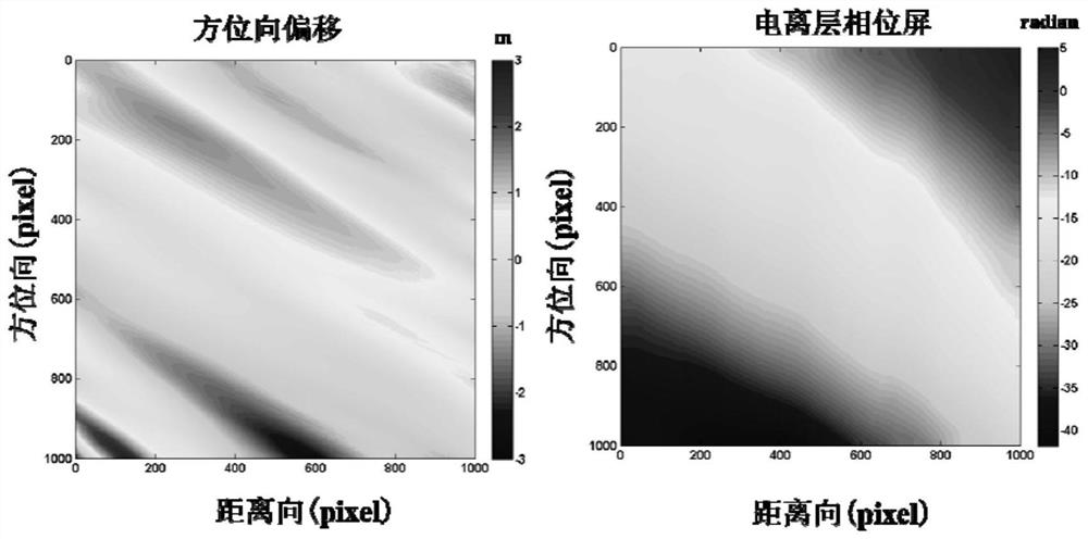
[0035] As a very potential space-to-earth observation technology, the signal of synthetic aperture radar (SAR) will pass through the ionosphere region during imaging, which will cause distortion of SAR image (such as phase advance, Faraday rotation, azimuth shift, etc. ). Based on the image distortion caused by the ionosphere, a certain model can be used to invert the ionosphere information on the SAR signal propagation path, including three-dimensional ionosphere tomography.

[0036] According to the above-mentioned technical scheme, the present invention discloses a method for constructing ionospheric tomography based on SAR azimuth offset, the method comprising:

[0037] Step 1, the ionosphere is divided into multiple sub-ionospheres according to height;

[0038] In this embodiment, for an observation area of ​​1000×1000 pixels, the height of the ionosphere is set to be 200 km, 300 km, 400 km and 500 km, respectively, with four sub-ionosphere layers.

[0039] Step 2, repe...


PUM


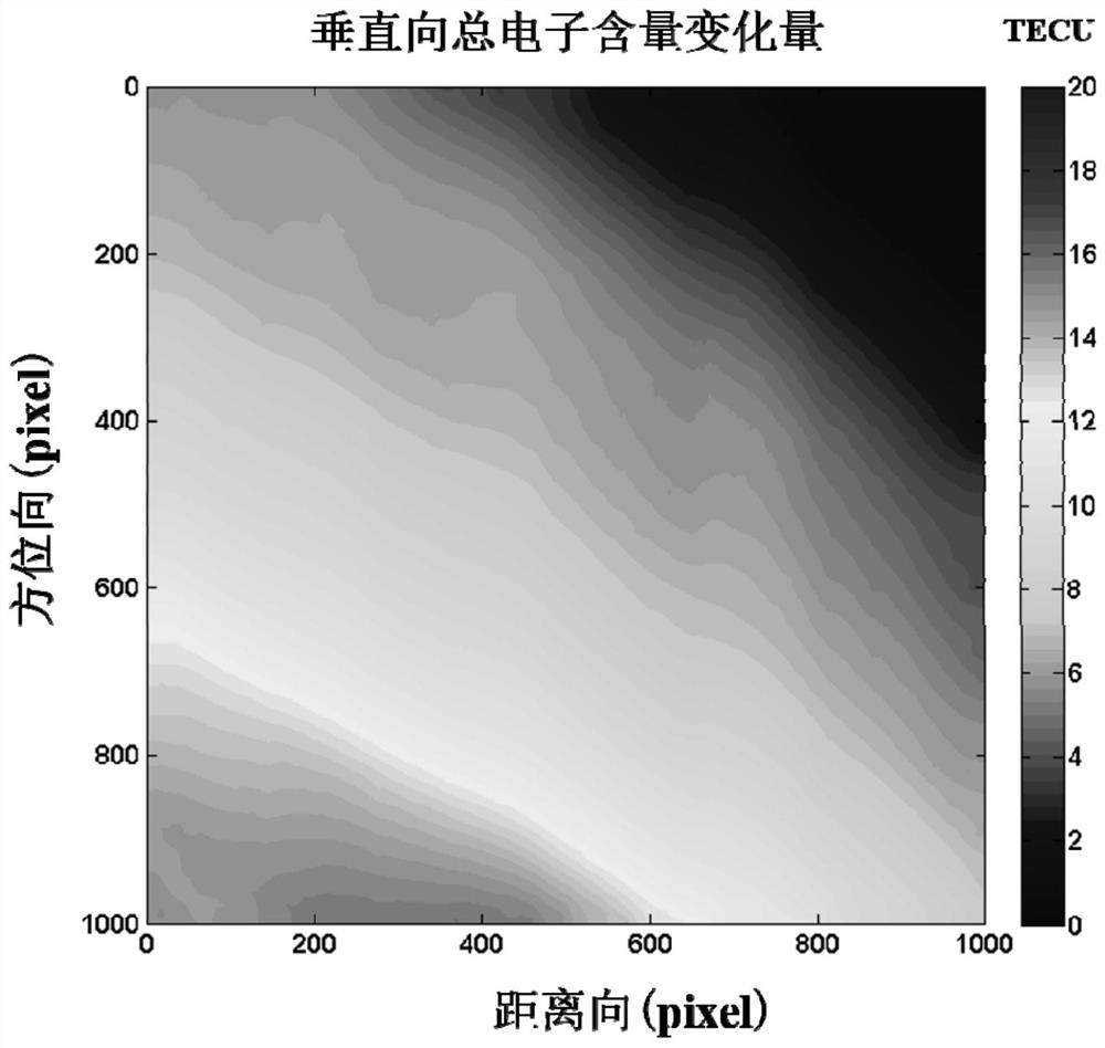
Abstract

The invention discloses an SAR azimuth offset based ionosphere chromatographic construction method. The method based on original SAR data comprises that a distance-Doppler imaging principle is used torealize 3D SAR imaging, differential interference phase and azimuth offset observed quantities are obtained, the two observation quantities are combined to estimate an ionosphere phase screen, the ionosphere phase screen is converted into the vertical total electron content variance VTEC, and SAR imaging in different ionosphere heights is taken into consideration to realize ionosphere chromatographic construction. The method can be used to obtain the high-resolution high-precision refined ionosphere chromatography, and has great significance in understanding the ionosphere structure and change thereof deeply.

Description

technical field [0001] The invention relates to an ionospheric tomography construction method, in particular to an ionospheric tomography construction method based on SAR azimuth offset. Background technique [0002] The ionosphere is the partially ionized atmospheric region above 60 kilometers above the ground. Ionospheric tomography (Computerized Ionosphere Tomography, CIT) is the expression of three-dimensional spatial structure information of the ionosphere, which contains not only horizontal structure information, but also vertical structure information, and is a precise parameter that characterizes the ionosphere spatial structure and its changes. By constructing ionospheric tomography, not only can the structure and changes of the entire space atmosphere be reversed, which is of great scientific significance for in-depth understanding of the entire solar-terrestrial space environment; It has great application value in serving human space activities. [0003] At pres...

Claims


Application Information

Patent Timeline
Patent Type & Authority Patents(China)
IPC IPC(8): G01S13/90
CPCG01S13/9023
Inventor 朱武张勤彭建兵赵超英杨成生张静赵丽华瞿伟
Owner CHANGAN UNIV
Learn More