A low-altitude UAV-based intersection od matrix estimation method
A technology for intersections and UAVs, which is applied in traffic control systems, calculations, and traffic flow detection of road vehicles, etc. It can solve the problem of the difficulty in determining the channelization information of intersections, the unfixed orientation of UAVs, and the difficulty in identifying the actual direction and other issues to achieve the effect of ensuring accuracy
- Summary
- Abstract
- Description
- Claims
- Application Information
AI Technical Summary
Problems solved by technology
Method used
Image
Examples
Embodiment
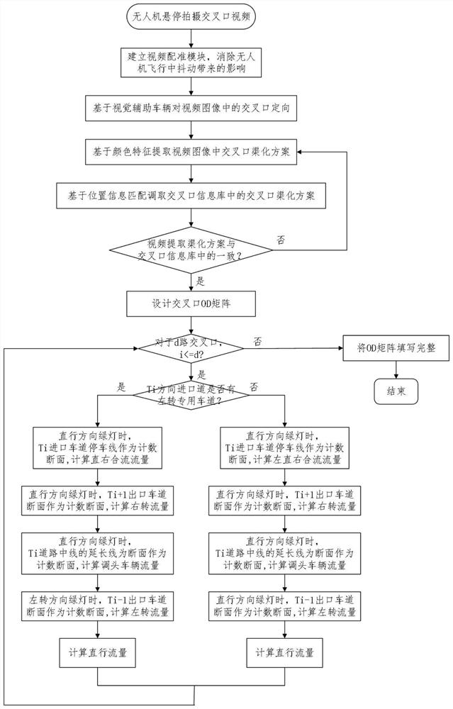
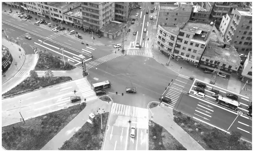
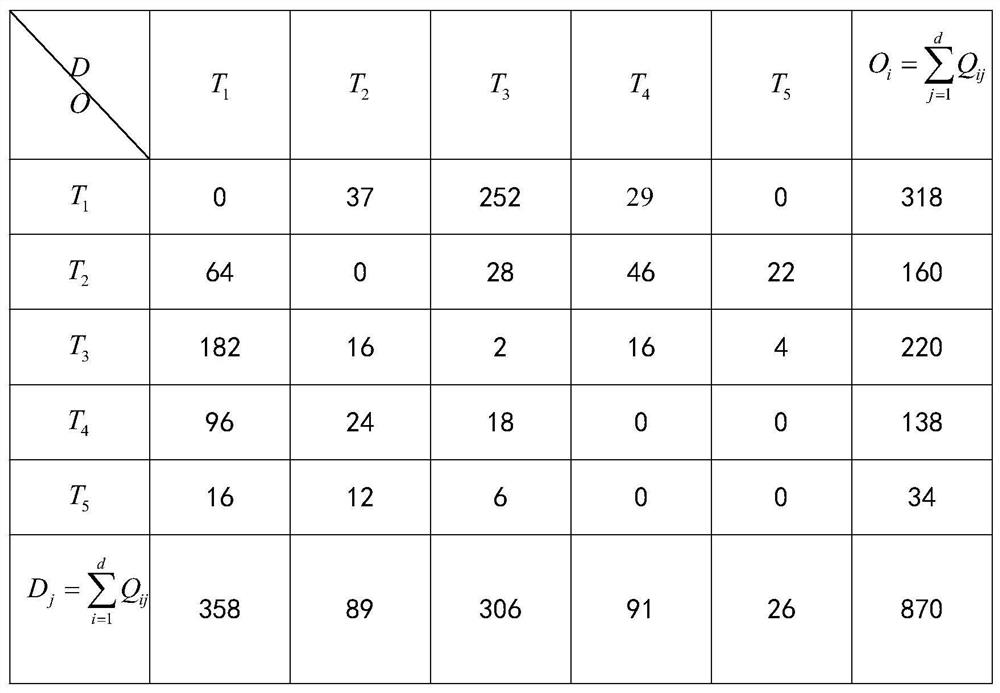
[0055] For a common four-phase four-way intersection, it is necessary to extract the OD matrix of the intersection based on the video of the drone, and the implementation of the present invention specifically includes the following steps:
[0056] A method for extracting intersection OD matrix based on low-altitude unmanned aerial vehicles, which specifically includes the following steps:
[0057] Step 1. Establish a video registration module to complete the shake correction of the UAV video image.
[0058] UAVs are small in mass, light and flexible, and because of this, their own mechanical vibration and airflow are likely to cause jitter in the captured images, whose frequency and amplitude far exceed traditional aerial and satellite remote sensing images, which is not conducive to subsequent processing.
PUM
 Abstract
Description
Claims
Application Information
 - R&D
- Intellectual Property
- Life Sciences
- Materials
- Tech Scout
- Unparalleled Data Quality
- Higher Quality Content
- 60% Fewer Hallucinations
Browse by: Latest US Patents, China's latest patents, Technical Efficacy Thesaurus, Application Domain, Technology Topic, Popular Technical Reports.
© 2025 PatSnap. All rights reserved.Legal|Privacy policy|Modern Slavery Act Transparency Statement|Sitemap|About US| Contact US: help@patsnap.com


