A multi-camera data fusion method based on a spatial coordinate system
A space coordinate system and multi-camera technology, applied in image data processing, image analysis, image enhancement, etc., can solve problems such as limitations, inability to reflect target position change information, inability to continuously track targets, etc., to reduce data volume and improve calculation efficiency effect
- Summary
- Abstract
- Description
- Claims
- Application Information
AI Technical Summary
Problems solved by technology
Method used
Image

Examples
Embodiment Construction
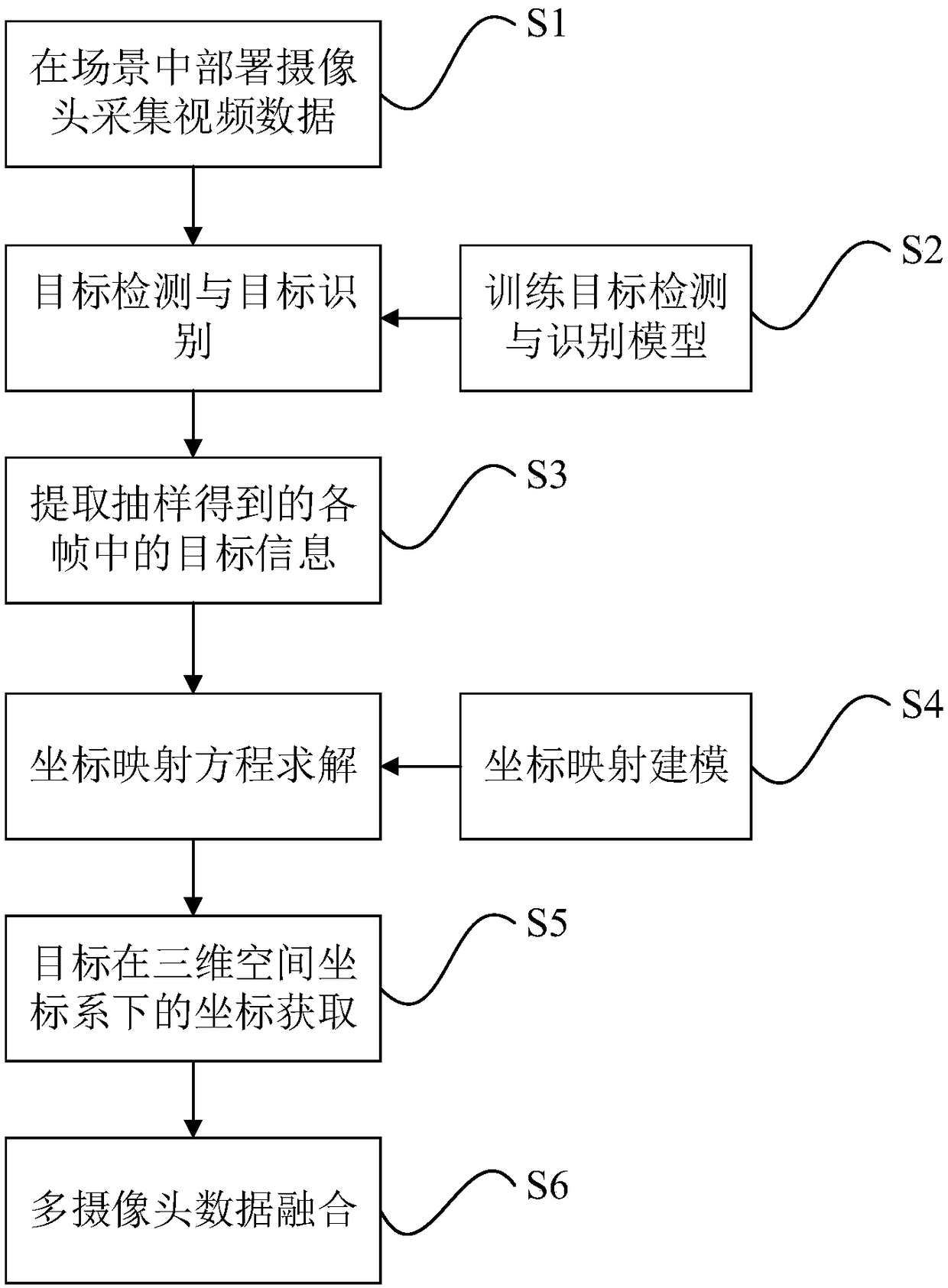
[0036] A kind of multi-camera data fusion method based on the spatial coordinate system of the present invention is further described in detail in conjunction with the accompanying drawings:
[0037] figure 1 It is a schematic flowchart of a multi-camera data fusion method based on a spatial coordinate system provided by an embodiment of the present invention. Such as figure 1 As shown, the multi-camera data fusion method based on the spatial coordinate system includes steps S1-S6:
[0038] S1. Deploy multiple cameras in the scene to be monitored, where the edges of the scene covered by adjacent cameras should be as close as possible, and the edges of the scene covered by adjacent cameras should overlap as little as possible.
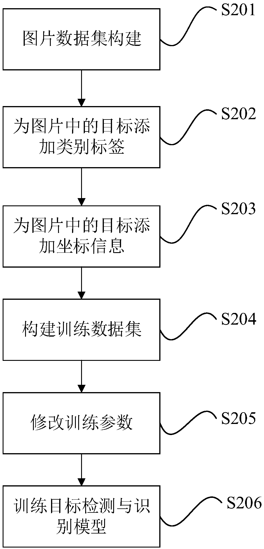
[0039] S2. Training the target detection and recognition model, the model training flow chart is attached figure 2 As shown, the specific implementation steps are as follows:
[0040] Step 201: For each category, 500-1000 pictures containing at lea...
PUM
 Abstract
Description
Claims
Application Information
 - R&D Engineer
- R&D Manager
- IP Professional
- Industry Leading Data Capabilities
- Powerful AI technology
- Patent DNA Extraction
Browse by: Latest US Patents, China's latest patents, Technical Efficacy Thesaurus, Application Domain, Technology Topic.
© 2024 PatSnap. All rights reserved.Legal|Privacy policy|Modern Slavery Act Transparency Statement|Sitemap