An intelligent campus assistant system based on webgis
An auxiliary system and smart campus technology, applied in image data processing, instruments, 3D modeling, etc., can solve problems such as trouble, easy mistakes in classrooms, waste of time, etc.
- Summary
- Abstract
- Description
- Claims
- Application Information
AI Technical Summary
Problems solved by technology
Method used
Image
Examples
Embodiment 1
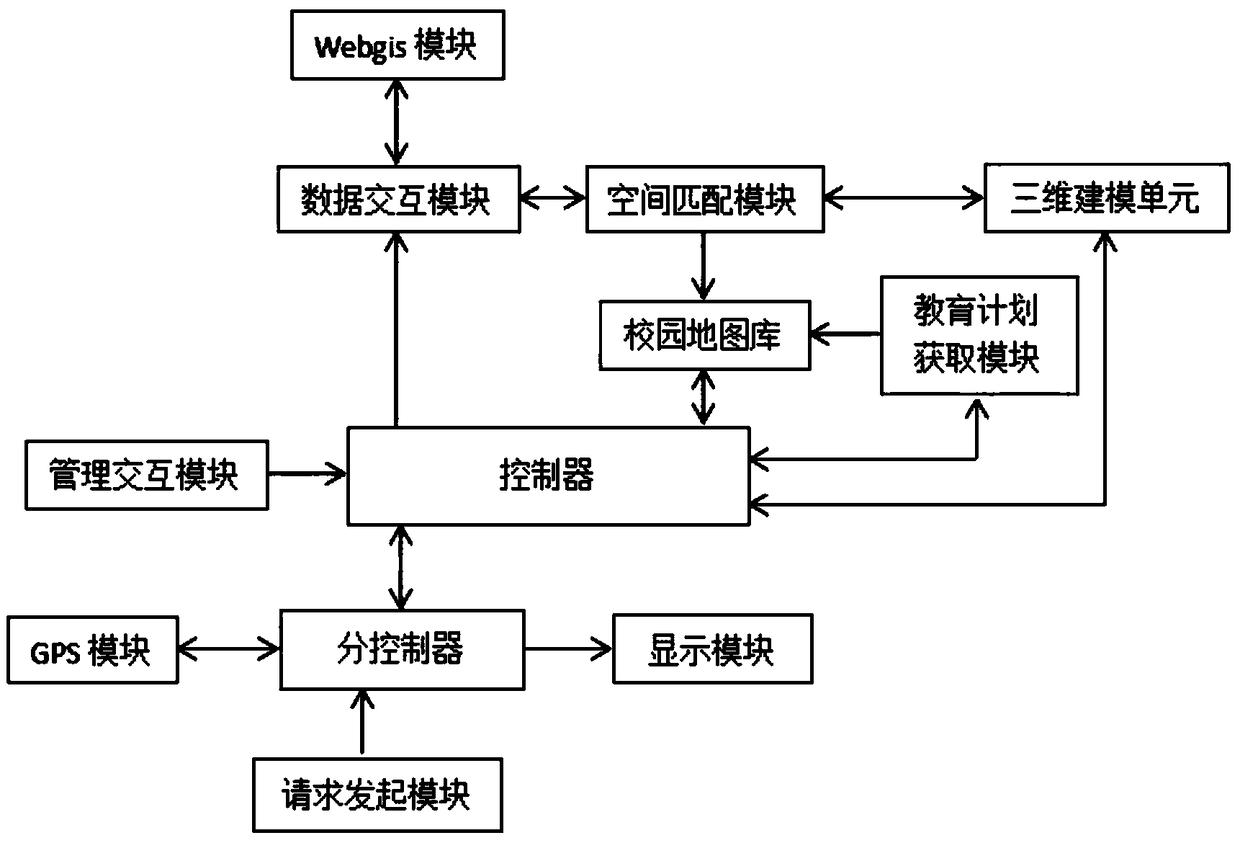
[0030] Embodiment 1: When a new student first comes to school, the student transmits navigation request information to the sub-controller through the request initiation module. At this time, the sub-controller will obtain the current student location from the GPS module, and then the sub-controller will transmit the navigation information and The location of the students, after the controller receives the navigation request information transmitted by the sub-controller and the location of the students, it will automatically combine the campus map library to obtain the navigation path information, and then transmit the navigation path information to the display through the sub-controller for real-time display. Students can observe the navigation path information and the specific path information on both sides of the path, including the specific information of the teaching buildings and landmark buildings on both sides;
[0031]During this process, the administrator can update th...
Embodiment 2
[0032] Embodiment 2: Students can transmit query signals to sub-controllers through the request initiation module to query classrooms that currently have no teaching plan, sub-controllers transmit query signals to the controller, and the controller combines the campus map library and the education plan Obtain the information of the first few idle classrooms and the corresponding path information with the short path automatically planned by the module, and can plan the information of the first ten idle classrooms with the shortest distance, and the controller is used to control the information of the idle classroom and the corresponding path The sensor is transmitted to the display module for real-time display.
[0033] The present invention can realize the three-dimensional map of newly-built campus through webgis module, three-dimensional modeling unit and space matching module, is convenient to view the concrete building information of campus from the map intuitively; It can...
PUM
 Abstract
Description
Claims
Application Information
 - R&D
- Intellectual Property
- Life Sciences
- Materials
- Tech Scout
- Unparalleled Data Quality
- Higher Quality Content
- 60% Fewer Hallucinations
Browse by: Latest US Patents, China's latest patents, Technical Efficacy Thesaurus, Application Domain, Technology Topic, Popular Technical Reports.
© 2025 PatSnap. All rights reserved.Legal|Privacy policy|Modern Slavery Act Transparency Statement|Sitemap|About US| Contact US: help@patsnap.com

