Distance-based energy balance dynamic geographic routing method in underwater sensor network

An underwater sensor and geographic routing technology, applied in network topology, electrical components, wireless communication, etc., can solve problems such as uneven distribution of network node density and difficult control of cone angle θ

Inactive Publication Date: 2019-01-18
TIANJIN UNIV
View PDF4 Cites 18 Cited by
  • Summary
  • Abstract
  • Description
  • Claims
  • Application Information

AI Technical Summary

Problems solved by technology

However, due to the uneven distribution of network node density, it is difficult to control the value of the cone angle θ to achieve better efficiency.

Method used


Image

  • Distance-based energy balance dynamic geographic routing method in underwater sensor network
  • Distance-based energy balance dynamic geographic routing method in underwater sensor network
  • Distance-based energy balance dynamic geographic routing method in underwater sensor network

Examples


Embodiment Construction

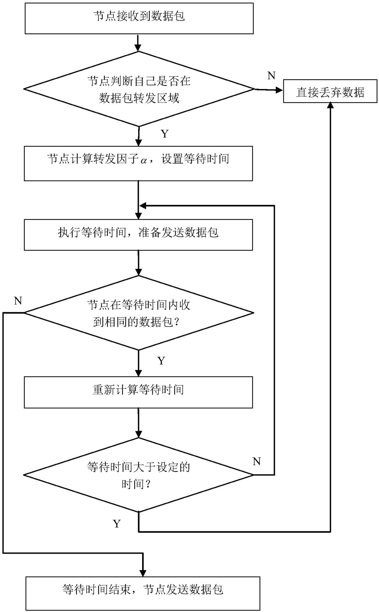
[0043] The distance-based energy balance dynamic geographical routing method in the underwater sensor network of the present invention will be described in detail below with reference to the embodiments and the accompanying drawings.

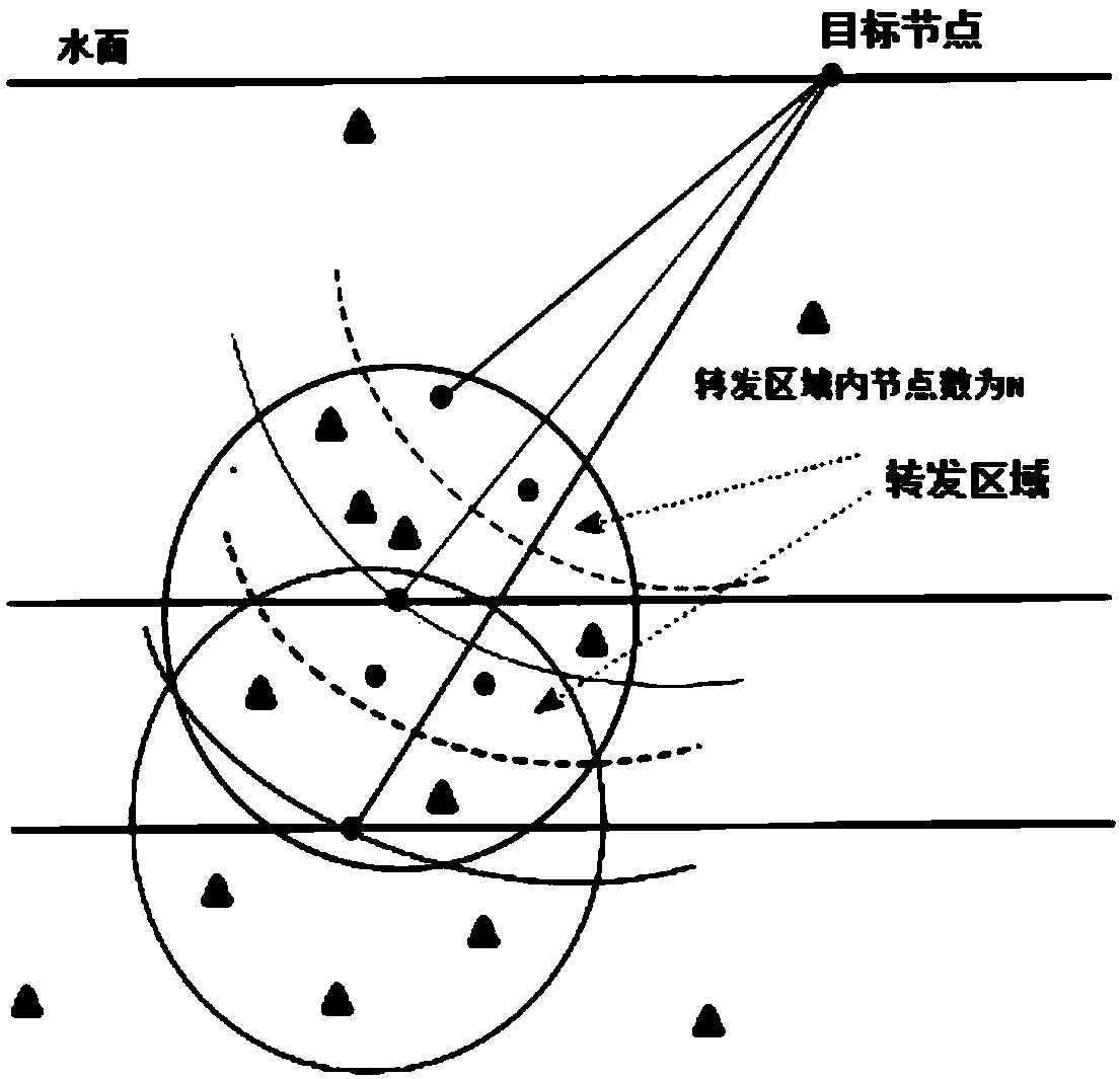
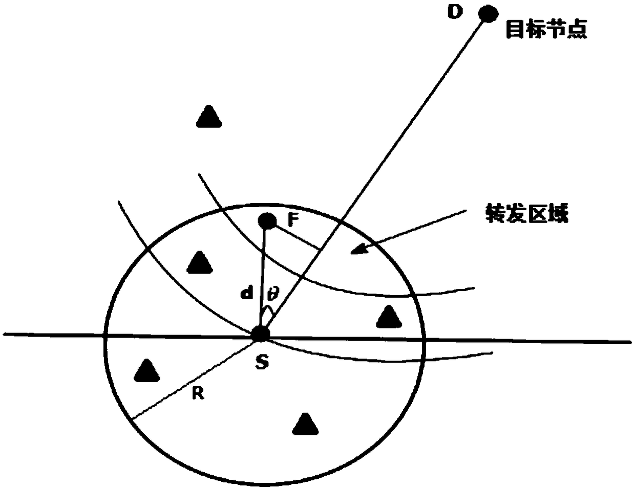
[0044] Such as figure 1 Shown, in the underwater sensor network of the present invention, based on the energy balance dynamic geographical routing method of distance, comprises the steps:

[0045] 1) Establishment and maintenance of neighbor node table;

[0046] The establishment of the neighbor node table is that each sensor node in the underwater sensor network broadcasts data packets respectively, and when each sensor node receives the data packets broadcast by adjacent sensor nodes for the first time, it records the corresponding The identification and location information of the adjacent sensor nodes form a neighbor node table.

[0047] The maintenance is that when the sensor node receives a data packet sent by an adjacent sensor node, if...


PUM


Abstract

The invention discloses a distance-based energy balance dynamic geographic routing method in an underwater sensor network, and the method comprises the steps: establishing and maintaining a neighbor node table; selecting neighbor nodes that forward a data packet according to the neighbor node table to form a data packet forwarding area; calculating a forwarding factor; and setting the time for theadjacent sensor nodes in waiting for the forwarding of the data packet according to the forwarding factor. The method performs routing selection through the coordinate position information of the nodes, effectively compensates for some defects of a topology information routing method, dynamically adjusts the size of the forwarding area, reduces excessive redundant nodes for sending data, and enables a routing protocol to have dynamic adaptability. The greater the remaining energy of a node is, the easier it is to forward data, and vice versa. Finally, energy balance can be achieved.

Description

technical field [0001] The invention relates to an underwater wireless sensor network routing method. In particular, it relates to a distance-based energy-balanced dynamic geographic routing method in underwater sensor networks. Background technique [0002] The underwater wireless sensor network is an underwater detection network system composed of a series of sensor nodes with acoustic communication capabilities and computing capabilities. It has broad application prospects in the fields of marine resource survey, water pollution detection, marine seismic monitoring, tactical surveillance, etc. . The routing problem is one of the key issues in underwater sensor networks. [0003] Because radio waves will be severely absorbed underwater, the loss will be serious, and light waves will be severely scattered, which do not meet the communication requirements of underwater networks. In the underwater environment, node communication consumes a lot of energy, energy supply and ...

Claims


Application Information

Patent Timeline
Patent Type & Authority Applications(China)
IPC IPC(8): H04W40/10H04W40/20H04W84/18
CPCH04W40/10H04W40/20H04W84/18
Inventor 王博张钢
Owner TIANJIN UNIV
Why Eureka
Try Eureka