Double-base imaging method based on navigation satellite signals

A technology of navigation satellites and imaging methods, applied in the field of satellite navigation signal processing, can solve problems such as research difficulty, and achieve the effect of improving the quality of dual-base imaging

Active Publication Date: 2019-03-22
曲卫
View PDF3 Cites 11 Cited by
  • Summary
  • Abstract
  • Description
  • Claims
  • Application Information

AI Technical Summary

Problems solved by technology

[0008] The advantages and military value of dual-station SAR based on navigation satellite signals have aroused the interest and attention of various research units, but due to some limitations of the system, the research is difficult

Method used


Image

  • Double-base imaging method based on navigation satellite signals
  • Double-base imaging method based on navigation satellite signals
  • Double-base imaging method based on navigation satellite signals

Examples


Embodiment Construction

[0051] In order to make the technical problems, technical solutions and beneficial effects solved by the present invention clearer, the present invention will be further described in detail below in conjunction with the accompanying drawings and embodiments. It should be understood that the specific embodiments described here are only used to explain the present invention, not to limit the present invention.

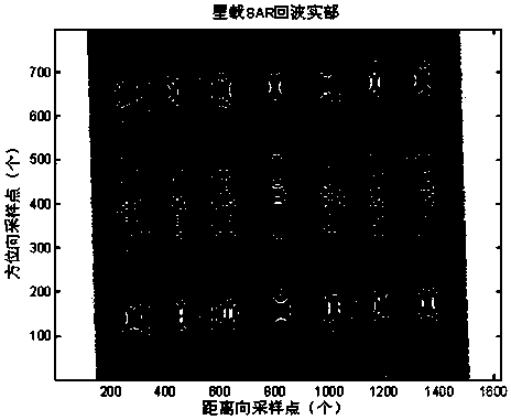
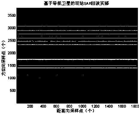
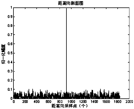
[0052] The invention belongs to the technical field of satellite navigation signal processing and is used for remote sensing imaging based on navigation satellite signals. In the dual-station synthetic space radar imaging process based on navigation satellite signals provided by the present invention, range compression, range migration correction, two-dimensional decoupling, and azimuth compression processing are performed. The difference from the conventional monostatic synthetic aperture radar imaging SAR is that the range signal is no longer a chirp signal, but a bino...


PUM


Abstract

The invention provides a double-base imaging method based on navigation satellite signals. The method comprises the steps that range processing is carried out on an original echo; two-dimensional decoupling processing is carried out; range migration correction is carried out; azimuth compression processing is carried out; the echo obtained after azimuth compression processing is subjected to azimuth IFFT, and an imaging result of a two-dimensional time-domain midpoint target is obtained. The method has the advantage that in the double-station synthetic space radar imaging process based on thenavigation satellite signals, range compression, range migration correction, two-dimensional decoupling and azimuth compression processing are carried out; different from a conventional single-stationsynthetic aperture radar imaging SAR, range signals are no longer linear frequency modulation signals, but are binomial continuous waves, and range needs to obtain distinguishing performance according to correlation characteristics of C/A codes. According to the method, the double-base imaging quality can be obviously improved.

Description

technical field [0001] The invention belongs to the technical field of satellite navigation signal processing, and in particular relates to a dual-base imaging method based on navigation satellite signals. Background technique [0002] Synthetic Aperture Radar (SAR) emerged in the 20th century. It uses microwave remote sensing technology to realize image recognition of targets. It has the advantages of multi-polarization and penetrability. It is widely used in battlefield reconnaissance, target recognition, attack, terrain Military and civilian fields such as surveying and mapping, geological exploration, ocean observation, disaster forecasting, crop yield estimation, and forest census. The traditional monostatic radar transceiver platform is integrated, and the transmission power is relatively high, so it is easy to expose its position and be attacked. [0003] The dual-station SAR transceiver platform is placed on different platforms. The transceiver platform can have dif...

Claims


Application Information

Patent Timeline
Patent Type & Authority Applications(China)
IPC IPC(8): G01S13/90
Inventor 曲卫杨君李云涛邱磊孟磊朱卫纲庞洪峰
Owner 曲卫
Why Eureka
Try Eureka