Tower inclination early warning method based on airborne liDAR point cloud data

A point cloud data, tower technology, applied in the field of remote sensing, to achieve the effect of good separation, simple calculation, high measurement efficiency and accuracy

Pending Publication Date: 2019-04-12
INST OF REMOTE SENSING & DIGITAL EARTH CHINESE ACADEMY OF SCI
View PDF8 Cites 13 Cited by
  • Summary
  • Abstract
  • Description
  • Claims
  • Application Information

AI Technical Summary

Problems solved by technology

[0004] The purpose of the present invention is to provide a tower tilt early warning method based on airborne LiDAR point cloud data, which can overcome the defect that traditional manual detection is not suitable for efficient detection in complex en...

Method used


Image

  • Tower inclination early warning method based on airborne liDAR point cloud data
  • Tower inclination early warning method based on airborne liDAR point cloud data
  • Tower inclination early warning method based on airborne liDAR point cloud data

Examples


Embodiment

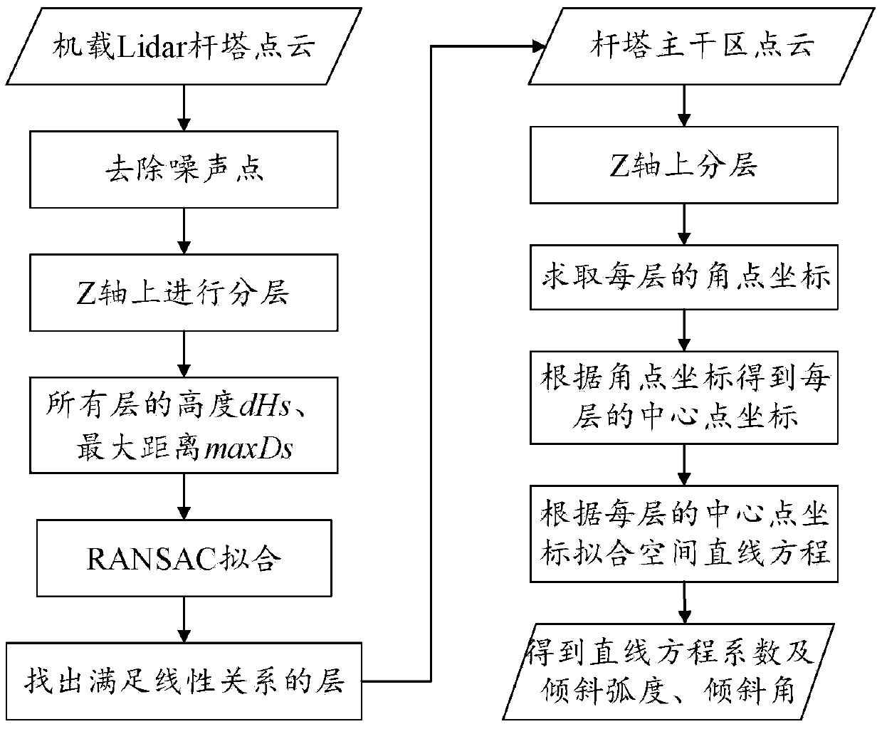
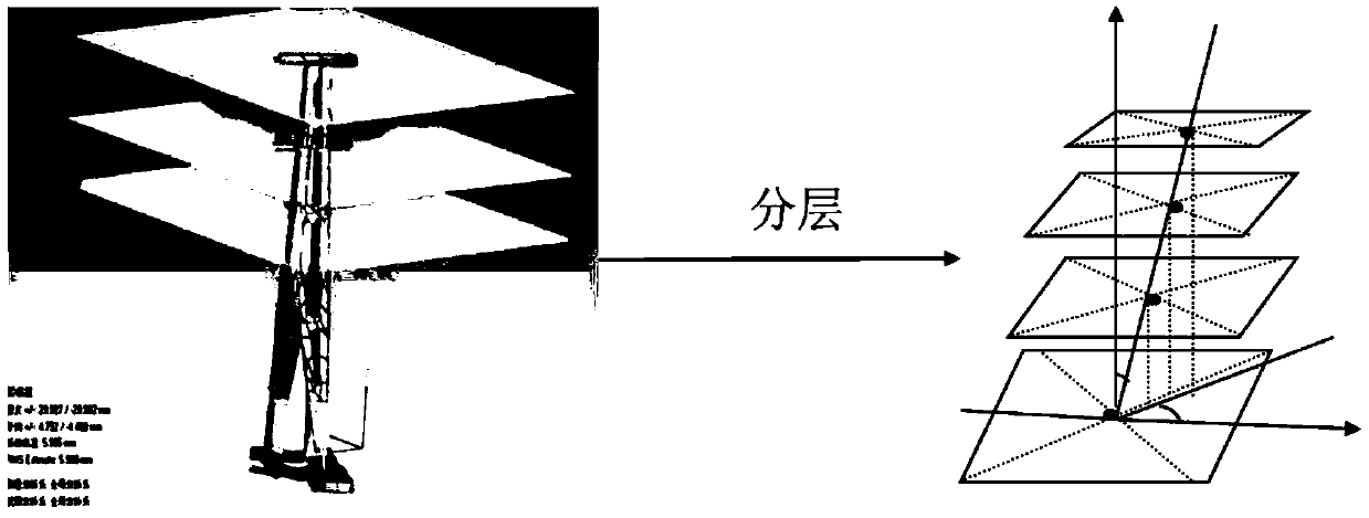
[0029] figure 1 shows the implementation process of this embodiment, refer to figure 1 Shown, the present invention discloses a kind of tower tilt early warning method based on airborne LiDAR point cloud data, and it comprises the following steps:

[0030] S1. Based on Kd-tree clustering and spatial grid growth, preprocess the tower point cloud data scanned by the airborne lidar to remove noise points:

[0031] The tower point cloud data scanned by the airborne lidar contains noise points caused by the comet tail effect and air impurities, and due to the complex geographical environment of the transmission corridor, the rapid growth of vegetation, and the different types and sizes of towers in the entire transmission corridor , resulting in higher terrain points and vegetation points in the tower point cloud data set, which directly affects the determination of the subsequent backbone area of ​​the tower, thereby reducing the calculation accuracy of the tower inclination. By...


PUM


Abstract

The invention discloses a tower inclination early warning method based on airborne liDAR point cloud data. The tower inclination early warning method based on the airborne liDAR point cloud data comprises the steps that the tower point cloud data scanned by an airborne lidar based on Kd-tree clustering and spatial grid growth is preprocessed to remove noise points; secondly, point clouds in a tower trunk area are extracted based on tower geometric features; then angular point coordinates of the point cloud data of each layer in the tower trunk area are calculated based on a coordinate system rotation method again; finally, center point coordinates of each layer are calculated by using the angular point coordinates and a space linear equation is fitted to obtain the inclination radian and inclination angle of a tower; and safety warning is given to the tower with the inclination angle exceeding a certain safety threshold value. The defect that traditional manual detection is not suitable for efficient detection in a complex environment is overcome, the inclination and inclination radian of the tower can be automatically obtained based on the airborne LiDAR tower point cloud data, high measurement efficiency and high precision are achieved, and early warning can be timely given to the tower with serious inclination to prevent more serious consequences in the later period.

Description

technical field [0001] The invention relates to the technical field of remote sensing, in particular to a tower tilt early warning method based on airborne LiDAR point cloud data. Background technique [0002] With the rapid development of the national economy, people's demand for electric energy is increasing day by day, which in turn leads to the substantial expansion of high-voltage, ultra-high voltage and ultra-high voltage large-capacity power lines. The tower is the basic equipment of the transmission line. It is erected in the field and is vulnerable to collapse accidents caused by factors such as strong winds, unstable geological environment, and underground mining. When the transmission line passes through special areas such as coal mining areas, soft soil areas, hillsides, and riverbed areas, the foundation of the tower will slip, tilt, settle, crack, etc., which will cause deformation or inclination of the tower; During hoisting, unreasonable selection of lifting...

Claims


Application Information

Patent Timeline
IPC IPC(8): G01S7/48G01C9/00G06K9/62
CPCG01C9/00G01S7/4802G06F18/23
Inventor 王成朱笑笑习晓环聂胜
Owner INST OF REMOTE SENSING & DIGITAL EARTH CHINESE ACADEMY OF SCI
Why Eureka
Try Eureka