Atmosphere environment ground monitoring station disposing networking method based on satellite remote sensing

An atmospheric environment and monitoring station technology, applied in the field of atmospheric satellite remote sensing applications, can solve problems such as low efficiency and low effective utilization rate of monitoring data, and achieve the effects of good application prospects, low consumption, and easy implementation.

Inactive Publication Date: 2019-04-19
天津珞雍空间信息研究院有限公司
View PDF10 Cites 10 Cited by
  • Summary
  • Abstract
  • Description
  • Claims
  • Application Information

AI Technical Summary

Problems solved by technology

[0005] The present invention aims at the technical defects of the prior art, and provides a satellite-based remote sensing atmospheric environment ground monitoring site deployment and control networking method to solve the technical problem of low efficiency of conventional methods in the prior art
[0006] Another technical problem to be solved by the present invention is that the current method of evenly distributing nets leads to a low effective utilization rate of monitoring data

Method used


Image

  • Atmosphere environment ground monitoring station disposing networking method based on satellite remote sensing
  • Atmosphere environment ground monitoring station disposing networking method based on satellite remote sensing
  • Atmosphere environment ground monitoring station disposing networking method based on satellite remote sensing

Examples


Embodiment 1

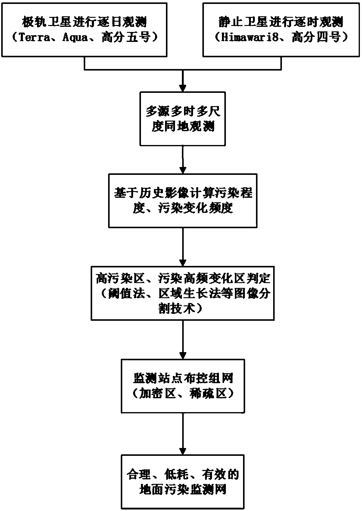
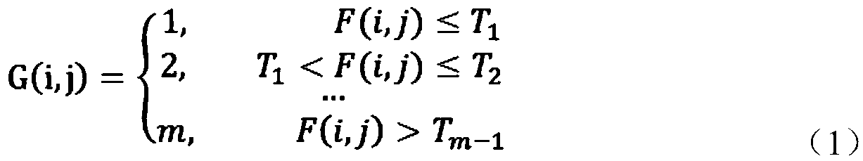
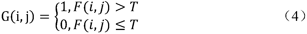
[0038] Polar orbiting satellites and geostationary satellites can separately observe the monitored area at multiple time and multiple scales, and provide multi-source, multiple time, and multi-scale historical satellite atmospheric products; based on these rich atmospheric products, calculate the difference in the geographical distribution of pollution and pollution changes in the monitored area Frequency is used to determine the high-pollution area and high-frequency pollution change area of ​​the monitoring area, set the dense area and sparse area, and finally establish a reasonable, low-consumption, and effective atmospheric environmental ground pollution monitoring network.

[0039] In order to achieve the foregoing objective, the present embodiment provides a method for deployment, control and networking of ground monitoring sites for atmospheric environment based on satellite remote sensing, including:

[0040] Step 1. Because different satellites obtain different information ...

Embodiment 2

[0056] Combine below figure 1 The specific implementation of the present invention will be further described in detail.

[0057] The present invention first clarifies the use of polar orbiting satellites and geostationary satellites to perform multi-source, multi-time, multi-scale co-location observation of the monitoring area, ensuring that atmospheric information reflecting the daily average concentration and intra-day concentration changes of the monitoring area can be obtained. For satellite atmospheric products, data with a quality control of 2-3 levels is used to ensure the reliability of the data; at the same time, dark pixel method products focusing on high vegetation coverage and dark blue algorithm products focusing on bright surfaces such as cities are used to ensure The geographic coverage of the data.

[0058] Secondly, based on the acquired historical atmospheric satellite data, calculate the monthly, seasonal and annual average values ​​of atmospheric pollution conc...


PUM


Abstract

The invention discloses an atmosphere environment ground monitoring station disposing networking method based on satellite remote sensing. The method comprises the steps of firstly, considering large-area continuous historical satellite image information in ground monitoring disposing networking; secondly, performing time space information mining on multi-source multi-time multidimensional satellite image data, and obtaining pollution information such as pollution geographical distribution, pollution evolution trend and pollution change frequency in a long-time sequence; afterwards, based on the pollution information of the historical satellite image, determining a high-pollution area and a pollution high-frequency change area; and afterwards, dividing an encrypting area and a sparse areabased on a determined pollution grading area, and furthermore performing disposing network for establishing a reasonable, low-power-consumption and effective ground pollution monitoring network. The ground monitoring station disposing networking method according to the invention realizes a more reasonable plan and acquires ground monitoring information with highest data utilization rate through lowest consumption of manpower, physical resource and financial resource. Furthermore the method has good application prospect in an environment ground monitoring field.

Description

Technical field [0001] The invention relates to the technical field of atmospheric satellite remote sensing application, and in particular to a method for deploying, controlling and networking of ground monitoring sites of atmospheric environment based on satellite remote sensing. Background technique [0002] As the most direct ground monitoring method of atmospheric environment, the atmospheric environment ground monitoring network can obtain real real-time ground atmospheric environment information, quantitatively describe the current situation of atmospheric environmental pollution, and provide a reliable and powerful reference for the formulation of atmospheric environment monitoring and governance policies. How to establish a ground monitoring network for the atmospheric environment is a problem that the environmental monitoring department must consider. At present, the general ground monitoring network of atmospheric environment adopts a uniform layout method. This method ...

Claims


Application Information

Patent Timeline
Patent Type & Authority Applications(China)
IPC IPC(8): G01N33/00G06K9/62
CPCG01N33/0062G06F18/24
Inventor 朱忠敏黄雨斯张天浩史硕宋沙磊夏幸会
Owner 天津珞雍空间信息研究院有限公司
Why Eureka
Try Eureka