High-precision outdoor positioning method integrating Beidou satellite system and image features

A technology of image features and Beidou satellites, applied in the field of navigation and positioning, can solve the problems of weak satellite signals and low positioning accuracy, and achieve the effects of improving accuracy, reducing range, and speeding up

Inactive Publication Date: 2019-06-18
WUHAN UNIV
View PDF6 Cites 10 Cited by
  • Summary
  • Abstract
  • Description
  • Claims
  • Application Information

AI Technical Summary

Problems solved by technology

[0005] The embodiment of the present application provides a high-precision outdoor positioning method combining the Beidou satellite system and image features, which solves the problem of low positioning accuracy caused by weak satellite signals when the visibility is poor in the prior art

Method used


Image

  • High-precision outdoor positioning method integrating Beidou satellite system and image features
  • High-precision outdoor positioning method integrating Beidou satellite system and image features
  • High-precision outdoor positioning method integrating Beidou satellite system and image features

Examples


Embodiment Construction

[0029] In order to better understand the above-mentioned technical solution, the above-mentioned technical solution will be described in detail below in conjunction with the accompanying drawings and specific implementation methods.

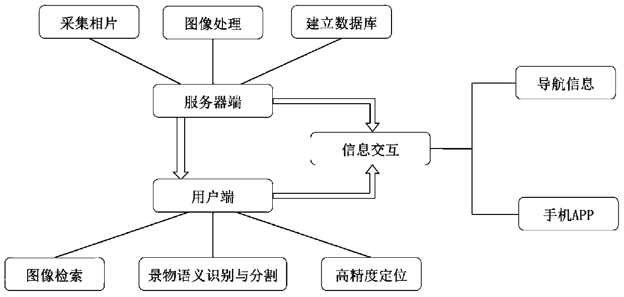
[0030] This embodiment provides a high-precision outdoor positioning method combining the Beidou satellite system and image features, see figure 1 , mainly including the following steps:

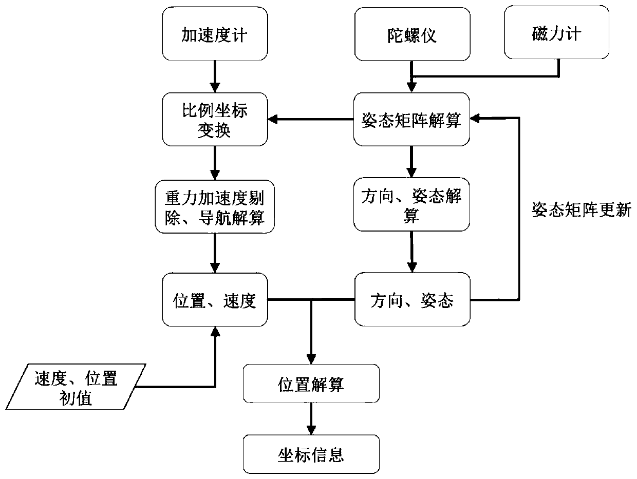
[0031] (1) Acquire reference images (that is, database images), and use real-time dynamic carrier phase difference RTK technology and inertial measurement unit (IMU) technology to obtain the precise position of the image and the attitude and angle of shooting.

[0032] Among them, RTK technology is used to determine the position of the database image with high precision, and IMU technology is used to determine the attitude and angle of the database image when it is taken. That is, the reference image not only has precise position information, but also has clea...


PUM


Abstract

The invention belongs to the field of navigation and positioning technologies and discloses a high-precision outdoor positioning method integrating a Beidou satellite system and image features. The method includes the following steps that: reference images are collected; the reference images are processed; and a database is established according to the processed reference images; the Beidou satellite system is adopted to obtain a preliminary positioning result; and an image to be positioned is obtained, and the similarity of the image to be positioned and the reference images in the database is calculated on the basis of the preliminary positioning result, a reference image matched with the image to be positioned is obtained through search, and a visual aided positioning result is obtained. With the method of the invention adopted, the problem of low positioning accuracy caused by weak satellite signals under a poor visibility condition in the prior art can be solved.

Description

technical field [0001] The invention relates to the technical field of navigation and positioning, in particular to a high-precision outdoor positioning method combining the Beidou satellite system and image features. Background technique [0002] The Global Navigation Satellite System (GNSS for short) is a major national space and information infrastructure, which plays an important role in national economic construction and national defense security. Following the GPS of the United States, the GLONASS system of Russia and the Galileo system of Europe, my country is vigorously developing the Beidou satellite navigation system with independent intellectual property rights. Satellite navigation has entered a new era of multi-GNSS competition and cooperation from a single system monopoly. The Beidou satellite navigation system consists of three parts: the space segment, the ground segment and the user segment. It can provide high-precision, high-reliability positioning, navig...

Claims


Application Information

Patent Timeline
Patent Type & Authority Applications(China)
IPC IPC(8): G01S19/45
Inventor 石莹李若莹余晖汪世文韩俊杰
Owner WUHAN UNIV
Why Eureka
Try Eureka