Navigation buoy detection and maintenance system

A maintenance system and navigation mark technology, applied in the field of navigation mark system, can solve the problems of high energy consumption, low efficiency, poor verification accuracy, etc., and achieve the effects of high maintenance efficiency, alleviation of transmission and storage pressure, and high accuracy

Active Publication Date: 2019-06-21
SHANDONG JIAOTONG UNIV
View PDF5 Cites 9 Cited by
  • Summary
  • Abstract
  • Description
  • Claims
  • Application Information

AI Technical Summary

Problems solved by technology

[0005] The purpose of the present invention is to solve the problems of poor verification accuracy, low efficiency, and large energy consumption by using unmanned aerial vehicles to obtain images one by one in the existing navigation mark maintenance

Method used


Image

  • Navigation buoy detection and maintenance system
  • Navigation buoy detection and maintenance system
  • Navigation buoy detection and maintenance system

Examples


specific Embodiment approach 1

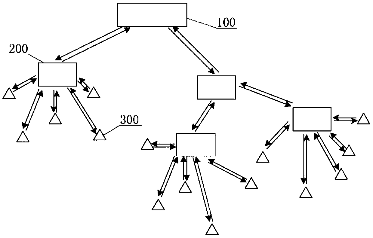
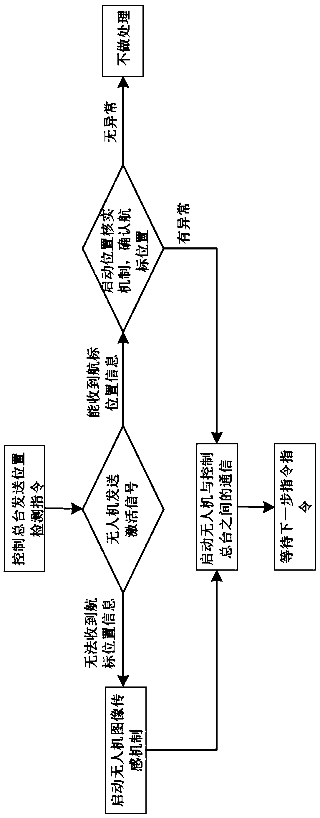
[0015] Specific implementation mode one: the following combination figure 1 and figure 2 This embodiment will be specifically described. In this embodiment, a navigation buoy detection and maintenance system includes a control console 100, a drone 200 and a navigation mark 300;

[0016] The navigation mark 300 is equipped with a GPS positioning device, and the GPS positioning device is used to send a position signal of the navigation mark 300 to the drone 200;

[0017] The UAV 200 is provided with a navigation mark 300 position verification device and an image acquisition device, and the navigation mark 300 position verification device compares the position information of the navigation mark 300 stored by itself with the position information sent by the GPS positioning device, and determines the position of the navigation mark 300. With or without offset, the image acquisition device is used to acquire the image of the navigation mark 300;

[0018] The control center 100 c...

specific Embodiment approach 2

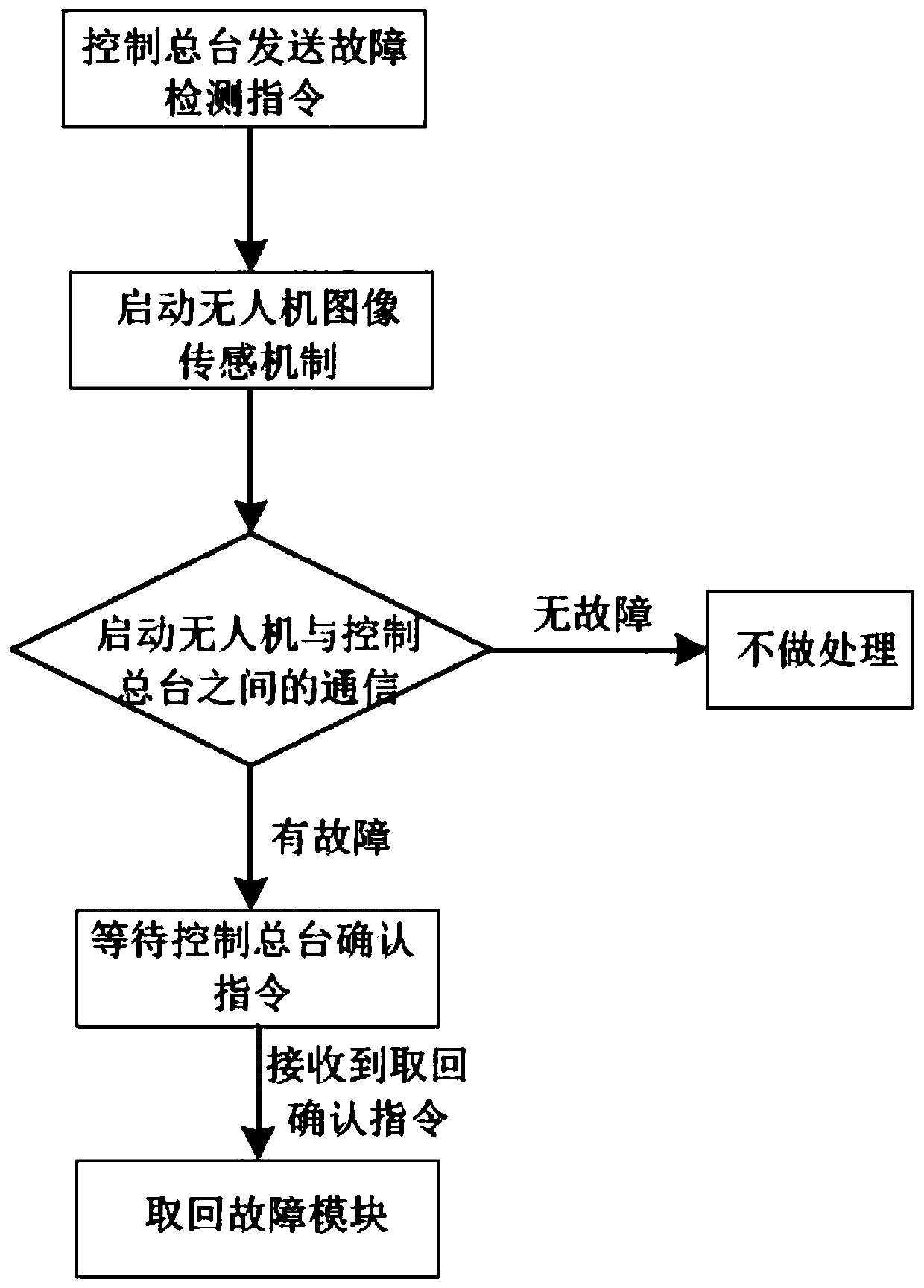
[0022] Embodiment 2: This embodiment is a further improvement to Embodiment 1. The difference between this embodiment and Embodiment 1 is that the navigation mark 300 is also equipped with an activation device, and the activation device is controlled according to the signal of the UAV 200. Turn on or off the GPS positioning device.

[0023] When there is no drone 200 patrolling, the GPS positioning device is in a low-power dormant state; when the drone 200 is patrolling, the drone 200 transmits a signal to the navigation mark 300 according to the approximate coordinates, and at this time, the activation device on the navigation mark 300 turns on the GPS after receiving the signal The positioning device starts to work and sends the position coordinates to the UAV 200, which further saves energy,

specific Embodiment approach 3

[0024] Embodiment 3: This embodiment is a further improvement on Embodiment 1. The difference between this embodiment and Embodiment 1 is that there is also a controller on the drone 200, and the controller is used to control the unmanned The flight status of the aircraft 200 is periodically sent to the control console 100.


PUM


Abstract

The invention provides a navigation buoy detection and maintenance system, relates to the technical field of navigation mark systems, and aims to solve the problems that the existing navigation mark maintenance adopts a unmanned aerial vehicle to acquire images one by one, and results in poor verification accuracy, low efficiency and large energy consumption. The system comprises a control console, an unmanned aerial vehicle and a navigation mark; the navigation mark is provided with a positioning device, and the positioning device is used for sending a navigation mark position signal to the unmanned aerial vehicle; the unmanned aerial vehicle is provided with a navigation mark position verification device and an image acquisition device, the navigation mark position verification device isused for verifying whether coordinates of the navigation mark are offset, and the image acquisition device is used for acquiring a navigation mark image; communication connection is adopted between the control console and the unmanned aerial vehicle, between the unmanned aerial vehicles, and between the unmanned aerial vehicle and the navigation mask. By adopting the navigation buoy detection andmaintenance system, the maintenance efficiency is high, the maintenance is performed by using the position coordinate, the accuracy is high, and all navigation marks do not need to be image-acquiredand sent to the control console, thereby alleviating the transmission and storage pressure. The navigation buoy detection and maintenance system can be widely applied to the field of navigation mark maintenance.

Description

technical field [0001] The invention relates to the technical field of navigation buoy systems, in particular to a navigation buoy detection and maintenance system. Background technique [0002] The maintenance work of the navigation mark mainly includes monitoring whether the navigation mark is offset or lost, monitoring and repairing the failure of the navigation mark, replacing the power supply and other fault monitoring and maintenance, etc. The traditional implementation method is to send ships to patrol regularly. The disadvantage of this is that it takes a long time, is inefficient, consumes a lot of manpower and material resources, and due to the complexity of sea conditions, the inspectors have certain risks during the inspection process. [0003] At present, UAV technology is developing rapidly and is widely used in military and civilian fields. UAVs are used to regularly detect the navigation mark and complete some maintenance functions. Not only can the abnormal...

Claims


Application Information

Patent Timeline
Patent Type & Authority Applications(China)
IPC IPC(8): B63B22/16B64C39/02H04W4/029H04W4/40H04N7/18
CPCY02D30/70
Inventor 宫月红张少君王明雨孙兰君孟雄飞
Owner SHANDONG JIAOTONG UNIV
Why Eureka
Try Eureka