Hyperspectral image-based regional ecological risk assessment method

An ecological risk and evaluation method technology, applied in the field of regional ecological risk evaluation based on hyperspectral images, can solve the problems of regional ecological risk evaluation that cannot form a continuous space, and achieve a large-scale continuous geographical space, high reliability, and sample size. small amount of effect

Pending Publication Date: 2019-08-06
NANJING INST OF ENVIRONMENTAL SCI MINIST OF ECOLOGY & ENVIRONMENT OF THE PEOPLES REPUBLIC OF CHINA
View PDF2 Cites 6 Cited by
  • Summary
  • Abstract
  • Description
  • Claims
  • Application Information

AI Technical Summary

Problems solved by technology

[0008] Aiming at the problem that the ecological risk assessment method in the prior art can only realize comprehensive judgment based on multiple sampling points, and cannot form a continuous spatial regional ecological ri

Method used


Image

  • Hyperspectral image-based regional ecological risk assessment method
  • Hyperspectral image-based regional ecological risk assessment method
  • Hyperspectral image-based regional ecological risk assessment method

Examples


Embodiment 1

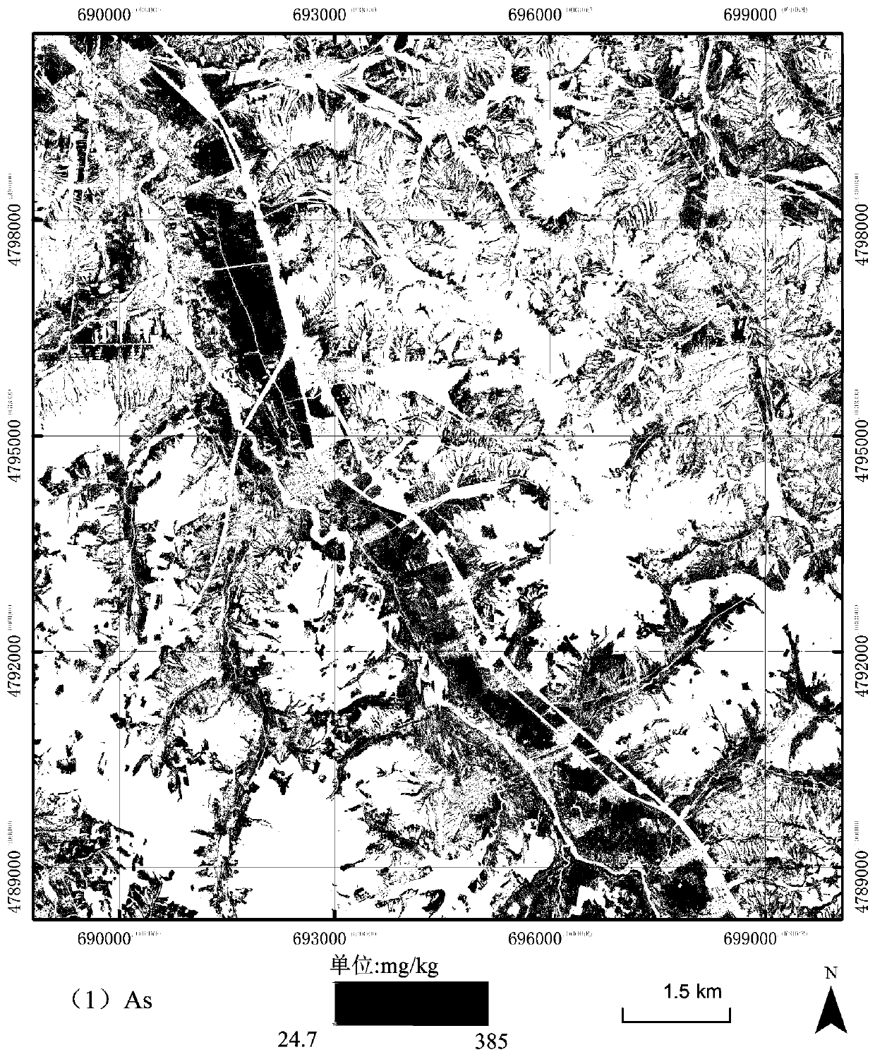
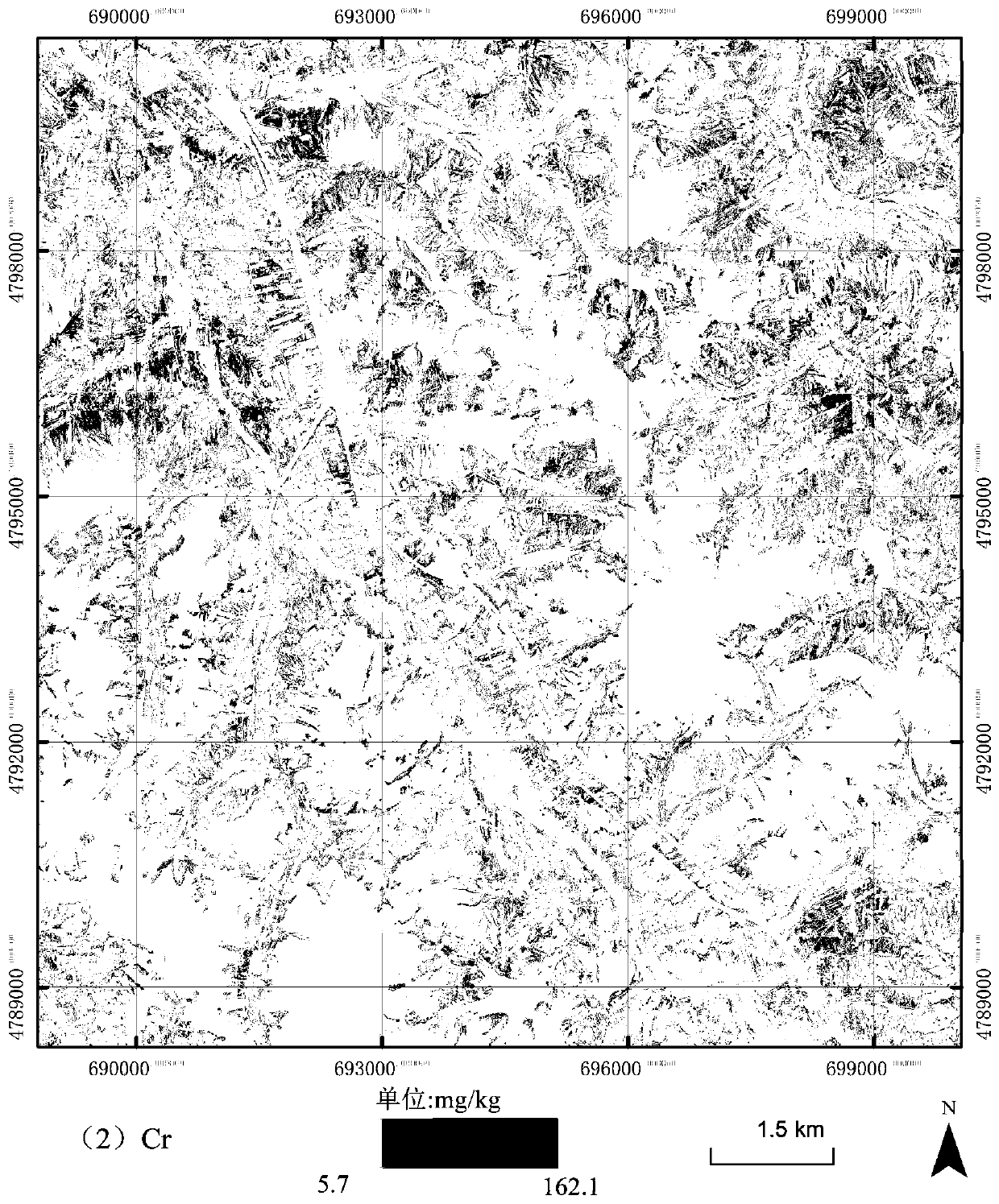
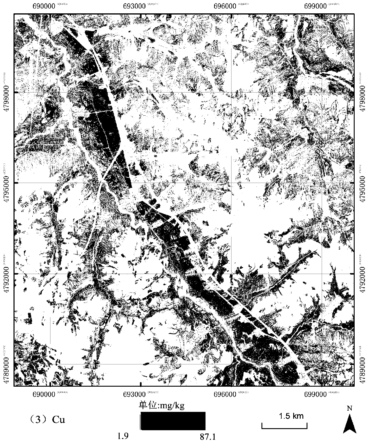
[0050] This embodiment takes the study area of ​​Yitong County, Jilin Province as an example to describe in detail the application of regional ecological risk assessment based on hyperspectral images. The study area is selected as the black soil area in Yitong County, Jilin Province. The specific steps are as follows:

[0051] 1) Before the start of the experiment, after thorough investigation, the sampling points are arranged in the study area according to the checkerboard method. The soil sample collection method is based on the topography of the study area and the ground soil properties. The area is greater than 3*3 image spatial resolution units The location of the sampling point is specifically determined in the area of ​​​​the sampling point; each sampling point collects multiple soil samples with a thickness of 2 cm; the experiment collects a total of 95 soil samples; the coordinate record at each sampling point is precisely determined by the real-time dynamic difference me...


PUM


Abstract

The invention belongs to the field of soil environment monitoring and ecological risk assessment and relates to a hyperspectral image-based regional ecological risk assessment method. The method comprises the following steps that: 1) a soil sample in a study area is collected; 2) the laboratory chemical determination of the concentration of heavy metal in the soil sample is performed; 3) the imaging spectral data of the study area are acquired, and aeronautical hyperspectral data preprocessing is completed; 4) the inversion estimation of the concentration of various kinds of soil heavy metalsin the study area is realized on the basis of hyperspectral image data; and 5) the estimation results of the various soil heavy metals are inputted into an ecological risk assessment model, so that the ecological risk assessment mapping analysis of large-range continuous geospatial space with spatial pixels adopted as units, in the study area, can be obtained. The method has non-contact performance, is based on pixel-scale large-range continuous geospatial space, and can rapidly and efficiently carry out regional ecological risk assessment.

Description

Technical field [0001] The invention relates to the field of soil environment monitoring and ecological risk assessment, and in particular to a regional ecological risk assessment method based on hyperspectral images. Background technique [0002] At present, soil heavy metal pollution is one of the most widely polluted and most harmful environmental problems in environmental pollution. It has received widespread attention. Objective and true evaluation of the degree of heavy metal pollution in soil is of great importance to the control of environmental pollution and the protection of human health. significance. [0003] Xu Guiping et al. published an article "Research Summary of Soil Heavy Metal Pollution Evaluation Methods" in "Rural Economy and Technology" (2014 Vol. 25 No. 1). They introduced the evaluation methods of heavy metal pollution in soil commonly used at home and abroad. There are: single pollution index method, Nemerow index method, pollution load index method, envi...

Claims


Application Information

Patent Timeline
IPC IPC(8): G01N33/24
CPCG01N33/24
Inventor 马伟波李海东谭琨高媛赟李辉叶尔那尔·胡马尔汗燕守广
Owner NANJING INST OF ENVIRONMENTAL SCI MINIST OF ECOLOGY & ENVIRONMENT OF THE PEOPLES REPUBLIC OF CHINA
Why Eureka
Try Eureka