Route point positioning method, device and system based on BIM+GIS
A positioning method and route technology, which is applied in special data processing applications, structured data retrieval, geographic information databases, etc., can solve the problems of low positioning accuracy and low calculation efficiency, and achieve the effect of improving positioning accuracy
- Summary
- Abstract
- Description
- Claims
- Application Information
AI Technical Summary
Problems solved by technology
Method used
Image


Examples
Embodiment 1
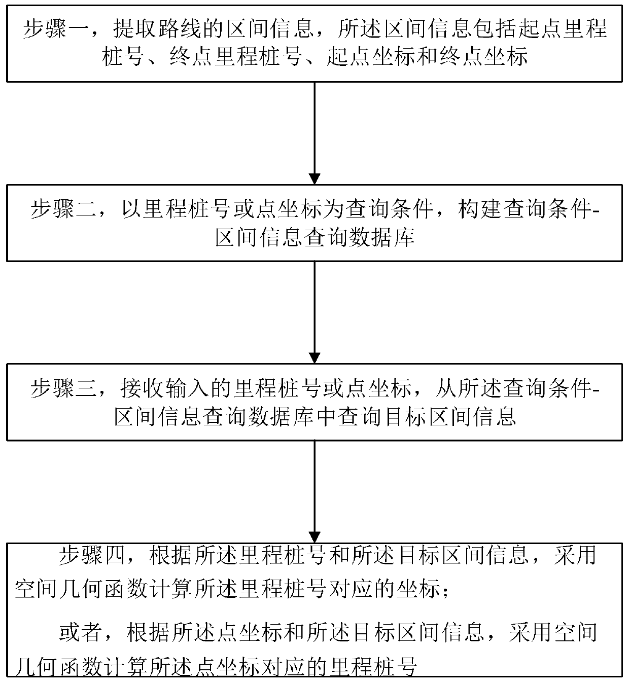
[0156] A route point positioning method based on BIM+GIS, such as figure 1 shown, including:
[0157] Step 1, extracting the interval information of the route, the interval information includes the starting point mileage stake number, the end point mileage stake number, the starting point coordinates and the ending point coordinates;
[0158] Step 2, taking the mileage stake number or point coordinates as the query condition, constructing the query condition-interval information query database;
[0159] Step 3, receiving the input mileage stake or point coordinates, and querying the target interval information from the query condition-interval information query database;
[0160] Step 4, according to the mileage stake number and the target interval information, using a spatial geometric function to calculate the coordinates corresponding to the mileage stake number; or,
[0161] According to the point coordinates and the target interval information, the mileage chain number...
Embodiment 2
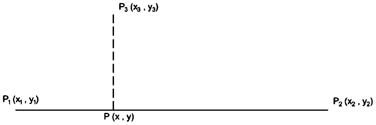
[0222] The difference between embodiment 2 and embodiment 1 is that different positioning algorithms are used for different line segment types in the route interval, and the flow chart of the positioning method is as follows Figure 4 shown.
[0223] The interval information also includes a line segment type, and the line segment type includes a straight line segment and / or a curved line segment. Further, the curve segment includes a circular curve segment and / or a transitional curve segment. For the curve segment interval, the interval information also includes geometric feature information of the curve segment. The geometric feature information of the circular curve segment includes the radius of the circular curve and the coordinates of the center of the circle; the geometric feature information of the transitional curve segment includes the radius of the starting point, the coordinates of the center of the starting point, the radius of the end point, and the coordinates o...
Embodiment 3
[0312] Figure 9 It shows a route point positioning device based on BIM+GIS according to Embodiment 3 of the present invention, that is, an electronic device 1010 (such as a computer server with a program execution function), which includes at least one processor 1011, a power supply 1014, and the At least one processor 1011 is communicatively connected to a memory 1012 and an input-output interface 1013; the memory 1012 stores instructions that can be executed by the at least one processor 1011, and the instructions are executed by the at least one processor 1011, so that The at least one processor 1011 can execute the method disclosed in any of the foregoing embodiments; the input-output interface 1013 can include a display, a keyboard, a mouse, and a USB interface for inputting and outputting data; the power supply 1014 is used for powering the electronic device 1010 provides electrical energy.
PUM
 Abstract
Description
Claims
Application Information
 - R&D
- Intellectual Property
- Life Sciences
- Materials
- Tech Scout
- Unparalleled Data Quality
- Higher Quality Content
- 60% Fewer Hallucinations
Browse by: Latest US Patents, China's latest patents, Technical Efficacy Thesaurus, Application Domain, Technology Topic, Popular Technical Reports.
© 2025 PatSnap. All rights reserved.Legal|Privacy policy|Modern Slavery Act Transparency Statement|Sitemap|About US| Contact US: help@patsnap.com