
Space target high-precision on-orbit positioning method based on angle measurement and distance measurement information

A technology of space target and positioning method, which is applied in the direction of measuring angle, measuring device, surveying and mapping and navigation, etc., can solve the problem of low orbit determination accuracy of space debris in orbit and short arc

Inactive Publication Date: 2019-08-23
AEROSPACE DONGFANGHONG SATELLITE
View PDF7 Cites 21 Cited by
  • Summary
  • Abstract
  • Description
  • Claims
  • Application Information

AI Technical Summary

Problems solved by technology

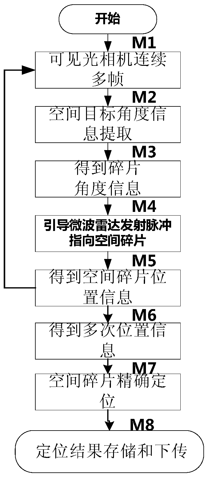
[0004] The technical problem solved by the present invention is: to overcome the problems that space debris is difficult to be found by the ground-based monitoring system and the accuracy of on-orbit short-arc orbit determination is not high, and to provide a high-precision on-orbit positioning method for space targets based on angle measurement and ranging information, It can take images of space debris through a visible light camera, and at the same time obtain the distance information of space debris through the microwave ranging payload, extract the angle information of space debris relative to the satellite through the optical recognition algorithm, and obtain the distance information of space debris relative to the satellite through the radar pulse ranging model. According to the angle information and distance information of the space debris relative to the satellite, the high-precision positioning result of the space debris can be obtained through the conventional data fusion model

Method used


Image

  • Space target high-precision on-orbit positioning method based on angle measurement and distance measurement information

Examples


Embodiment Construction

[0030] The present invention will be further described in detail below in conjunction with the accompanying drawings and specific embodiments.

[0031] The present invention is a high-precision on-orbit positioning method for space targets based on angle measurement and ranging information. The image of space debris is captured by a visible light camera, and the distance information of space debris is obtained through a microwave ranging load, which is extracted by an optical recognition algorithm. The angle information of the space debris relative to the satellite is obtained, and the distance information of the space debris relative to the satellite is obtained through the radar pulse ranging model. The angle information and distance information of the space debris relative to the satellite are known, and the high-precision positioning result of the space debris can be obtained through the data fusion model. It can reduce the arc section of the satellite tracking space debri...


PUM


Abstract

The invention discloses a space target high-precision on-orbit positioning method based on angle measurement and distance measurement information. An image of space debris is shot through a visible light camera; distance information of the space debris is obtained through a microwave distance measurement load; angle information of the space debris relative to a satellite is extracted through an optical recognition algorithm; and distance information of the space debris relative to the satellite is obtained through a radar pulse distance measurement model. The angle information and the distanceinformation of the space debris relative to the satellite are known, and a high-precision positioning result of the space debris can be obtained through a data fusion model. The arc segments of the satellite on-orbit tracking space debris can be reduced; the high-precision positioning of the space debris can be realized in combination with a calculation method convenient for software processing through the angle information and the distance information obtained through measurement in a relatively short tracking time; and the high-precision positioning of a space target can be realized withina space-based observation time from tens of seconds to a few minutes.

Description

technical field [0001] The invention relates to a high-precision on-orbit positioning method for a space target based on angle measurement and distance measurement information, and belongs to the technical field of space on-orbit positioning. Background technique [0002] Efforts have been made to ascertain the amount and distribution of space debris since the hazards of the large amount of space debris were known. This requires knowing the position and changes of the space debris on the orbit, and determining the orbit of the space debris. The distribution of space debris in space is extremely uneven, and it is difficult to be tracked throughout the entire process. How to accurately obtain the orbital parameters of space debris has always been a challenge. a puzzle. Space debris can be observed through ground-based radar or optical telescopes, and the observation data can be calculated to obtain the position information of space debris, but more space debris is difficult t...

Claims


Application Information

Patent Timeline
IPC IPC(8): G01C21/00G01C1/00G01S13/10
CPCG01C1/00G01C21/00G01S13/10
Inventor 叶钊杨芳曾春平曹丽君
Owner AEROSPACE DONGFANGHONG SATELLITE
Learn More