Machine learning-based batched measurement method and system for street space sunshine durations
A technology of machine learning and measurement method, applied in sunshine time recorder, measuring device, meteorology and other directions, can solve the problems of huge simulation accuracy error, long time consumption, and difficulty in simulating the sunlight occlusion of tree canopy by urban geometric models. To achieve the effect of efficient operation and high accuracy
- Summary
- Abstract
- Description
- Claims
- Application Information
AI Technical Summary
Problems solved by technology
Method used
Image
Examples
Embodiment 1
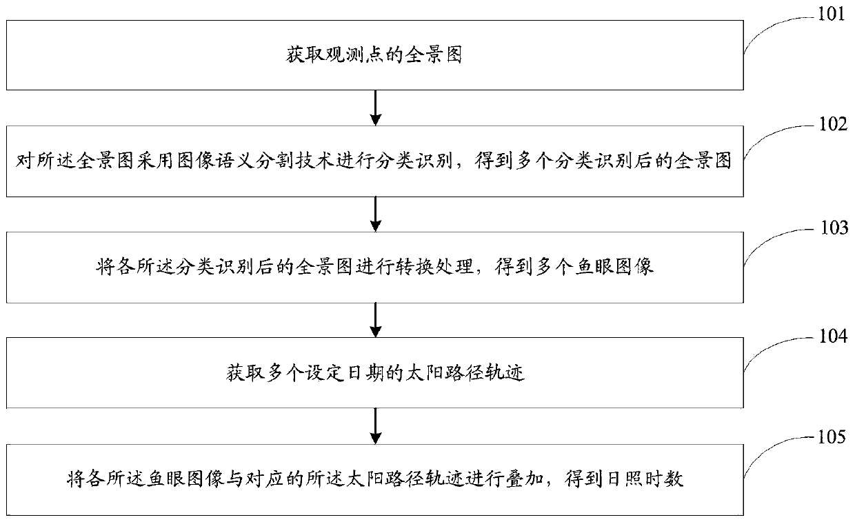
[0081] figure 1 It is a flow chart of the method for batch measurement of sunshine hours in street space based on machine learning in the present invention. Such as figure 1 As shown, a batch measurement method of street space sunshine hours based on machine learning, including:
[0082] Step 101: Acquiring the panorama of the observation point, specifically including:
[0083] Obtain the latitude and longitude location information of each observation point through the network street view map.
[0084] The panorama of all observation points is determined according to the latitude and longitude position information of each observation point.
[0085] Step 102: Classify and identify the panorama using image semantic segmentation technology to obtain multiple panoramas after classification and identification, specifically including:
[0086] The convolutional neural network model in the image semantic segmentation technology is used to classify and identify the panorama, and ...
Embodiment 2
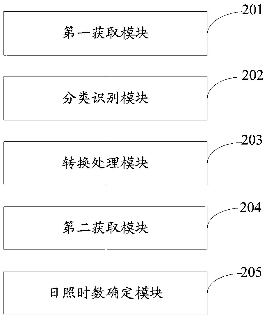
[0100] figure 2 It is a structural diagram of the batch measurement system for street space sunshine hours based on machine learning in the present invention. Such as figure 2 As shown, a machine learning-based batch measurement system of sunshine hours in street space includes:
[0101] The first acquiring module 201 is configured to acquire a panorama of an observation point.
[0102] The classification and recognition module 202 is configured to classify and recognize the panorama by using image semantic segmentation technology to obtain a plurality of classified and recognized panoramas.
[0103] The conversion processing module 203 is configured to perform conversion processing on each of the classified and recognized panoramic images to obtain multiple fisheye images.
[0104] The second acquiring module 204 is configured to acquire solar path trajectories on multiple set dates.
[0105] The sunshine hours determining module 205 is configured to superimpose each of...
Embodiment 3
[0121] In specific implementation, a machine learning-based method for batch measurement of sunshine duration in street space includes:
[0122] Step 1: Obtain a panorama of the observation point
[0123] Step 1.1: Obtain the longitude and latitude position information of a series of observation points.
[0124] Based on the selected street view map, first obtain the road network information through the API provided by the map itself, and then use the GIS software to generate observation points at regular intervals for the selected roads, and obtain the latitude and longitude position information of all observation points. The data sources of the present invention are street view maps provided by companies such as Baidu on the Internet, including Baidu Street View, Tencent Street View, Google Street View, and the like.
[0125] Step 1.2: Obtain a panoramic photo.
[0126] Based on the obtained longitude and latitude information of the observation points, the API provided by ...
PUM
 Abstract
Description
Claims
Application Information
 - R&D
- Intellectual Property
- Life Sciences
- Materials
- Tech Scout
- Unparalleled Data Quality
- Higher Quality Content
- 60% Fewer Hallucinations
Browse by: Latest US Patents, China's latest patents, Technical Efficacy Thesaurus, Application Domain, Technology Topic, Popular Technical Reports.
© 2025 PatSnap. All rights reserved.Legal|Privacy policy|Modern Slavery Act Transparency Statement|Sitemap|About US| Contact US: help@patsnap.com


