Aircraft route track generation method and device, unmanned aerial vehicle and storage medium
A trajectory generation and aircraft technology, applied in the computer field, can solve problems such as reducing the efficiency of aircraft use, the number of flight routes, and the long flight mileage.
- Summary
- Abstract
- Description
- Claims
- Application Information
AI Technical Summary
Problems solved by technology
Method used
Image
Examples
Embodiment 1
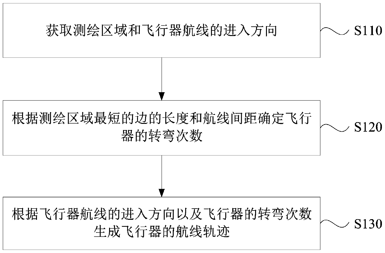
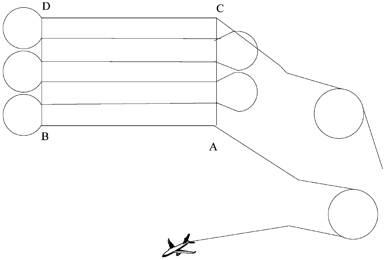
[0061] Figure 1A It is a flow chart of a method for generating aircraft route trajectories provided by Embodiment 1 of the present invention. This embodiment is applicable to the situation of generating aircraft route trajectories. The hardware for executing the method is the flight controller in the unmanned aerial vehicle. The method can Executed by the aircraft route trajectory generation device in the embodiment of the present invention, the device can be implemented in the form of software and / or hardware, such as Figure 1A As shown, the method specifically includes the following steps:
[0062] S110, acquiring the mapping area and the entry direction of the aircraft route.
[0063] Wherein, the surveying and mapping area may be the area selected or drawn by the user on the terminal device, or may be a preset area on the map, or may be obtained by the user dragging or adding area points to the preset area on the map area, which is not limited in this embodiment of the p...
Embodiment 2
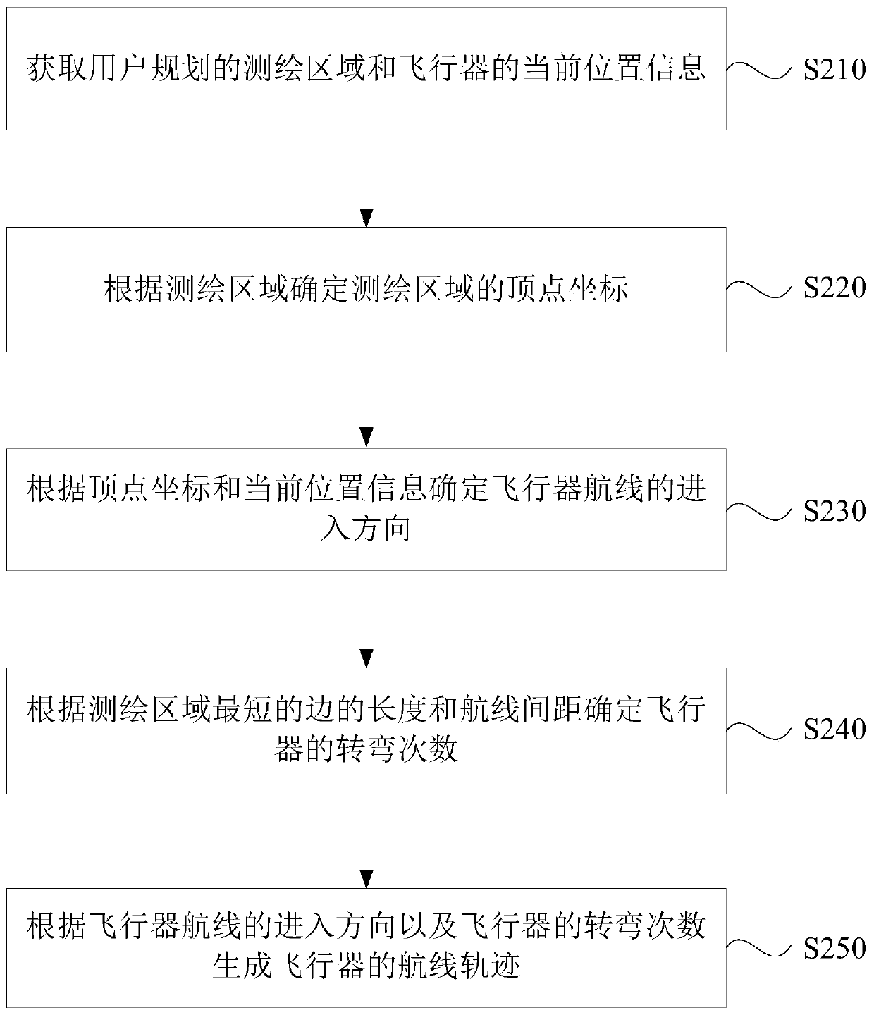
[0094] Figure 2A It is a flow chart of a method for generating an aircraft route trajectory in Embodiment 2 of the present invention. This embodiment is optimized on the basis of the above-mentioned embodiments. In this embodiment, obtaining the entry direction of the surveying and mapping area and the aircraft route includes: obtaining the user The planned surveying area and the current position information of the aircraft; determining the vertex coordinates of the surveying area according to the surveying area; determining the entry direction of the aircraft route according to the vertex coordinates and the current position information.
[0095] Such as Figure 2A As shown, the method of this embodiment specifically includes the following steps:
[0096] S210. Obtain the surveying area planned by the user and the current location information of the aircraft.
[0097] Wherein, the current position information of the aircraft may be the current position information of the a...
Embodiment 3
[0109] image 3 It is a schematic structural diagram of an aircraft route trajectory generation device provided in Embodiment 3 of the present invention. This embodiment can be applicable to the situation that aircraft route track generation, and this device can adopt the mode of software and / or hardware to realize, and each module in this device can be the flight controller of unmanned aerial vehicle, and this device can be integrated in any providing aircraft In the device of the function of route trajectory generation, such as image 3 As shown, the aircraft route trajectory generation device specifically includes: an acquisition module 310 , a determination module 320 and a generation module 330 .
[0110] Wherein, the obtaining module 310 is used to obtain the entering direction of the surveying and mapping area and the flight route of the aircraft;
[0111] A determining module 320, configured to determine the number of turns of the aircraft according to the length of ...
PUM
 Abstract
Description
Claims
Application Information
 - R&D
- Intellectual Property
- Life Sciences
- Materials
- Tech Scout
- Unparalleled Data Quality
- Higher Quality Content
- 60% Fewer Hallucinations
Browse by: Latest US Patents, China's latest patents, Technical Efficacy Thesaurus, Application Domain, Technology Topic, Popular Technical Reports.
© 2025 PatSnap. All rights reserved.Legal|Privacy policy|Modern Slavery Act Transparency Statement|Sitemap|About US| Contact US: help@patsnap.com


