Building classification method based on satellite remote sensing images
A technology of satellite remote sensing and classification methods, which is applied in the field of satellite remote sensing image processing, can solve the problem of few processing methods, and achieve the effects of strong applicability, improved speed and accuracy, and wide application fields
- Summary
- Abstract
- Description
- Claims
- Application Information
AI Technical Summary
Problems solved by technology
Method used
Image

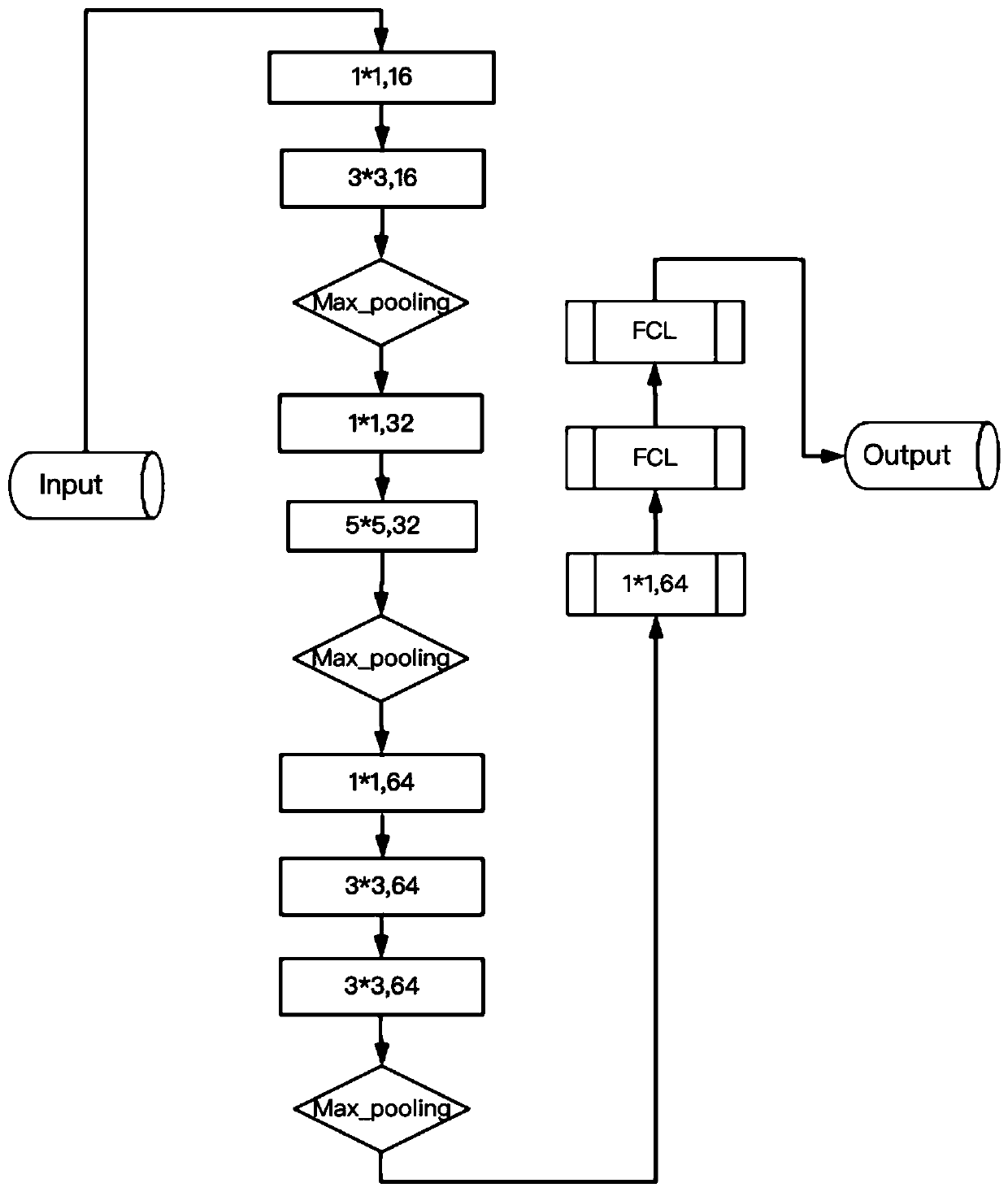
Examples
Embodiment Construction
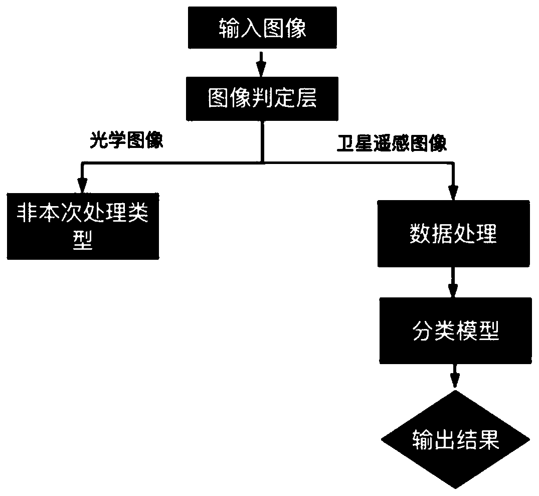
[0056] In order to facilitate a better understanding of the present invention, the present invention will be further described below in conjunction with examples. This example is only used to explain and illustrate the present invention, not to limit the present invention. The main steps are as follows.
[0057] Step 1: First, use the latitude and longitude coordinate point set of the building to obtain satellite remote sensing images, and perform various precise processing on the satellite remote sensing image data to make a sample data set. The specific steps are as follows:
[0058] (1) Import 116,800 longitude and latitude coordinate points of all buildings in a city into professional software in batches, and obtain satellite remote sensing images of all buildings in a certain city according to the longitude and latitude coordinate points;
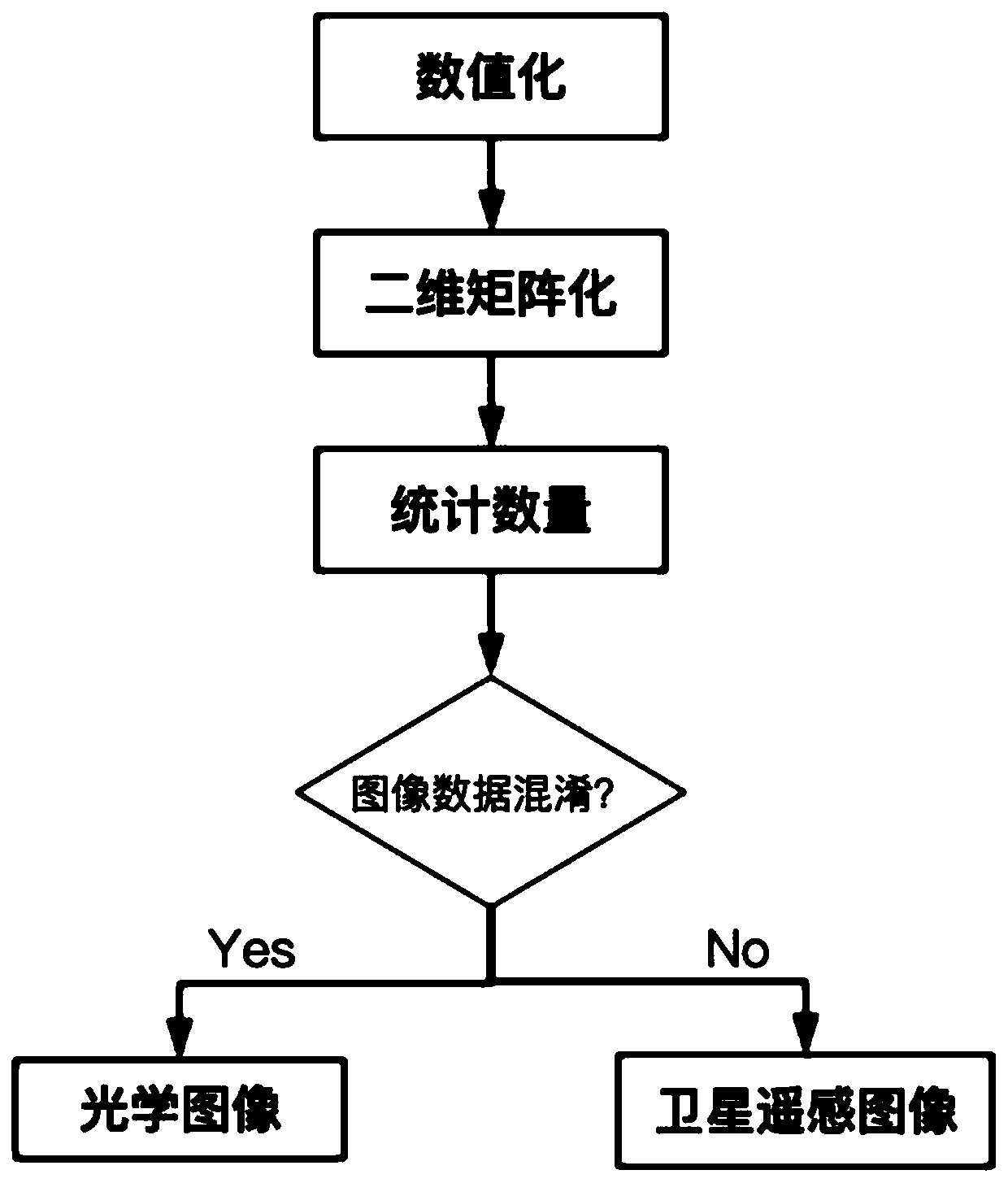
[0059] (2) Due to the phenomenon of low resolution and building faults in satellite remote sensing images, it is necessary to perform...
PUM
 Abstract
Description
Claims
Application Information
 - R&D
- Intellectual Property
- Life Sciences
- Materials
- Tech Scout
- Unparalleled Data Quality
- Higher Quality Content
- 60% Fewer Hallucinations
Browse by: Latest US Patents, China's latest patents, Technical Efficacy Thesaurus, Application Domain, Technology Topic, Popular Technical Reports.
© 2025 PatSnap. All rights reserved.Legal|Privacy policy|Modern Slavery Act Transparency Statement|Sitemap|About US| Contact US: help@patsnap.com