Novel calculation method for surface soil moisture content of CBERS-02B satellite image data

A technology of soil moisture content and satellite imagery, applied in the field of quantitative inversion of soil moisture content by remote sensing technology, can solve problems such as low accuracy and difficult algorithm implementation, and achieve the effects of speeding up inversion, improving inversion accuracy, and reducing costs.

Inactive Publication Date: 2019-11-29
GUILIN UNIVERSITY OF TECHNOLOGY
View PDF3 Cites 0 Cited by
  • Summary
  • Abstract
  • Description
  • Claims
  • Application Information

AI Technical Summary

Problems solved by technology

This method solves the difficulties and low accuracy of the algorithm for retrieving surface soil moisture content of CBERS-02B satellite image data

Method used


Image

  • Novel calculation method for surface soil moisture content of CBERS-02B satellite image data
  • Novel calculation method for surface soil moisture content of CBERS-02B satellite image data
  • Novel calculation method for surface soil moisture content of CBERS-02B satellite image data

Examples


Embodiment 1

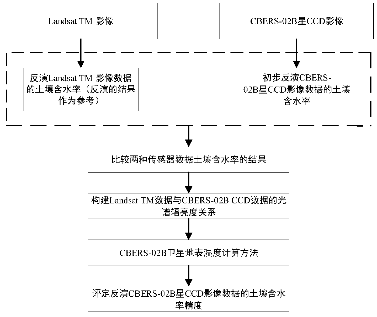
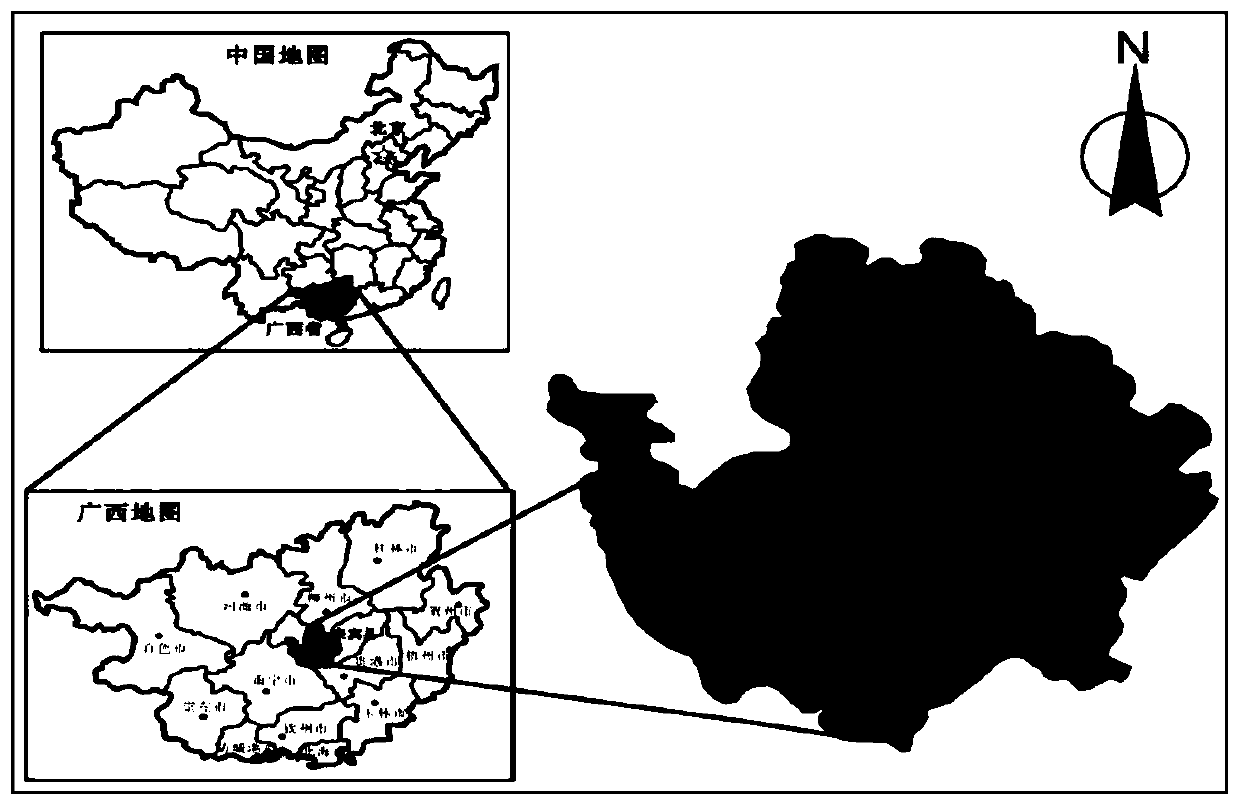
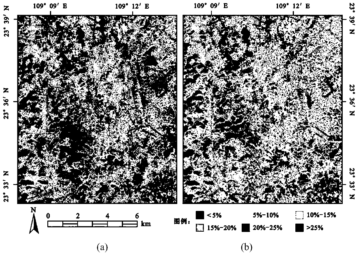
[0078] Taking Jili Village, Liangjiang Town, Laibin City, Guangxi Province as the research area, the calculation method constructed by the present invention is used to invert the soil moisture content of the CBERS-02B satellite image data in the Jili Village area. figure 2 It is Jili Village in the research area; image 3 It is the result map of the initial inversion of Landsat TM data and the soil moisture content of CBERS-02B satellite image data using the calculation method of soil moisture content of the original Landsat TM image data. Through accuracy analysis, we found that the calculation method of soil moisture content using the original Landsat TM image data to invert the results obtained from the CBERS-02B satellite image data is biased. Considering the four influencing factors in the LandsatTM and CBERS-02B satellite image data (band range, surface reflectance, atmospheric transmittance and incident solar energy), construct a new calculation method for surface soil...


PUM


Abstract

The invention discloses a novel calculation method for the surface soil moisture content of CBERS-02B satellite image data. The novel calculation method constructs a new inversion CBERS-02B satelliteimage data soil moisture content calculation method according to the relationship between two data sources and spectral radiance related waveband ranges, ground object reflectivity, atmospheric transmittance and incident solar energy. Besides, a large number of inspection results show that the calculation method not only improves the accuracy of soil moisture content inversion of the CBERS-02B satellite image data and accelerates the inversion speed, but also solves the problem that an algorithm for inverting the surface soil moisture content of the image data is difficult to implement and thelike, and is suitable for estimating the soil moisture content of a large-area region.

Description

technical field [0001] The present invention relates to the field of remote sensing technology, in particular to the method and technology for quantitative inversion of soil moisture content by remote sensing technology, and is to construct a new calculation method for inversion of soil moisture content of CBERS-02B satellite image data, making it more suitable for CBERS-02B Inversion of soil surface water content from satellite image data. [0002] technical background [0003] Surface soil moisture content is one of the important indicators in hydrology, ecological environment and agricultural application in Karst area. In the karst area, the groundwater is rich, but the surface water system is extremely underdeveloped, resulting in the consequences of farmland drought and karst rocky desertification. Therefore, it is of great significance to use the remote sensing technology with the characteristics of high efficiency, rapidity, and macroscopicity to monitor the moisture ...

Claims


Application Information

Patent Timeline
Patent Type & Authority Applications(China)
IPC IPC(8): G06F17/50G06F17/18
CPCG06F17/18
Inventor 周国清家彬陶晓东
Owner GUILIN UNIVERSITY OF TECHNOLOGY
Why Eureka
Try Eureka