
Environment comprehensive evaluation and prediction method based on remote sensing images

A technology of comprehensive evaluation and forecasting methods, applied in forecasting, image data processing, structured data retrieval, etc., can solve problems such as multiple manpower, material resources and time, and achieve the effect of assisting emergency decision-making

Active Publication Date: 2019-12-20
袁静 +1
View PDF12 Cites 8 Cited by
  • Summary
  • Abstract
  • Description
  • Claims
  • Application Information

AI Technical Summary

Problems solved by technology

[0006] The physical model method can graphically reflect the pollution characteristics of the more complex ground environment and the physical process of pollutant migration, but it requires suitable test sites and conditions as well as necessary basic data, and making this model requires more manpower , resources and time

Method used

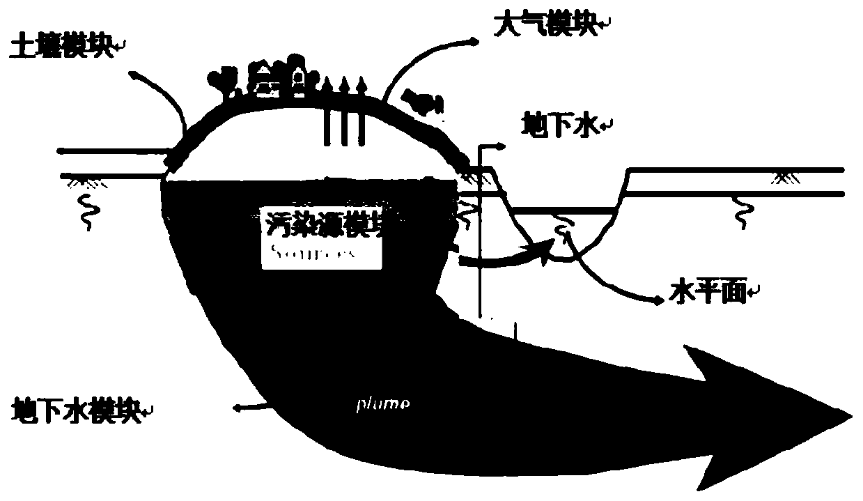

Image

  • Environment comprehensive evaluation and prediction method based on remote sensing images
  • Environment comprehensive evaluation and prediction method based on remote sensing images
  • Environment comprehensive evaluation and prediction method based on remote sensing images

Examples


Embodiment Construction

[0033] In order to make the technical means, creative features, goals and effects achieved by the present invention easy to understand, the present invention will be further described below in conjunction with specific embodiments.

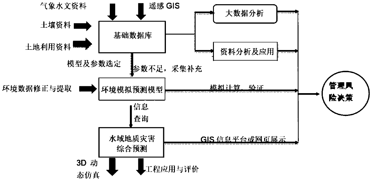
[0034] A method for comprehensive assessment and prediction of environment (atmosphere, soil and groundwater) based on remote sensing images of the present invention, the method comprises the following steps:

[0035] Step 1: Basic database construction;

[0036] In order to be able to judge the pollution level and pollution time effectively in a timely manner, it is necessary to collect basic data related to pollutants, mainly including:

[0037] (1) The spatial dimension of the model;

[0038] (2) The time scale described (or used) by the model;

[0039] (3) Pollution loads, sources and sinks;

[0040] (4) The scope of simulation prediction;

[0041] (5) Pollution flow and mixed transport;

[0042] (6) Variables and dynamic structure in the...


PUM


Abstract

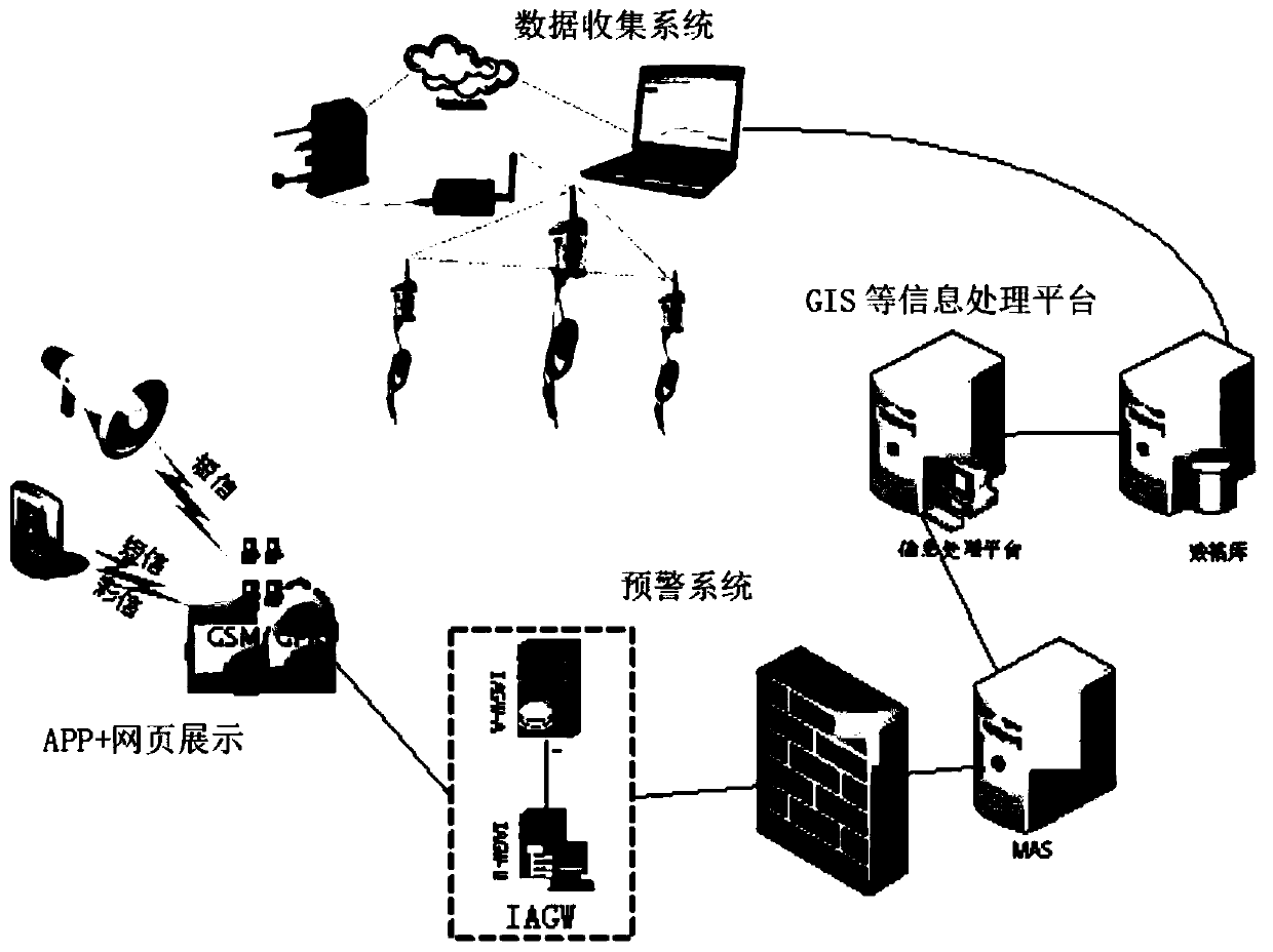
The invention discloses an environment comprehensive evaluation and prediction method based on the remote sensing images, and the method comprises the steps of collecting a satellite remote sensing image and the environment data of a target region through a data information system, and building a basic database; then, according to the basic database, obtaining the parameters required for establishing an environment simulation prediction model; establishing an environment simulation prediction model based on the basic database and the parameters; simulating the space-time distribution of the pollutant concentration through the environment simulation prediction model; and fiinally performing big data analysis on the simulation result and importing the simulation result into an ArcGIS and a webpage platform to realize the real-time dynamic visual display of the simulation result. According to the invention, the pollutant concentration distribution and the dynamic change conditions at different moments and different spatial positions can be visually and intuitively displayed, an image and visual presentation platform is provided for the emergency disposal, and the emergency decision making can be effectively assisted.

Description

technical field [0001] The present invention relates to the field of environment prediction and assessment, in particular to a method for comprehensive assessment and prediction of environment based on remote sensing images. Background technique [0002] At present, the methods for comprehensive assessment and prediction of the environment (atmosphere, soil and groundwater) mainly include professional judgment method, analogy analysis method, mathematical model method and physical model method. [0003] Among them, for the professional judgment method, because it can qualitatively judge the environmental impact of the atmosphere, soil and groundwater. This method is generally used when the environmental impact problem is special and it is difficult to accurately identify its environmental impact characteristics or it is impossible to use common methods to predict the environmental impact. [0004] The analogy analysis method belongs to qualitative or semi-quantitative predi...

Claims


Application Information

Patent Timeline
Patent Type & Authority Applications(China)
IPC IPC(8): G06F16/29G06F17/50G06Q10/04G06T17/05
CPCG06T17/05G06F16/29G06Q10/04
Inventor 袁静袁宏宇
Owner 袁静
Learn More