
A GNSS interference source location method based on grid energy traversal search

A positioning method and technology for interference sources, which are applied in satellite radio beacon positioning systems, measurement devices, radio wave measurement systems, etc., can solve problems such as weak satellite signals, and achieve the effect of improving positioning accuracy and high positioning accuracy.

Active Publication Date: 2022-03-22
中国电波传播研究所 +1
View PDF0 Cites 0 Cited by
  • Summary
  • Abstract
  • Description
  • Claims
  • Application Information

AI Technical Summary

Problems solved by technology

However, GNSS satellite signals are weak and are extremely susceptible to interference from co-frequency radio radiation sources

Method used


Image

  • A GNSS interference source location method based on grid energy traversal search
  • A GNSS interference source location method based on grid energy traversal search
  • A GNSS interference source location method based on grid energy traversal search

Examples


Embodiment 1

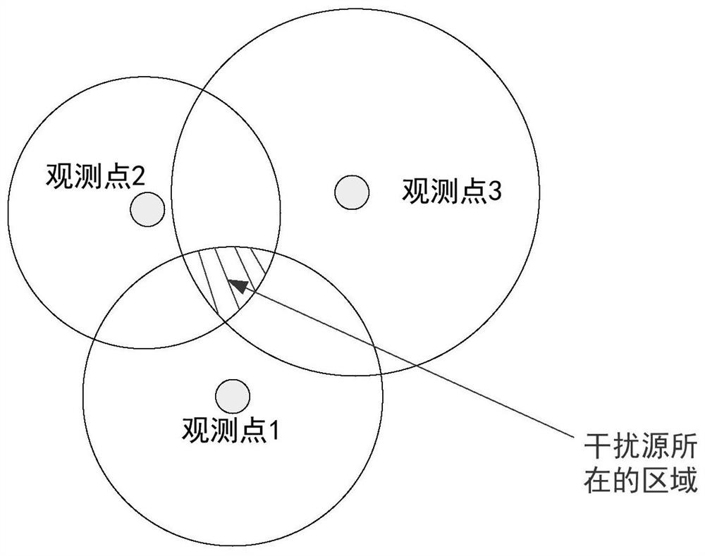
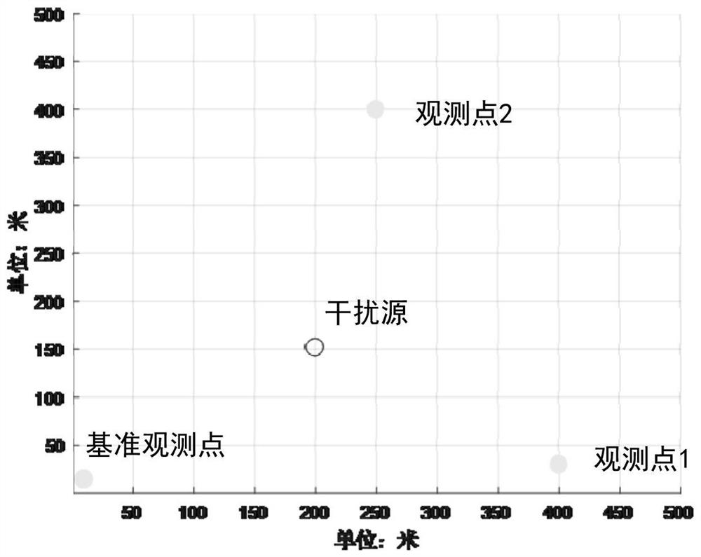
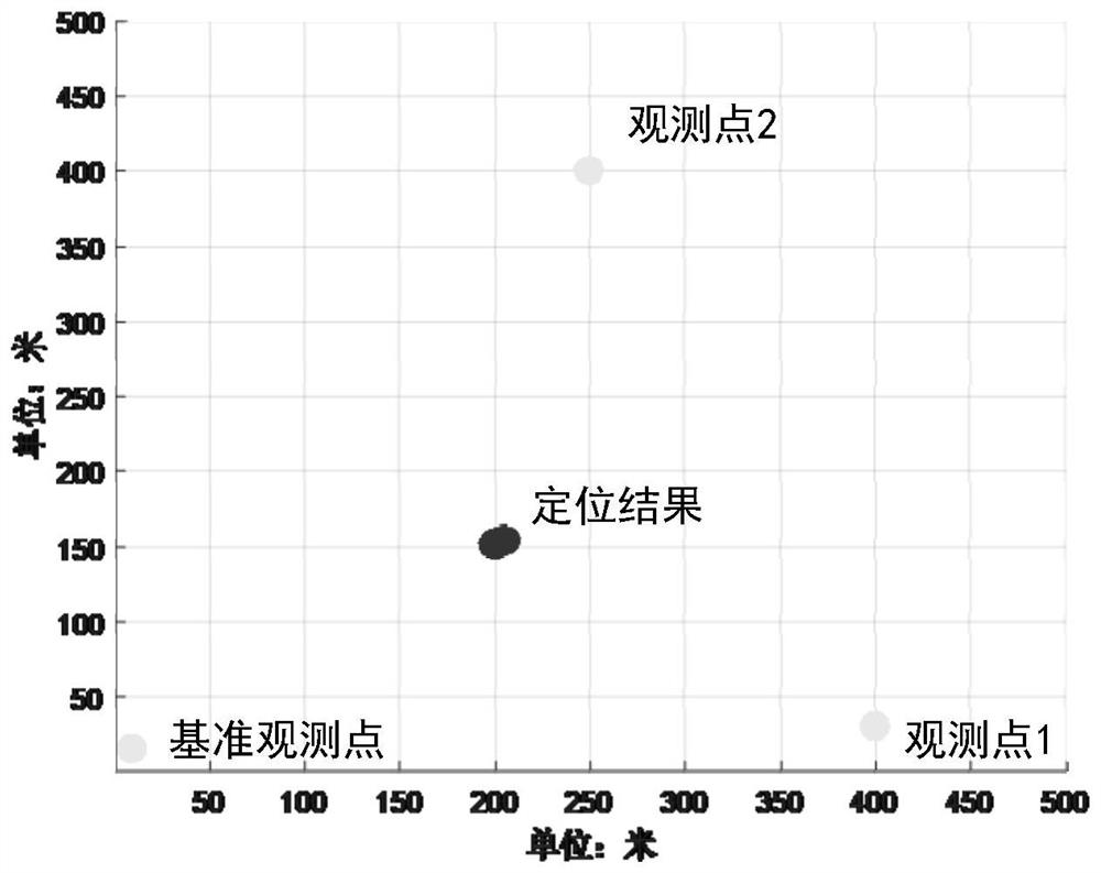
[0033] Embodiment 1, this embodiment discloses a GNSS interference source positioning method based on grid energy traversal search on the basis of the existing commonly used received signal strength indication positioning method (RSSI), including the following steps:

[0034] Step 1, divide the selected area into several grids;

[0035] Step 2, take any observation point as a reference observation point, and radiate energy back to each grid point according to the measured value of the received signal energy of the reference observation point, so as to calculate the reverse radiation energy value of each grid point, specifically including:

[0036] Step 21, select a reference observation point, and analyze the propagation characteristics from the reference observation point to each grid point according to the geographic information system. The propagation characteristics are divided into three categories: urban high-rise buildings, low-rise building distribution areas, and unobs...


PUM


Abstract

The invention discloses a GNSS interference source positioning method based on grid energy traversal search, comprising the following steps: step 1, divide the selected area into several grids; The reverse radiation energy value of each grid point, step 3, use the method of traversal search to radiate the energy of each grid point to another observation point, and calculate the radiation energy value received by the observation point, step 4, each observation point The energy obtained by the actual measurement of the point and the energy obtained by the radiation by the ergodic search method are fitted by least squares, and the grid point with the smallest fitting error is determined as the point where the interference source is located. The method disclosed by the invention can divide the attention area into several grids, the smaller the grid, the higher the accuracy and the larger the calculation amount, and the positioning accuracy can be greatly improved on the basis of the existing RSSI positioning method.

Description

technical field [0001] The invention belongs to the field of GNSS interference source positioning, in particular to a GNSS interference source positioning method based on grid energy traversal search in the field. Background technique [0002] The global navigation satellite system (GNSS) sends coded and modulated navigation signals from the satellite to the ground. When the ground receiver receives more than 4 satellite signals at the same time, it can calculate the position of the receiver and the current system time to realize positioning. , navigation and timing functions. However, GNSS satellite signals are weak and are extremely susceptible to interference from co-frequency radio radiation sources. Contents of the invention [0003] The technical problem to be solved by the present invention is to provide a GNSS interference source positioning method based on grid energy traversal search. [0004] The present invention adopts following technical scheme: [0005] A...

Claims


Application Information

Patent Timeline
Patent Type & Authority Patents(China)
IPC IPC(8): G01S19/42
CPCG01S19/42
Inventor 陈奇东甄卫民陶海红张风国刘睿靳睿敏
Owner 中国电波传播研究所
Learn More