Multipath error modeling method for LAAS

A modeling method and multi-path error technology, applied in satellite radio beacon positioning systems, measurement devices, instruments, etc., can solve the problems of continuous reduction of differential enhancement information accuracy, etc.

Active Publication Date: 2020-01-14
NO 54 INST OF CHINA ELECTRONICS SCI & TECH GRP
View PDF7 Cites 10 Cited by
  • Summary
  • Abstract
  • Description
  • Claims
  • Application Information

AI Technical Summary

Problems solved by technology

[0005] The invention proposes a method for separating and compensating multipath errors suitable for LAAS, aiming at problems such as the multipath restriction of the monitoring station on the continuity of the LAAS system and the reduction of the accuracy of differential enhancement information.

Method used


Image

  • Multipath error modeling method for LAAS
  • Multipath error modeling method for LAAS
  • Multipath error modeling method for LAAS

Examples


Embodiment Construction

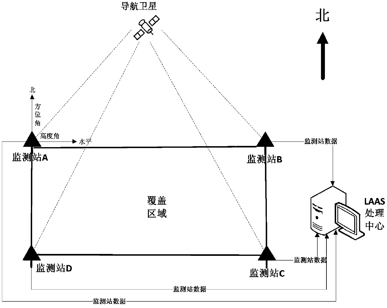
[0049] In order to better illustrate the purpose and advantages of the present invention, below in conjunction with the attached figure 1 The technical scheme of the present invention will be further described. In this specific implementation manner, four ground monitoring stations (A, B, C, and D) of LAAS are taken as examples for method description. The equipment in the present invention includes: LAAS system ground GNSS monitoring station, the schematic diagram is as figure 1 As shown, the monitoring station receives the GNSS signal, tracks and captures the carrier phase measurement and pseudo-range measurement data, and then sends it to the LAAS ground processing center, which performs multipath error separation and modeling based on the accumulated historical data of each monitoring station, and according to The observation data of each monitoring station received in real time is processed by LAAS differential enhancement information and integrity processing. The whole p...


PUM


Abstract

The invention discloses a multipath error modeling method for a local area augmentation system (LAAS), wherein the method is suitable for multipath error correction of pseudo-range and carrier wave observed quantities of a ground monitoring station. On the basis of traditional precision single-point positioning, a non-combined precision single-point ambiguity fixing processing method is adopted torealize multipath error separation of pseudo-range and carrier wave phases; a multipath error model of an elevation angle / azimuth angle is constructed based on precise single-point positioning pseudo-range and a carrier phase posterior residual error; and real-time compensation of multipath errors of the pseudo-range and the carrier phase of a monitoring station is carried out based on the model,so that the adverse effect of the multipath errors on LAAS anomaly detection is reduced and the differential enhancement information generation precision is improved.

Description

technical field [0001] The invention discloses a multipath error modeling method applicable to local area augmentation system (LAAS), which is suitable for multipath error compensation and correction of ground monitoring station pseudo-range and carrier wave observation. Background technique [0002] The aircraft precision asymptotic landing system LAAS based on the GNSS satellite navigation system can effectively guarantee the high precision, safety and continuous landing requirements of civil aviation aircraft. Analyze, provide users with differential enhancement information and integrity information, and guide civil aviation users to make accurate and safe landings. [0003] Since the GNSS signal is affected by the surrounding environment of the monitoring station, reflection and scattering are generated, resulting in multipath, which makes the pseudo-range and carrier phase observations of the monitoring station contain multipath errors, especially for low-elevation sate...

Claims


Application Information

Patent Timeline
Patent Type & Authority Applications(China)
IPC IPC(8): G01S19/22G01S19/23G01S19/29G01S19/44
CPCG01S19/22G01S19/23G01S19/29G01S19/44
Inventor 盛传贞蔚保国解晶张京奎王垚赵精博惠沈盈
Owner NO 54 INST OF CHINA ELECTRONICS SCI & TECH GRP
Why Eureka
Try Eureka