A regional rainfall prediction method combining spatial reasoning and machine learning
A spatial reasoning and machine learning technology, applied in the field of spatial reasoning and machine learning, can solve problems such as difficult weather forecast decision-making, low level, complex rainfall forecast model equations, etc., and achieve the effect of improving the accuracy of rainfall forecasting and improving real-time performance
- Summary
- Abstract
- Description
- Claims
- Application Information
AI Technical Summary
Problems solved by technology
Method used
Image

Examples
Embodiment 1
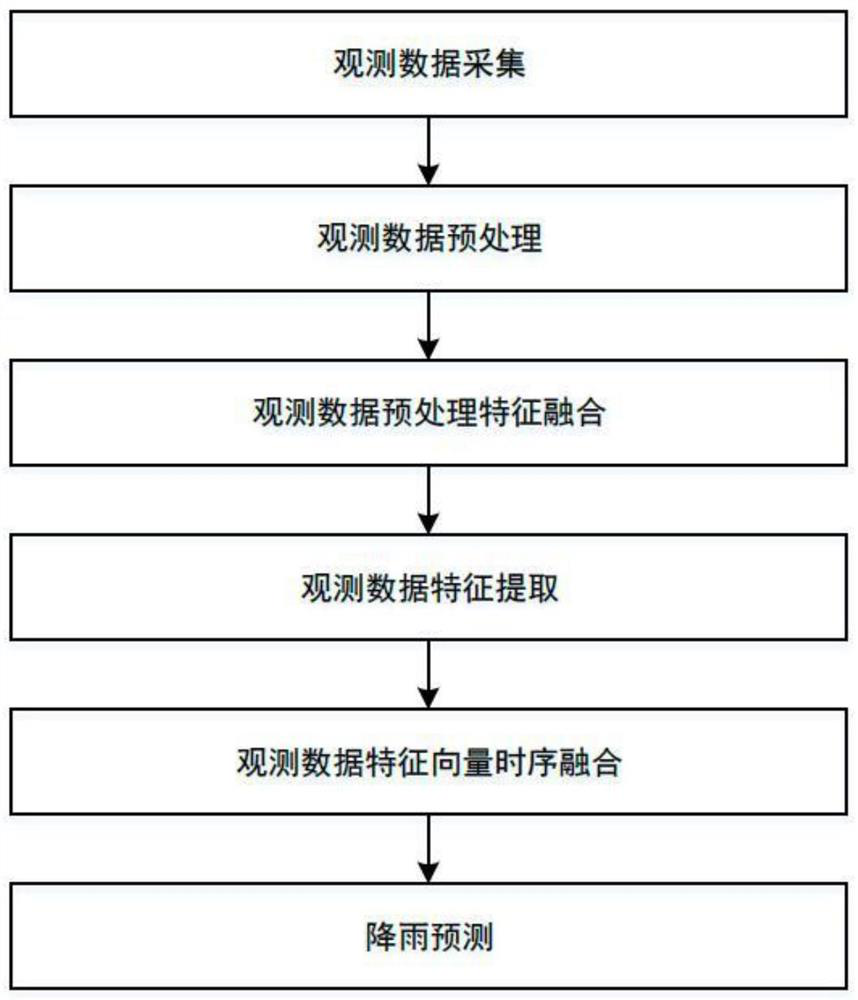
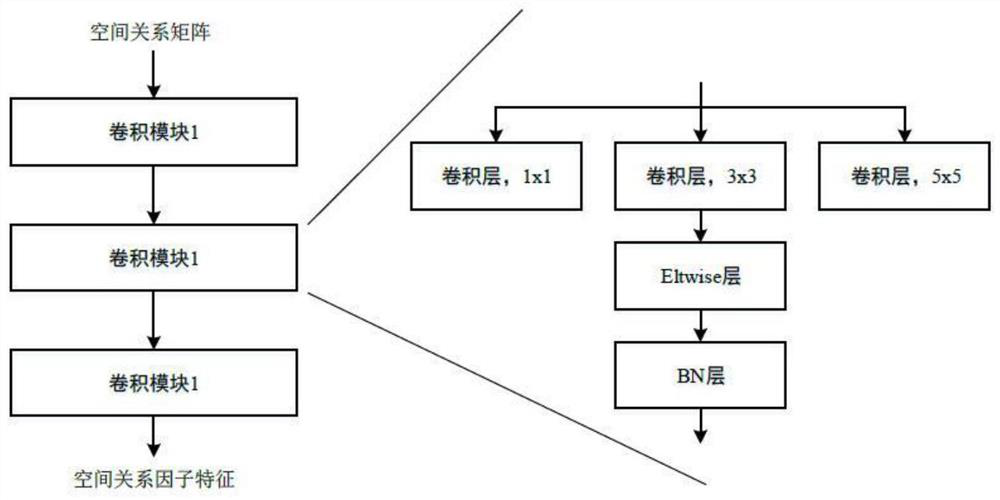
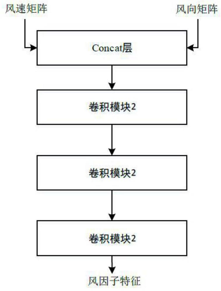
[0053] A regional rainfall prediction method based on spatial reasoning and machine learning, which uses the methods and theories of spatial reasoning to describe the spatial location and climate state information of the area to be monitored, and then analyzes and analyzes it with the help of a deep neural network model in machine learning. Rainfall forecast; specific implementation steps are as follows figure 1 It includes the following 6 steps: observation data collection, observation data preprocessing, observation data preprocessing feature fusion, observation data feature extraction, observation data feature vector time series fusion, and rainfall prediction;
[0054] Wherein, step 1: observation data collection, using n radiosondes distributed in fixed positions to detect the state of the atmosphere as observation data; the observation data includes temperature value, humidity, whether it rains, and wind speed and direction;
[0055] Step 2: Preprocessing of observation ...
Embodiment 2
[0089] A training method for a regional rainfall prediction model based on spatial reasoning and machine learning, which includes preparing a training data set, pre-training and full network training;
[0090] Obtain the historical value of observation data of the state of the atmosphere detected by n radiosondes for a long time, and record the corresponding rainfall state;
[0091] For each observation data, according to the method in Example 1, generate a spatial relationship matrix, a wind speed matrix and a wind direction matrix, a temperature vector and a humidity vector, and according to the rainfall status of each simple area, according to the intersection matrix representation method, generate its label rainfall Matrix, the dimension is n+2 in width and height;
[0092] The above-mentioned spatial relationship matrix, wind speed matrix and wind direction matrix, temperature vector, humidity vector and label rainfall matrix are a set of training data;
[0093] The hist...
PUM
 Abstract
Description
Claims
Application Information
 - R&D
- Intellectual Property
- Life Sciences
- Materials
- Tech Scout
- Unparalleled Data Quality
- Higher Quality Content
- 60% Fewer Hallucinations
Browse by: Latest US Patents, China's latest patents, Technical Efficacy Thesaurus, Application Domain, Technology Topic, Popular Technical Reports.
© 2025 PatSnap. All rights reserved.Legal|Privacy policy|Modern Slavery Act Transparency Statement|Sitemap|About US| Contact US: help@patsnap.com