
Attitude and Orbit Refinement Method of Domestic Land Observation Satellite Based on Cloud Control

An observation satellite and cloud control technology, applied in the interpretation of photos, space navigation equipment, space navigation aircraft, etc., can solve the problem of insufficient geometric positioning accuracy, to ensure high efficiency and stability, reduce image residual errors, Wide range of effects

Active Publication Date: 2021-05-18
WUHAN UNIV
View PDF6 Cites 0 Cited by
  • Summary
  • Abstract
  • Description
  • Claims
  • Application Information

AI Technical Summary

Problems solved by technology

[0004] The invention mainly solves the problem that the geometric positioning accuracy is not high enough in the existing satellite image ground processing system

Method used


Image

  • Attitude and Orbit Refinement Method of Domestic Land Observation Satellite Based on Cloud Control
  • Attitude and Orbit Refinement Method of Domestic Land Observation Satellite Based on Cloud Control
  • Attitude and Orbit Refinement Method of Domestic Land Observation Satellite Based on Cloud Control

Examples


Embodiment Construction

[0035] The technical solutions of the present invention will be further specifically described below through the embodiments and in conjunction with the accompanying drawings.

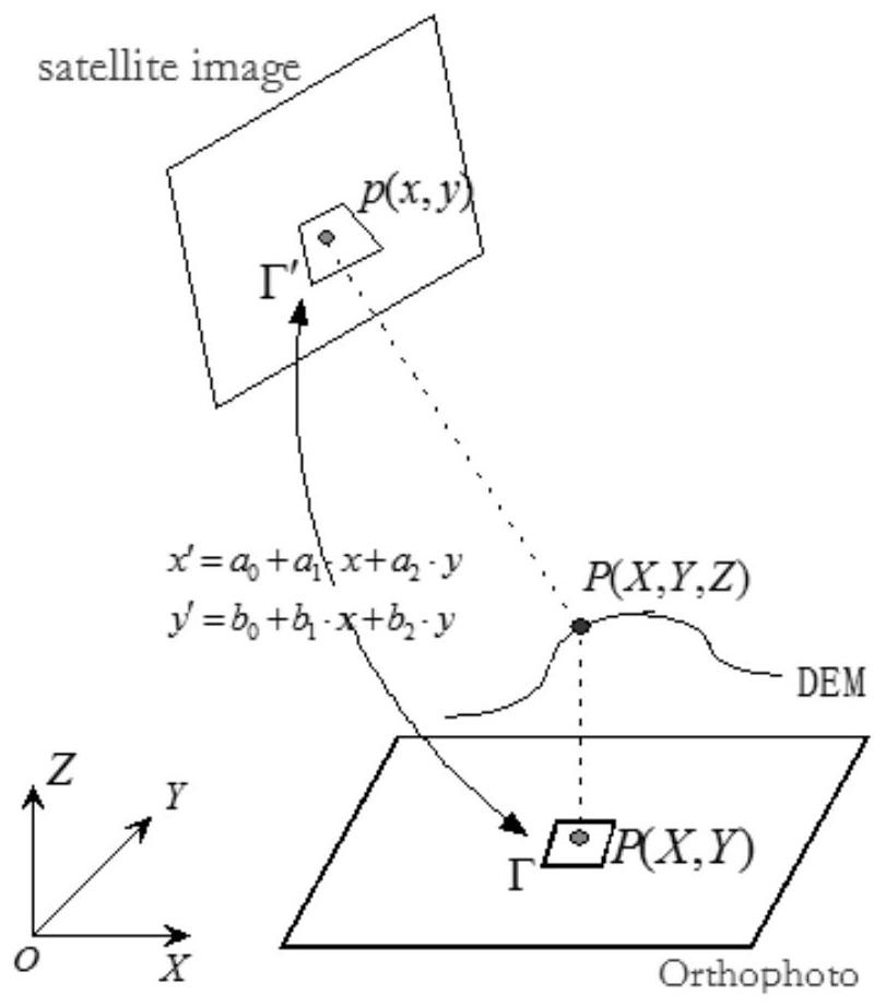
[0036] The technical solution provided by the present invention is, based on the existing reference digital orthophoto image and digital surface model or digital elevation model, through automatic matching of control points and satellite image strip adjustment based on attitude-orbit data, the domestic The attitude and orbit refinement of satellite images can improve the accuracy of images, and can be used for various types of satellite images. like Figure 4 shown, including the following steps:

[0037] Step 1, data decompression. Read all the satellite image files in the 1A-level image of the whole track scene. The original file format of the satellite image is tar.gz, and decompress it to a temporary directory.

[0038] Step 2, sub-scene control point matching. For the file directory decompress...


PUM


Abstract

The invention discloses a method for refining the attitude and orbit of a domestic land observation satellite based on cloud control. The method is based on a reference base map composed of an existing digital orthophoto image and a digital surface model or a digital elevation model, and performs 1A-level standard scene image and Automatically measure the control points between the reference base maps, obtain the control point data, logically stitch the 1A-level images through the sub-view information of the standard scene, restore the original strip image information, combine the travel time, GPS track, Attitude and other data, perform strip adjustment based on the original attitude and orbit, and calculate accurate attitude parameters. At the same time, the distribution law of the residual error of the image point is analyzed, and the inner azimuth geometric calibration of the CCD line array of the satellite is carried out according to the residual error law. Finally, according to the calibrated internal orientation elements and the calculated precise orbit and attitude (ie, the external orientation elements), the rational polynomial parameter RPC of the standard scene 1A image is re-fitted.

Description

technical field [0001] The present invention relates to a method for refining the attitude and orbit of domestic land observation satellites based on generalized "cloud control" information, in which the key points of the method are fully automatic matching control points based on the reference base map and satellite image strip adjustment based on the attitude and orbit technology. Background technique [0002] With the continuous launch of domestic satellites such as the Gaofen series (such as Gaofen-1, Gaofen-2, Gaofen-6, etc.) Accumulation provides a large number of satellite images for related scientific research and practical engineering applications. The demand for large-scale mapping puts forward higher and higher requirements for the geometric positioning accuracy of satellite images. Therefore, using generalized multi-source ground control information as a geometric reference, through geometric calibration and geometric orientation, the direct ground-to-ground acc...

Claims


Application Information

Patent Timeline
Patent Type & Authority Patents(China)
IPC IPC(8): G01C11/34B64G1/24
CPCB64G1/24B64G1/245
Inventor 陶鹏杰张祖勋柯涛席可
Owner WUHAN UNIV
Learn More