Unmanned vehicle track recording and tracking method

A trajectory tracking, unmanned vehicle technology, applied in vehicle position/route/altitude control, non-electric variable control, control/regulation system and other directions, can solve problems such as inability to receive signals, and achieve accurate tracking and strong robustness , the effect of strong applicability

Active Publication Date: 2020-05-19
GUANGZHOU SAITE INTELLIGENCE TECH CO LTD
View PDF6 Cites 4 Cited by
  • Summary
  • Abstract
  • Description
  • Claims
  • Application Information

AI Technical Summary

Problems solved by technology

Differential GPS aligns the longitude, latitude and angle information of the vehicle through 4 or more satellites, but GPS requires to operate in a relatively open place, and it cannot receive signals when there are dark clouds, under the woods, in tunnels, etc.

Method used


Image

  • Unmanned vehicle track recording and tracking method
  • Unmanned vehicle track recording and tracking method
  • Unmanned vehicle track recording and tracking method

Examples


Embodiment Construction

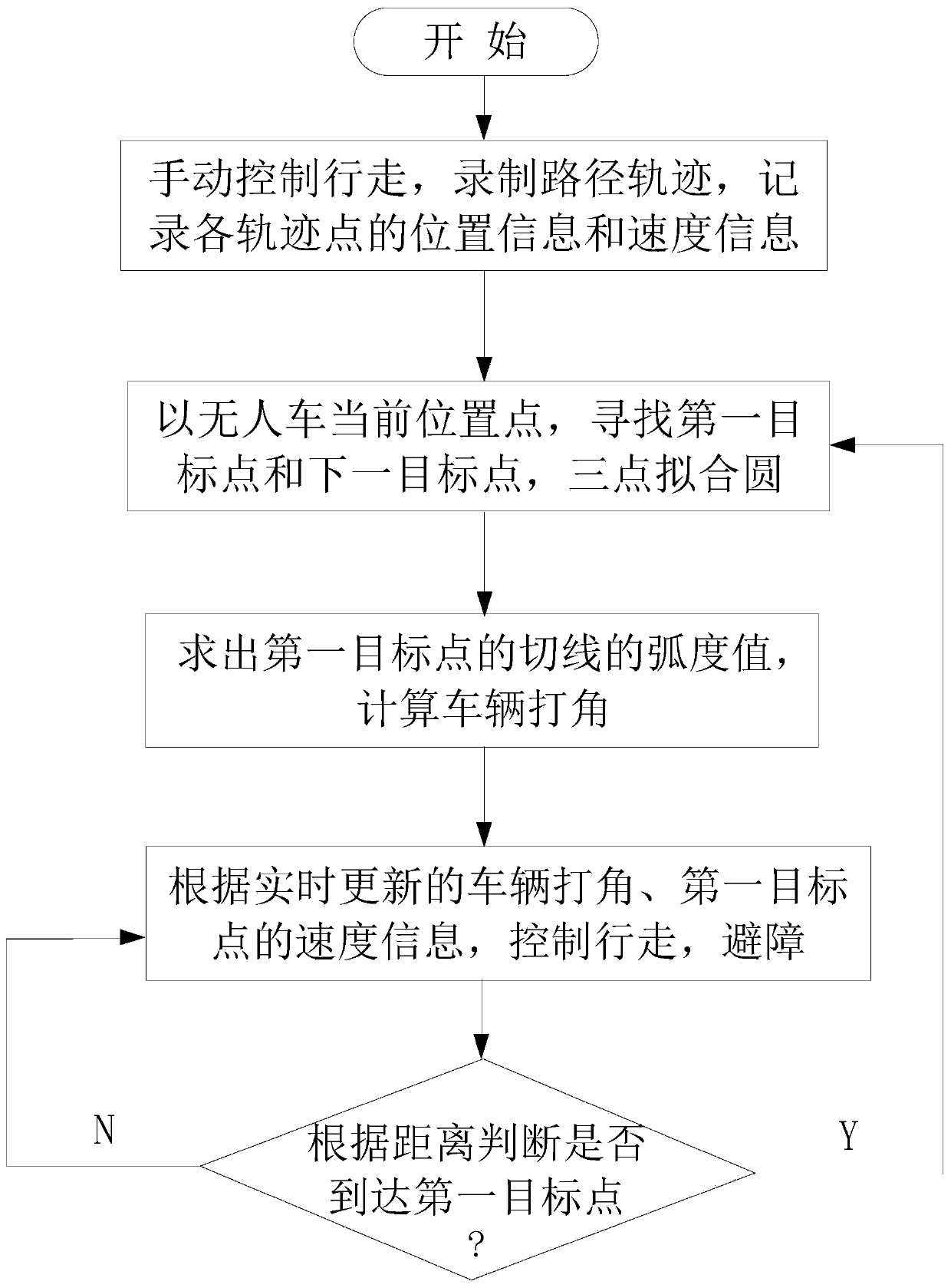
[0029] A method for track recording and track tracking of unmanned vehicles, such as figure 1 shown, including the following steps:

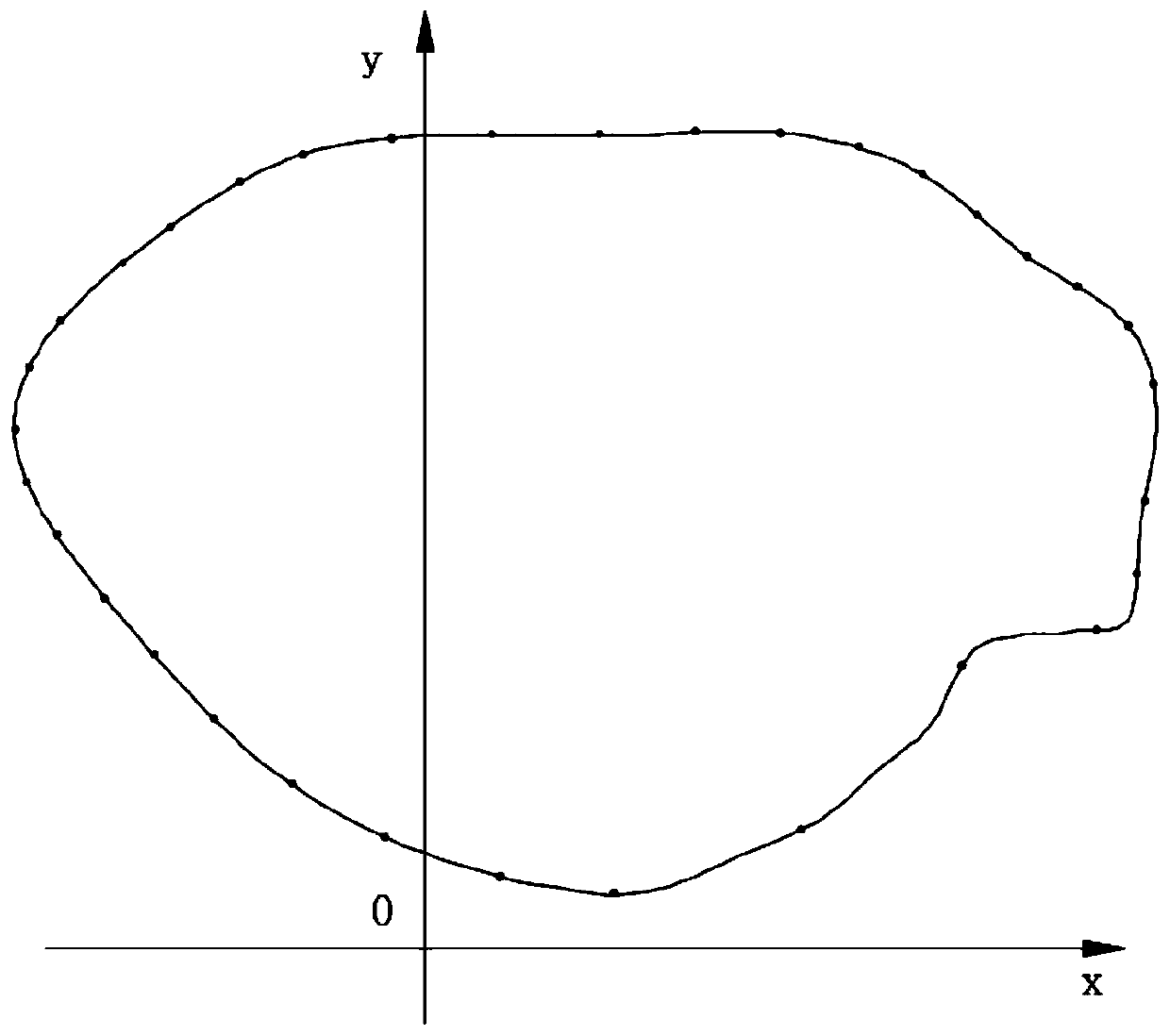
[0030] S1. Manually control the unmanned vehicle to walk, record the path trajectory, record the coordinate information and speed information of each trajectory point on the path trajectory, and form a path trajectory map with coordinates;

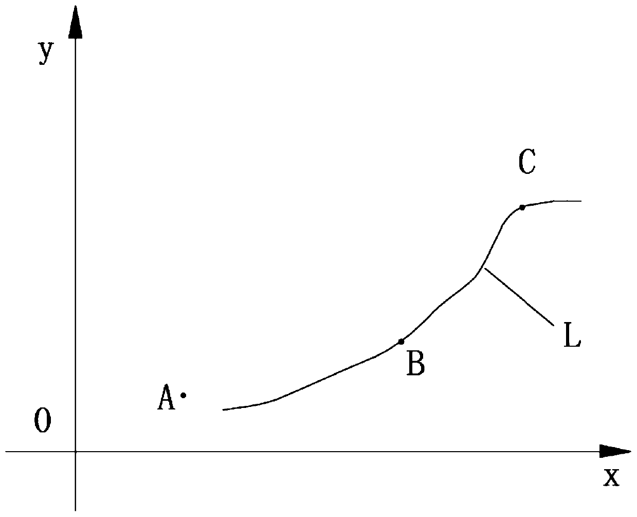
[0031] S2. According to the current position point of the unmanned vehicle on the path trajectory map, the direction of pre-walking and the recorded path trajectory, select two points from the trajectory points on the path trajectory as the first position of the unmanned vehicle respectively. The target point and the next target point, using the current position point of the unmanned vehicle, the first target point and the next target point to fit a circle passing through the three points, and obtain the center coordinates of the circle;

[0032] S3. Record the radian value of the current heading angle of t...


PUM


Abstract

The invention relates to an unmanned vehicle trajectory recording and tracking method. The method comprises steps of manually controlling an unmanned vehicle to walk, recording a path trajectory, andrecording coordinate information and speed information of each trajectory point by using the positioning information provided by a differential GPS or a multi-line laser radar; searching a first target point and a next target point which are closest to each other; for a three-point fitting circle, solving an arc tangent function of a tangent line of a first target point on the circle as a radian value of the first target point, calculating a difference value between the radian of the first target point and the current radian of the unmanned vehicle to calculate a vehicle angle. The method is advantaged in that the speed information is loaded to control the vehicle to walk, angle-making walking is updated in real time, the vehicle tracks the track step by step along the track points, the patrol function is achieved, the method has the advantage of being accurate in tracking, the starting point can be located at any point on the track line or outside the track line, and applicability ishigh, and a technical scheme is suitable for outdoor patrol, can be carried back and forth for a long time, and is high in robustness.

Description

technical field [0001] The invention relates to the field of path navigation of unmanned vehicles, in particular to a method for recording and tracking the trajectory of an unmanned vehicle. Background technique [0002] With the development of self-driving vehicle technology, there are various navigation methods for unmanned driving, such as laser navigation, visual navigation, GPS navigation, IMU and so on. There are also many path planning algorithms, such as global path planning, local path planning, and so on. Among the existing sensors, differential GPS and multi-line lidar can use this method for trajectory recording and trajectory tracking. Differential GPS aligns the longitude, latitude and angle information of the vehicle through 4 or more satellites, but GPS requires to operate in a relatively open place, and it cannot receive signals when there are dark clouds, under the woods, in tunnels, etc. . The multi-line lidar requires to operate in places with obvious ...

Claims


Application Information

Patent Timeline
Patent Type & Authority Applications(China)
IPC IPC(8): G05D1/02
CPCG05D1/0219G05D1/0223G05D1/0214
Inventor 李良源赖志林李睿
Owner GUANGZHOU SAITE INTELLIGENCE TECH CO LTD
Why Eureka
Try Eureka