Projection type landslide monitoring device, system and method
A monitoring device and projection technology, which is applied in the directions of measurement device, surveying and navigation, geophysical measurement, etc., can solve the problems of difficult installation or maintenance, increased installation and construction cost, and poor timeliness.
- Summary
- Abstract
- Description
- Claims
- Application Information
AI Technical Summary
Problems solved by technology
Method used
Image
Examples
Embodiment 1
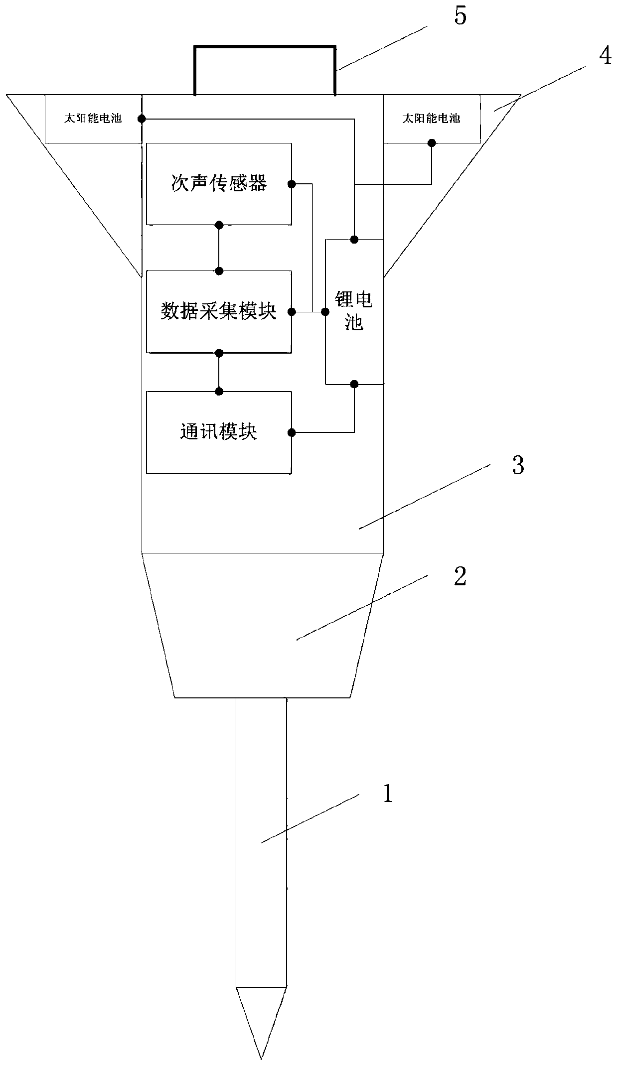
[0033] Such as figure 1 As shown, it is a schematic structural diagram of a projection-type landslide monitoring device provided by an embodiment of the present invention. The projection-type landslide monitoring device mainly includes a nose cone 1, a variable-diameter coupling cavity 2, a load compartment 3 and an empennage 4;
[0034] The top of the nose cone 1 has a conical structure, and the bottom end is coupled with the variable diameter port of the variable diameter coupling cavity 2. The inside of the nose cone 1 is hollow, and the other end of the variable diameter coupling cavity 2 is set There is the load compartment 3, the left and right sides of the load compartment 3 are respectively provided with the empennage 4, the infrasound sensor, data acquisition module, communication module and lithium battery are arranged in the load compartment 3, the infrasound The sensor is connected to the input end of the data acquisition module, the output end of the data acquisit...
Embodiment 2
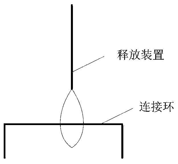
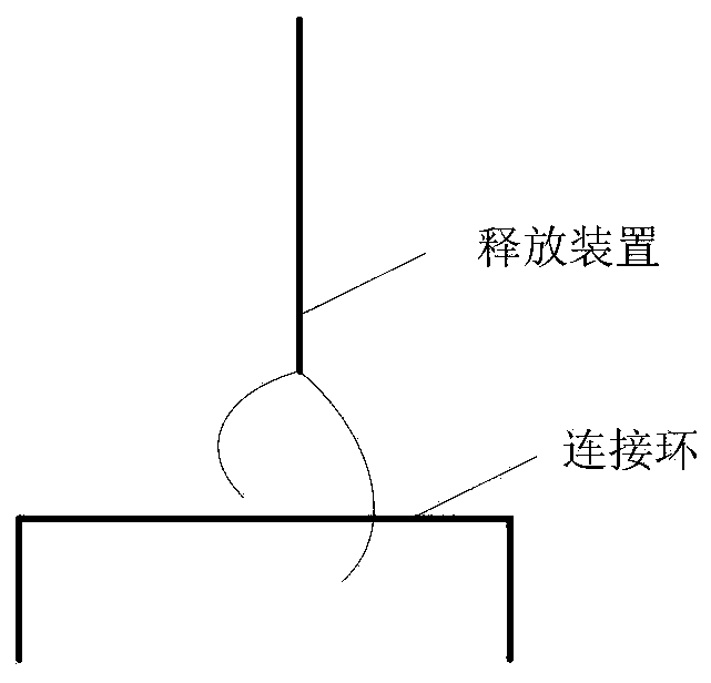
[0043] Such as Figure 4 As shown, the present invention also provides a projection-type landslide monitoring system, the system includes a drone, a central server, and any projection-type landslide monitoring device described in the above-mentioned embodiments, and the bottom of the drone is equipped with There is a release device, the release device is used to connect with the connection ring 5, and when the release device turns on the release function, it disconnects the connection with the connection ring 5, and the central server is used for receiving the infrasonic signal transmitted by the data acquisition module through the communication module, and monitoring the corresponding landslide body according to the infrasonic signal.
[0044] Specifically, first set up a preparation area 1-2km away from the landslide body to be tested. This distance can be adapted and adjusted according to the actual situation. It is necessary to consider the remote control distance of the d...
Embodiment 3
[0047] Such as Figure 5 As shown, the embodiment of the present invention also provides a projection type landslide monitoring method, the method includes the following steps:
[0048] S1, setting up a preparation area at a position with a preset distance from the landslide body to be tested;
[0049] S2, fixing any projected landslide monitoring device described in the above embodiments on the release device at the bottom of the drone;
[0050] S3, above the landslide body to be tested, the camera loaded by the UAV is used to capture the operation image of the landslide body to be measured in real time, and the operation image is sent back to the center through the communication module of the projected landslide monitoring device server;
[0051] S4, the central server selects the target monitoring point of the landslide body to be tested according to the returned operation image;
[0052] S5, controlling the UAV to fly directly above the target monitoring point, and adju...
PUM
 Abstract
Description
Claims
Application Information
 - R&D
- Intellectual Property
- Life Sciences
- Materials
- Tech Scout
- Unparalleled Data Quality
- Higher Quality Content
- 60% Fewer Hallucinations
Browse by: Latest US Patents, China's latest patents, Technical Efficacy Thesaurus, Application Domain, Technology Topic, Popular Technical Reports.
© 2025 PatSnap. All rights reserved.Legal|Privacy policy|Modern Slavery Act Transparency Statement|Sitemap|About US| Contact US: help@patsnap.com


