Real estate geospatial data desensitization method based on bilinear interpolation model

A real estate and data technology, applied in the field of real estate registration information management, can solve problems such as research inconvenience, achieve good application value, ensure local detailed fitting, and ensure topological consistency

Pending Publication Date: 2020-06-19
NANJING GUOTU INFORMATION IND
View PDF0 Cites 3 Cited by
  • Summary
  • Abstract
  • Description
  • Claims
  • Application Information

AI Technical Summary

Problems solved by technology

The secrecy processing of geospatial data can decipher the geospatial data from the two aspects of attribute information and control position accuracy. Decryption method of real estate geospatial data based on interpolation model

Method used


Image

  • Real estate geospatial data desensitization method based on bilinear interpolation model
  • Real estate geospatial data desensitization method based on bilinear interpolation model
  • Real estate geospatial data desensitization method based on bilinear interpolation model

Examples


Embodiment Construction

[0060] In order to make the implementation objectives, technical solutions and advantages of the present invention clearer, the technical solutions in the embodiments of the present invention will be clearly and completely described below in conjunction with the accompanying drawings in the embodiments of the present invention. Obviously, the described embodiments are Some embodiments of the present invention are not all embodiments. Based on the implementation manners in the present invention, all other embodiments obtained by persons of ordinary skill in the art without making creative efforts belong to the protection scope of the present invention.

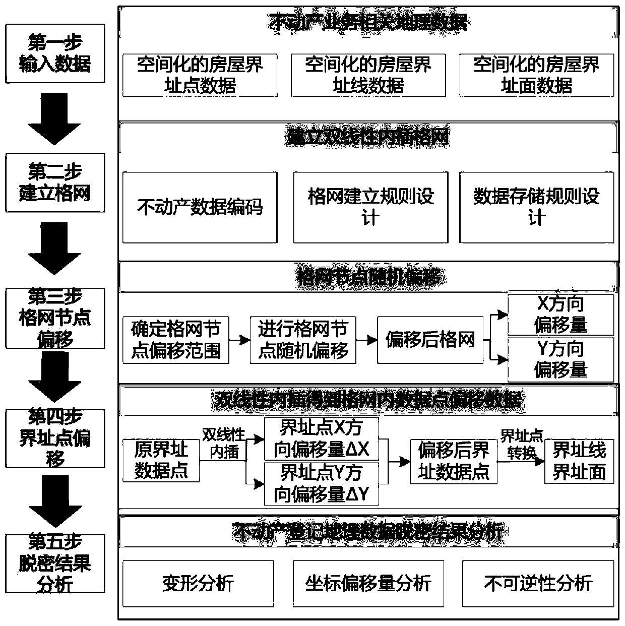
[0061] Combination diagram process figure 1 , a method for decrypting real estate geospatial data based on a bilinear interpolation model, comprising the following steps:

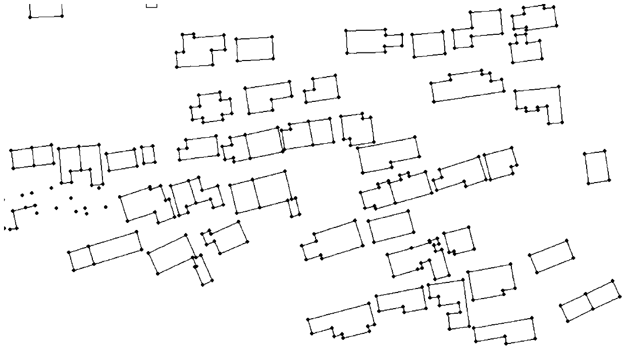
[0062] 1. Input real estate geospatial data. The real estate geographic data used for decryption includes boundary point data, boundary line data, and int...


PUM


Abstract

The invention relates to a real estate geospatial data decryption method based on a bilinear interpolation model, and the method comprises the following steps: inputting real estate geospatial data which comprises boundary point data, boundary line data and boundary surface data of a real estate house after spatialization; selecting and establishing a proper grid based on the size of the researcharea; randomly offsetting grid node coordinates within a range required by precision; grid interpolation is carried out to calculate the offset of boundary point data; coordinate correction is carriedout on the boundary point data; and analyzing the desensitized result of the real estate registration data and the like. According to the invention, real estate geographic space data can be decrypted; the problems of confidentiality and shareability of real estate registration data are well solved; the formed decrypted real estate registration data has non-reducibility, can realize real estate transverse service sharing, Internet sharing and real estate big data analysis and wide application, effectively reduces the security level of the real estate registration data, reserves and representsreal estate space-time situation type basic characteristics, and has a good application value in practical application.

Description

technical field [0001] The invention relates to the technical field of real estate registration information management, in particular to a method for decrypting real estate geographic space data based on a bilinear interpolation model. Background technique [0002] With the development of geographic information technology and economic society, the demand for geospatial data in all walks of life is becoming more and more urgent. Real estate registration data, as multivariate data that records multi-time series and multi-subject related information and archives in the whole city, includes source Based on real estate attribute data and geospatial data in various aspects such as society, economy, and government affairs, urban real estate geospatial data is an objective holographic three-dimensional depiction of the urban development process, and is an important basis for studying the characteristics of urban development in time and space. It is of great significance to study the...

Claims


Application Information

Patent Timeline
Patent Type & Authority Applications(China)
IPC IPC(8): G06F16/29G06F21/62G06Q50/26
CPCG06F16/29G06F21/6245G06Q50/26
Inventor 陈磊沈周刘冰鲍远军江洋
Owner NANJING GUOTU INFORMATION IND
Why Eureka
Try Eureka