A multi-scale adaptive airborne lidar point cloud building segmentation method

A building, multi-scale technology, applied in image analysis, computer components, image enhancement, etc., can solve the problems of irregular spatial distribution, uneven density, etc., to achieve uneven density, good robustness, and anti-noise. strong effect

Active Publication Date: 2022-07-15
WUHAN UNIV
View PDF5 Cites 0 Cited by
  • Summary
  • Abstract
  • Description
  • Claims
  • Application Information

AI Technical Summary

Problems solved by technology

[0004] The technical problem to be solved by the present invention is to avoid the single-scale non-adaptive problem of the existing method, and provide a multi-scale self-adaptive airborne LiDAR point cloud building segmentation method, combining the existing clustering method with the building Combining individual evaluation methods, fully considering the complex structure and irregular spatial distribution of buildings, to solve the dense buildings in the old city, the podium of the modern urban area, and the uneven density of building point clouds due to building materials, etc. The data building monomer segmentation problem is adaptive to a variety of data, and the over-segmented monomers are merged to achieve multi-scale adaptive building monomer segmentation

Method used


Image

  • A multi-scale adaptive airborne lidar point cloud building segmentation method
  • A multi-scale adaptive airborne lidar point cloud building segmentation method
  • A multi-scale adaptive airborne lidar point cloud building segmentation method

Examples


Embodiment Construction

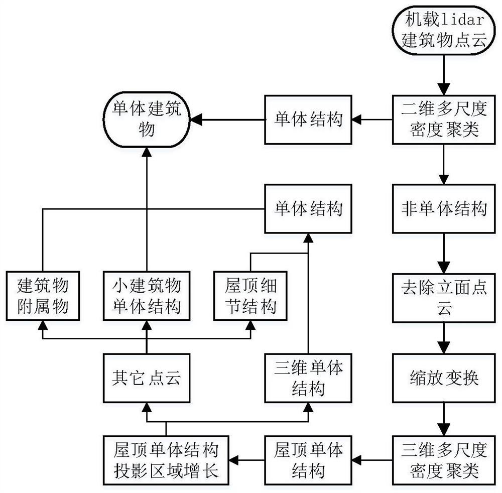
[0072] In order to make the objectives, technical solutions and advantages of the present invention clearer, the present invention will be further described in detail below with reference to the accompanying drawings and embodiments. It should be understood that the specific embodiments described herein are only used to explain the present invention, but not to limit the present invention.

[0073] In order to solve the problem of the dense buildings in the old urban area, the podiums of the modern city, and the non-uniform building point cloud density caused by building materials, etc., the following describes the technical solution of the present invention in detail with reference to the accompanying drawings and embodiments. illustrate.

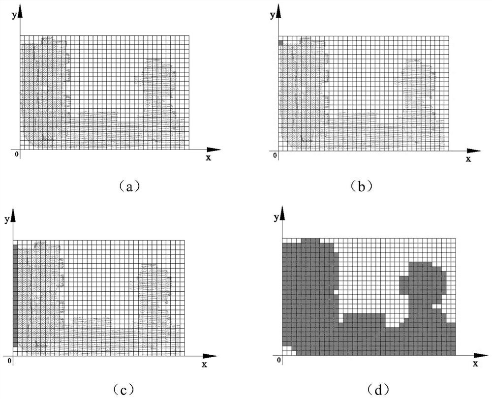
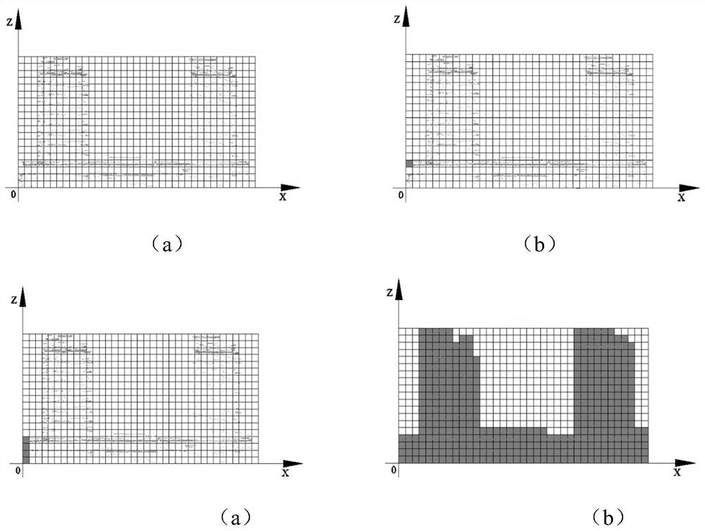
[0074] In order to test the correctness of this technical scheme, the point cloud data on ISPRS and the airborne LiDAR point cloud data collected in Ningbo were selected for experiments. The data contains relatively dense building point c...


PUM


Abstract

The invention discloses a multi-scale adaptive airborne LiDAR point cloud building singulation segmentation method. The method includes the following steps: step 1, calculation of the point distance of the building point cloud; step 2, through the two-dimensional multi-scale density The clustering algorithm performs single segmentation on the building point cloud data; step 3, uses the three-dimensional multi-scale density clustering algorithm to perform single segmentation on the transformed point cloud; step 4, the non-roof single structure building point cloud The three-dimensional multi-scale density clustering algorithm is used again on the unscaled scale to segment it into single roof structures; step 5, identification of roof detail structures and merging of corresponding monomers; step 6, single structure of small buildings In step 7, the attachment points of the building are merged into the corresponding monomer structure to realize the segmentation of the building monomer. The invention solves the problem that the buildings in the dense area of ​​the old city, the podium structure buildings and the buildings with uneven point cloud density cannot be individually divided.

Description

technical field [0001] The invention relates to the technical field of computer three-dimensional reconstruction, in particular to a multi-scale adaptive airborne LiDAR point cloud building singulation segmentation method, which is mainly applied to building modeling, urban planning, municipal management, digital city construction, etc. an area. Background technique [0002] Airborne LiDAR can quickly obtain 3D surface information of ground objects and is an important data source for 3D modeling of buildings. The 3D model in the digital city system built in my country is a model lacking semantic information or a model established by manual manual segmentation, which cannot meet the needs of the construction and application of a real digital city. The volumetric 3D model serves as the basis. The single segmentation of the building point cloud can reconstruct the model in parallel, efficiently manage and analyze each single building, and generate a queryable and analyzable 3D...

Claims


Application Information

Patent Timeline
Patent Type & Authority Patents(China)
IPC IPC(8): G06T7/11G06K9/62G06V10/762
CPCG06T7/11G06T2207/10021G06F18/232
Inventor 张永军杨望山刘欣怡祝宪章黄星北
Owner WUHAN UNIV
Why Eureka
Try Eureka