
Karst slope vertical valley parameter measuring method

A parameter measurement and karst technology, applied in the field of UAV surveying and mapping, can solve the problems of no relevant reports, achieve good visual recognition, improve work efficiency, and reduce the workload of manual surveys

Pending Publication Date: 2020-07-17
广西善图科技有限公司
View PDF5 Cites 3 Cited by
  • Summary
  • Abstract
  • Description
  • Claims
  • Application Information

AI Technical Summary

Problems solved by technology

However, there is no report on how to use UAV surveying and mapping technology to survey and map the relevant geomorphic parameters of the karst Poli Valley.

Method used


Image

  • Karst slope vertical valley parameter measuring method
  • Karst slope vertical valley parameter measuring method
  • Karst slope vertical valley parameter measuring method

Examples


Embodiment Construction

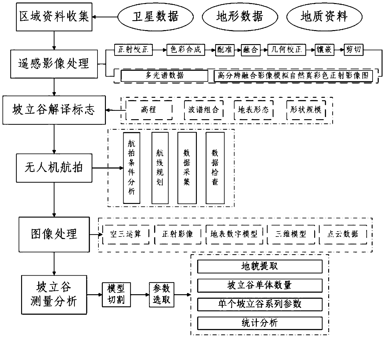
[0049] The invention provides a method for measuring karst Poli Valley parameters, the flow chart of which is shown in figure 1 shown. In order to express the present invention more clearly, the present invention will be further described in detail by taking the karst Poli Valley in Xinfujiang, Guilin City as an example below to measure the geomorphic parameters. The specific implementation methods and steps are as follows:

[0050] A method for measuring karst Poli Valley parameters, comprising the following steps:

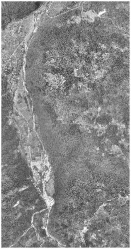
[0051] S1, satellite remote sensing interpretation of karst Poli Valley geomorphology: collect data of the karst area to be measured, including satellite data, terrain data and geological data, process satellite remote sensing images, and comprehensively interpret the typical Poli Valley landform of the karst area to be measured; The data comes from the Landsat satellite and the Gaofen-1 satellite. Satellite remote sensing image processing and comprehensive inte...


PUM


Abstract

The invention provides a karst slope vertical valley parameter measuring method, and belongs to the technical field of unmanned aerial vehicle surveying and mapping. The method comprises the followingsteps: interpreting a karst slope vertical valley landform based on satellite remote sensing data; determining a data acquisition area according to a terrain, the landform and a resolution, delimiting a imitation ground flight range and planning a route; adopting two modes of intelligent route planning flight shooting and manual control flight shooting to comprehensively acquire data; carrying out aerial image processing; and measuring and analyzing parameters of a slope vertical valley. According to the method, the landform of the slope vertical valley and the surrounding karst landform thereof can be obtained, a problem that manual measurement cannot be performed or measurement is inaccurate is solved, full-coverage, high-precision and multi-view karst slope vertical valley landform data is obtained, measurement parameters are comprehensive and high in accuracy, and permanent measurement data is provided for depiction, protection, development and utilization of the karst slope vertical valley landform.

Description

【Technical field】 [0001] The invention relates to the technical field of unmanned aerial vehicle surveying and mapping, in particular to a method for measuring karst Poli Valley parameters. 【Background technique】 [0002] Karst Poli Valley is a karst valley with a width of more than 1km and a length of more than 10km. The sides of the valley are mostly surrounded by peaks and forests. The slope of the valley is steep, but the bottom of the valley is flat. There are often cross-border rivers passing through the valley, flowing out from one end of the valley and diving into the ground at the other end. Under the influence of rivers, the valley not only expands rapidly, but also accumulates thicker alluvial deposits, which is one of the typical karst landform types. The plane shape, length of major axis and direction of the valley, length of minor axis, height, volume Parameters such as , steep slope and other parameters are the basic data for the protection, development and u...

Claims


Application Information

Patent Timeline
IPC IPC(8): G01C11/02G05D1/10G01S19/41G06T7/11
CPCG01C11/02G01S19/41G05D1/101G06T7/11
Inventor 沈利娜唐全生
Owner 广西善图科技有限公司
Learn More