Vision-based parking lot drivable area detection and local map construction method
A driving area and map construction technology, applied in the field of robot mapping, can solve the problems of weak GPS signals in underground parking lots, inability to perform accurate positioning, and inability to reduce production costs, so as to improve efficiency and comfort, and reduce dependence.
- Summary
- Abstract
- Description
- Claims
- Application Information
AI Technical Summary
Problems solved by technology
Method used
Image
Examples
Embodiment Construction
[0046] The accompanying drawings are for illustrative purposes only, and should not be construed as limiting the present invention; in order to better illustrate the present embodiment, some parts of the accompanying drawings may be omitted, enlarged or reduced, and do not represent the size of the actual product; for those skilled in the art It is understandable to the artisan that certain well-known structures and descriptions thereof may be omitted from the drawings. The technical solutions of the present invention will be further described below with reference to the accompanying drawings and embodiments.
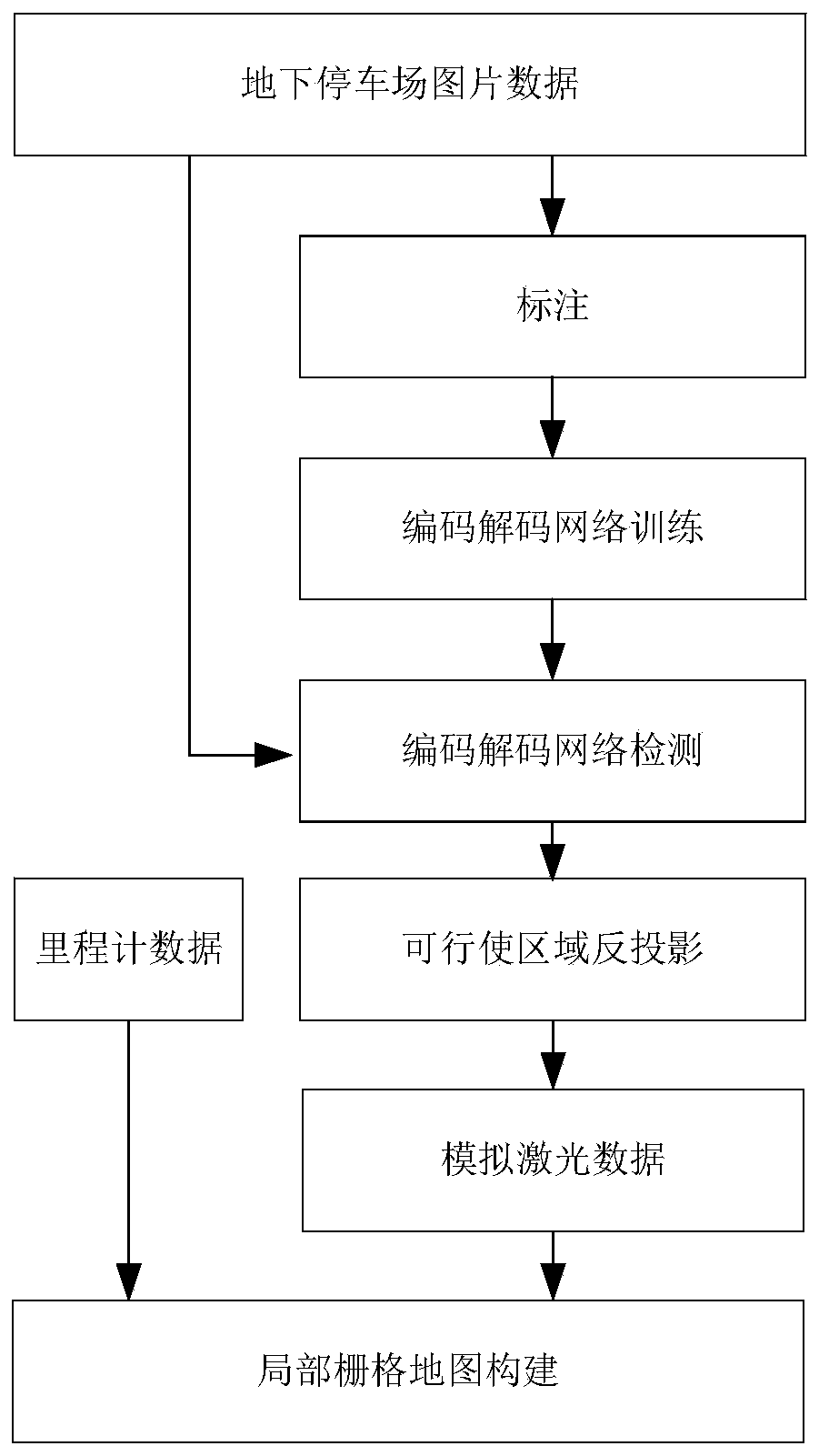
[0047] like figure 1 As shown in the figure, a vision-based method for detecting the drivable area of a parking lot and constructing a local map includes the following steps:
[0048] S1. Collect the image data set of the underground parking lot; continuously collect the scene data of the underground parking lot through the visual sensor mounted on the vehicle body t...
PUM
 Abstract
Description
Claims
Application Information
 - R&D
- Intellectual Property
- Life Sciences
- Materials
- Tech Scout
- Unparalleled Data Quality
- Higher Quality Content
- 60% Fewer Hallucinations
Browse by: Latest US Patents, China's latest patents, Technical Efficacy Thesaurus, Application Domain, Technology Topic, Popular Technical Reports.
© 2025 PatSnap. All rights reserved.Legal|Privacy policy|Modern Slavery Act Transparency Statement|Sitemap|About US| Contact US: help@patsnap.com


