Unmanned aerial vehicle navigation decoy system

A drone and satellite navigation technology, applied in the field of drones, can solve problems such as impact, loopholes, and huge flight control of civilian drones, achieving high efficiency, scientific and reasonable structure, and the effect of reducing backward radiation

Pending Publication Date: 2020-09-01
郝建新
View PDF8 Cites 3 Cited by
  • Summary
  • Abstract
  • Description
  • Claims
  • Application Information

AI Technical Summary

Problems solved by technology

[0003] With the continuous advancement of science and technology in recent years, drones have been widely used in all walks of life, especially in the military field, which can not only detect but also carry out precise attacks on established targets. These characteristics of drones have carried out close investigations and even terrorist attacks on the heads of governments of some countries, causing a series of bloody incidents. Al

Method used


Image

  • Unmanned aerial vehicle navigation decoy system
  • Unmanned aerial vehicle navigation decoy system
  • Unmanned aerial vehicle navigation decoy system

Examples


Embodiment

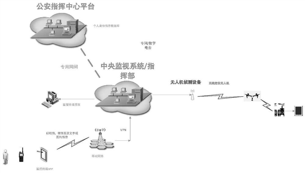
[0050] Example: such as Figure 1-7 As shown, the present invention provides a technical solution, a UAV navigation deception system, including a security protection module, a security license plate module, a detection module, a transmission module, a background processing module and a decoy module.

[0051] According to the above technical solution, the security guarantee module includes a detection module, a countermeasure module, a patrol module and a command center module;

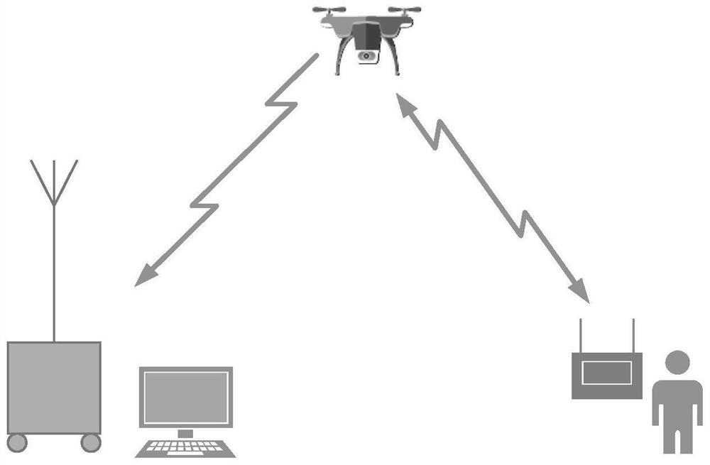
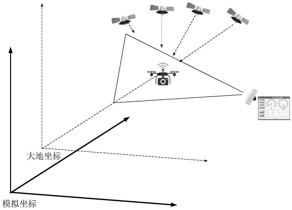
[0052] The detection module completes the reconnaissance, monitoring, and early warning of the UAV, and transmits the UAV's ID, speed, and angle information to the command center system, thereby realizing the detection and positioning of the UAV;

[0053] The countermeasure module mainly disables the UAV by various means, so as to achieve the purpose of driving away, controlling, capturing or destroying the invading UAV;

[0054] The inspection module combined with the ground monitoring to form a powe...


PUM


Abstract

The invention discloses an unmanned aerial vehicle navigation decoy system. The system comprises a security protection guarantee module, a security protection license plate module, a detection module,a transmission module, a background processing module and a decoy module. The security protection guarantee module comprises a detection module, a countering module, an inspection module and a command center module. The system having a structure being scientific and reasonable is safe and convenient to use; the system can be integrated highly; the security personnel can carry and use the system very conveniently in the attendance process. The use cost of equipment is greatly reduced by half; the expelling or forced landing function of the unmanned aerial vehicle can be realized; on the basisof the structural design optimization, no gain attenuation exists between the antennas; the efficiency is high; on the basis of the special antenna design, the front-to-back ratio index of the antennais improved, backward radiation is reduced, the system is harmless to the human body; the product meets the SAR index requirement of a communication product through an authentication test, the snipersighting system manufactured specially is more accurate in use; and secondary positioning and striking are more accurate based on a supervision platform.

Description

technical field [0001] The invention relates to the technical field of unmanned aerial vehicles, in particular to a navigation decoy system for unmanned aerial vehicles. Background technique [0002] Unmanned aircraft is referred to as "unmanned aerial vehicle", and the English abbreviation is "UAV". Compared with manned aircraft, drones are often more suitable for tasks that are too "dumb, dirty or dangerous". According to the application field, drones can be divided into military and civilian. In terms of military use, drones are divided into reconnaissance aircraft And target drones, civilian use, drones + industry applications, are the real rigid needs of drones; currently in aerial photography, agriculture, plant protection, micro selfies, express transportation, disaster relief, observing wild animals, monitoring infectious diseases, surveying and mapping, news Applications in fields such as reporting, power inspections, disaster relief, film and television shooting, ...

Claims


Application Information

Patent Timeline
IPC IPC(8): G01S19/21
CPCG01S19/215
Inventor 郝建新
Owner 郝建新
Why Eureka
Try Eureka