UAV data acquisition trajectory algorithm based on solar-powered agricultural Internet of Things

A technology of solar power supply and data collection, applied in location information-based services, network topology, electrical components, etc., can solve problems such as early death of sensor nodes, WSN energy hot spots, and less energy storage, and improve distributed estimation performance , the path length is short, the effect of saving resources

Active Publication Date: 2022-03-18
GUANGZHOU UNIVERSITY
View PDF7 Cites 0 Cited by
  • Summary
  • Abstract
  • Description
  • Claims
  • Application Information

AI Technical Summary

Problems solved by technology

The traditional WSN is usually composed of a large number of sensor nodes with small size, less energy storage, and low price, and several data fusion centers. The sensor nodes transmit data to the fusion center through clustering, non-clustering, single-hop, and multi-hop methods (FC ), for a static FC, it is easy to cause the early death of sensor nodes and the energy hotspot problem of WSN

Method used


Image

  • UAV data acquisition trajectory algorithm based on solar-powered agricultural Internet of Things
  • UAV data acquisition trajectory algorithm based on solar-powered agricultural Internet of Things
  • UAV data acquisition trajectory algorithm based on solar-powered agricultural Internet of Things

Examples


Embodiment

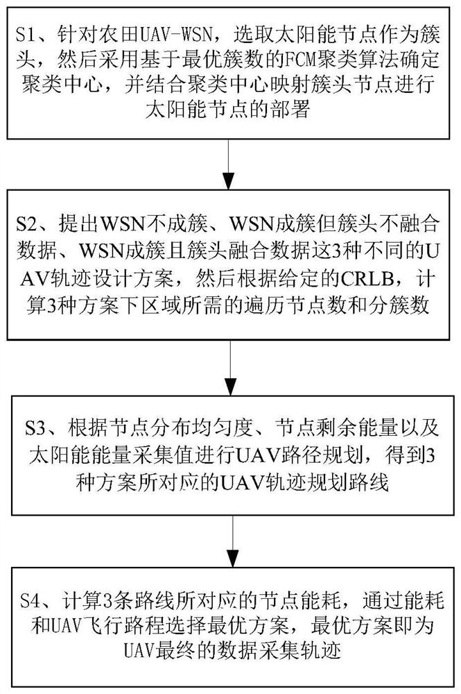
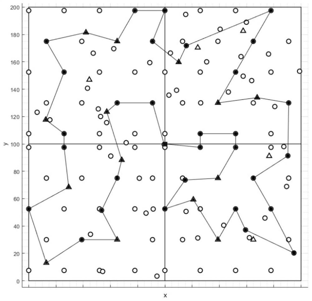
[0134] This embodiment discloses a UAV data acquisition trajectory algorithm based on solar-powered agricultural Internet of Things. First, determine and select solar nodes as cluster heads, and use the FCM clustering algorithm based on the optimal number of clusters combined with cluster center mapping to select solar node deployment. Then, in the UAV trajectory design part, it is divided into two modules for design, including the node selection module and the UAV path planning module. Finally, the optimal solution is selected by comparing the shortest path length and node energy consumption obtained from different schemes. Such as figure 1 As shown, the steps are as follows:

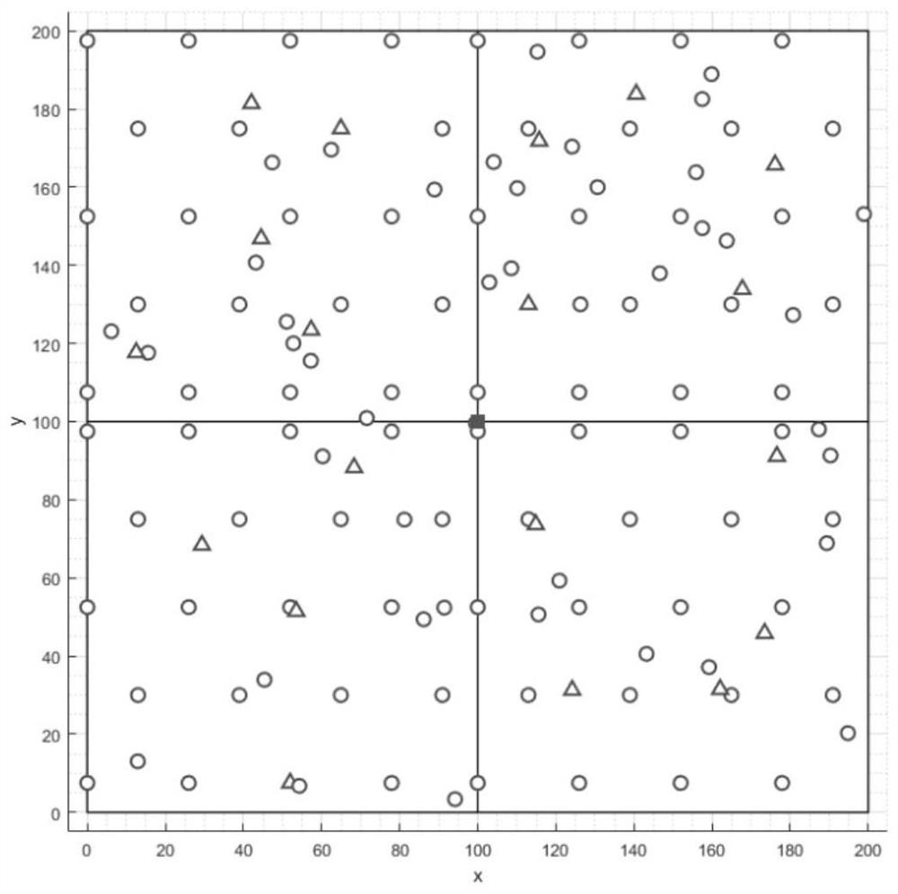
[0135] S1. Since the energy consumption of the cluster head is much greater than the energy consumption of ordinary nodes, for the consideration of energy balance, select the solar node in the farmland UAV-WSN as the cluster head, and then use the FCM (Fuzzy C-Means) based on the optimal number of clus...


PUM


Abstract

The invention discloses a UAV data acquisition trajectory algorithm based on solar-powered agricultural Internet of Things, which includes first selecting solar nodes as cluster heads for farmland UAV-WSN, and then adopting the FCM clustering algorithm based on the optimal number of clusters to determine clustering Center, and combined with the clustering center to map cluster head nodes to deploy solar energy nodes; propose three different UAV trajectory design schemes: WSN is not clustered, WSN is clustered but cluster head does not fuse data, WSN is clustered and cluster head fuses data. Then, according to the given CRLB, calculate the number of traversal nodes and the number of clusters required for the three schemes; UAV path planning is carried out according to the node distribution uniformity, node remaining energy and solar energy collection value, and three UAV trajectory planning routes are obtained ; Calculate the energy consumption of nodes corresponding to the three routes, and select the optimal solution through energy consumption and UAV flight distance. The invention can design a UAV data collection path with low energy consumption, short path length and wide data collection range.

Description

technical field [0001] The invention relates to the technical field of UAV trajectory design, in particular to a UAV data acquisition trajectory algorithm based on solar-powered agricultural Internet of Things. Background technique [0002] Wireless sensor network (WSN, wireless sensor network), as an important part of the agricultural Internet of Things system, is an important carrier to transform the agricultural production mode and promote the efficient development of agriculture. The traditional WSN is usually composed of a large number of sensor nodes with small size, less energy storage, and low price, and several data fusion centers. The sensor nodes transmit data to the fusion center through clustering, non-clustering, single-hop, and multi-hop methods (FC ), for a static FC, it is easy to cause the early death of sensor nodes and the energy hotspot problem of WSN. In order to optimize this problem, UAV (Unmanned aerial vehicle) is introduced in WSN. The use of UAV ...

Claims


Application Information

Patent Timeline
Patent Type & Authority Patents(China)
IPC IPC(8): H04W4/024H04W4/029H04W40/10H04W40/32H04W84/18
CPCH04W4/024H04W4/029H04W40/10H04W40/32H04W84/18
Inventor 刘贵云范卓伦钟晓静李致富
Owner GUANGZHOU UNIVERSITY
Why Eureka
Try Eureka