Landform monitoring and management system based on Internet

A technology of monitoring management and Internet, applied in the field of UAV monitoring and management, can solve the problems of determining the location and not being able to accurately analyze the terrain

Inactive Publication Date: 2020-10-23
朱强
View PDF0 Cites 1 Cited by
  • Summary
  • Abstract
  • Description
  • Claims
  • Application Information

AI Technical Summary

Problems solved by technology

[0003] At present, in some fields that are difficult to be completed by humans, drones are usually used to complete them. For example, for the monitoring of some natural resources, the existing drone monitoring is simply to use drones to monitor the location of natural resources. It

Method used


Image

  • Landform monitoring and management system based on Internet
  • Landform monitoring and management system based on Internet

Examples


Embodiment Construction

[0039] The following will clearly and completely describe the technical solutions in the embodiments of the present invention with reference to the accompanying drawings in the embodiments of the present invention. Obviously, the described embodiments are only some of the embodiments of the present invention, not all of them. Based on the embodiments of the present invention, all other embodiments obtained by persons of ordinary skill in the art without creative efforts fall within the protection scope of the present invention.

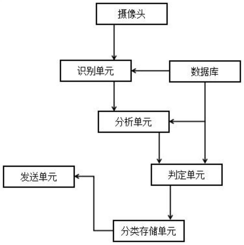
[0040] see Figure 1-2 As shown, the present invention is an Internet-based landform monitoring and management system, including a camera, an identification unit, a database, an analysis unit, a determination unit, a classification storage unit and a sending unit;

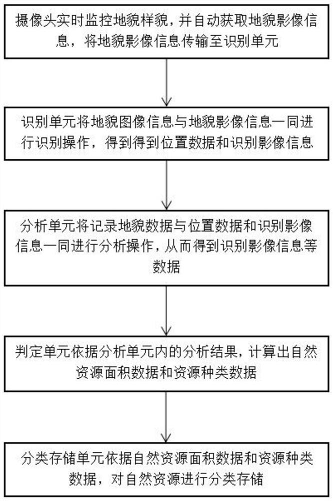
[0041] The user of the camera monitors the landscape appearance in real time, and automatically obtains landscape image information, and the camera is installed on the drone, and transmits...


PUM


Abstract

The invention discloses a landform monitoring and management system based on the Internet. The landform monitoring and management system comprises a camera, an identification unit, a database, an analysis unit, a judgment unit, a classified storage unit and a sending unit. The camera user monitors the landform and appearance in real time, obtains geomorphic video information automatically, and transmits the landform video information to an identification unit; geomorphic image information, natural resource image information and position data and shape data corresponding to the geomorphic imageinformation and the natural resource image information are stored in the database; the identification unit acquires geomorphic image information from a database, and the geomorphic image informationand the landform video information are subjected to identification operation together; through the arrangement of the classified storage unit, the types of natural resources on the surface of the earth are stored in a classified mode, and resource quantity sorting is carried out in different types, so that the resources are divided into first-class resource storage and second-class resource storage, the orderliness of storage is improved, workers can conveniently and rapidly search for the resources, time is saved, and the working efficiency is improved.

Description

technical field [0001] The invention relates to the technical field of unmanned aerial vehicle monitoring and management, in particular to an Internet-based landform monitoring and management system. Background technique [0002] Unmanned aircraft, referred to as "UAV", is an unmanned aircraft that is controlled by radio remote control equipment and its own program control device, or is completely or intermittently operated autonomously by an on-board computer. At present, it is widely used in aerial photography, agriculture, plant protection, micro selfie, express delivery, disaster relief, observation of wild animals, monitoring of infectious diseases, surveying and mapping, news reports, power inspection, disaster relief, film and television shooting, and romance creation. In addition to the use of drones themselves, developed countries are also actively expanding industry applications and developing drone technology. [0003] At present, in some fields that are difficul...

Claims


Application Information

Patent Timeline
IPC IPC(8): G06K9/00G06K9/62
CPCG06V20/13G06F18/22
Inventor 朱强
Owner 朱强
Why Eureka
Try Eureka