Real-time forest fire risk monitoring method based on remote sensing data

A technology for risk monitoring and remote sensing data, applied in the fields of spatiotemporal data mining and spatiotemporal prediction modeling, which can solve problems such as misjudgment and missed judgement, and achieve the effect of improving accuracy, real-time performance, and timely warning of wildfires and fires.

Active Publication Date: 2020-11-13
CHENGDU SIHAN TECH
View PDF8 Cites 0 Cited by
  • Summary
  • Abstract
  • Description
  • Claims
  • Application Information

AI Technical Summary

Problems solved by technology

[0003] The purpose of the present invention is to provide a real-time mountain fire risk monitoring method based on remote sensing data, which is used to solve the problem of misjudgment and missed judgment in the method of judging whether a pixel contains a fire point according to a selected threshold in the prior art

Method used


Image

  • Real-time forest fire risk monitoring method based on remote sensing data
  • Real-time forest fire risk monitoring method based on remote sensing data
  • Real-time forest fire risk monitoring method based on remote sensing data

Examples


Embodiment

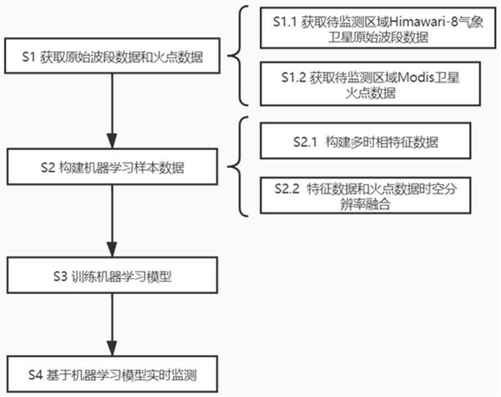
[0037] combined with figure 1 As shown, a real-time wildfire risk monitoring method based on remote sensing data, including:

[0038] S1 acquires original band data and fire point data

[0039] Download the L1 grid data of the area to be monitored from January 1, 2018 to the present from the Himawari-8 meteorological satellite. Since the Himawari-8 meteorological satellite currently has no fire point data, download the fire point data of the Modis satellite in the corresponding time period as the fire point mark;

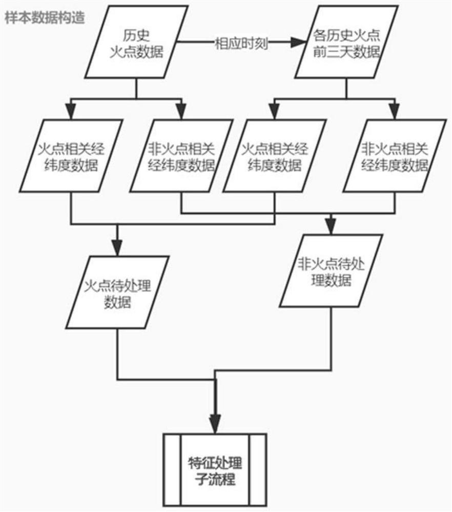
[0040] The fire point data field of Modis is the longitude, latitude and time information of the fire point, which needs to be matched in time and space according to the L1 grid data of Himawari-8 satellite. Data from two satellite sources can be kept at the same temporal and spatial resolution by neighbor matching. The amount of data after fusion is very huge, because more than 99.9% of the data has no fire point information, such extremely unbalanced data is not...


PUM


Abstract

The invention discloses a real-time forest fire risk monitoring method based on remote sensing data. The method comprises the steps: acquiring original waveband data and fire point data of a to-be-monitored area; constructing multi-temporal feature data; fusing the multi-temporal feature data and the fire point data based on time resolution and space resolution to obtain sample data; marking the multi-temporal feature data by adopting the training set and performing supervised binning; encoding to obtain an encoding result; performing classification learning by adopting logistic regression toobtain a logistic regression weight result; obtaining a machine learning model; monitoring in real time based on a machine learning model. According to the method disclosed in the invention, feature dialectics of the forest fire risk in two dimensions of time and space are constructed based on the wave band, the problem of poor learning effect of a machine learning model caused by few fire samplesin forest fire risk management and control is solved, the fire monitoring real-time performance is greatly improved, and forest fire early warning is more timely and accurate.

Description

technical field [0001] The invention relates to the technical fields of spatio-temporal data mining and spatio-temporal prediction modeling, in particular to a data-driven monitoring method for spatio-temporal data using machine learning technology, specifically, a real-time wildfire risk monitoring method based on remote sensing data. Background technique [0002] Since the 1970s, some scholars in the world have tried to use remote sensing technology to monitor the fire situation on the ground. Infrared and visible light band data will produce obvious changes, so as to obtain the perception of fire / non-fire. With the further development of remote sensing technology, we can obtain remote sensing information with higher temporal and spatial resolutions. Thanks to the vigorous development of big data related technologies, we can store, process and deeply mine massive remote sensing spatiotemporal data. . However, the traditional wildfire monitoring method, whether it is the ...

Claims


Application Information

Patent Timeline
Patent Type & Authority Applications(China)
IPC IPC(8): G06K9/00G06K9/62G06N20/00
CPCG06N20/00G06V20/13G06V20/188G06F18/24G06F18/214Y02A40/28
Inventor 王丹
Owner CHENGDU SIHAN TECH
Why Eureka
Try Eureka