
An Iterative Autonomous Navigation and Positioning Method Based on Coupling of Polarization Pose and Attitude Information

A technology of autonomous navigation and position and attitude information, applied in navigation, astronomical navigation, surveying and navigation, etc., can solve problems such as economic losses due to mistakes, satellite communication signal interference, performance failure, etc., and achieve good applicability, low device cost, and easy Realize the effect of the application

Active Publication Date: 2021-12-28
BEIHANG UNIV
View PDF14 Cites 0 Cited by
  • Summary
  • Abstract
  • Description
  • Claims
  • Application Information

AI Technical Summary

Problems solved by technology

However, with the widespread use of satellite navigation technology, in recent years, due to the interference, blocking, or even tampering of satellite communication signals, unpredictable errors and huge economic losses have been caused.
In 2018, Xi'an held a light show with 1374 UAV clusters. Due to directional interference, the performance failed and dozens of UAVs fell.
In 2019, due to the GPS interference equipment of a breeding farm, many flights in Harbin Airport frequently lost the GPS signal of the aircraft near it, and some flights had ADS-B system failures. These all warn us of the urgency of researching autonomous navigation technology
Existing methods have not achieved fully autonomous coupling attitude determination and positioning independent of GNSS and magnetic compass

Method used


Image

  • An Iterative Autonomous Navigation and Positioning Method Based on Coupling of Polarization Pose and Attitude Information
  • An Iterative Autonomous Navigation and Positioning Method Based on Coupling of Polarization Pose and Attitude Information
  • An Iterative Autonomous Navigation and Positioning Method Based on Coupling of Polarization Pose and Attitude Information

Examples


Embodiment Construction

[0053] The technical solutions in the embodiments of the present invention will be clearly and completely described below in conjunction with the accompanying drawings in the embodiments of the present invention. Obviously, the described embodiments are only part of the embodiments of the present invention, not all of them. Based on the embodiments of the present invention, all other embodiments obtained by persons of ordinary skill in the art without making creative efforts belong to the protection scope of the present invention.

[0054] The method of the invention is applicable to moving bodies such as global navigation satellite system denial or failure, magnetic interference, unmanned aerial vehicles, missiles, and ships.

[0055] According to one embodiment of the present invention, a polarization sensor with two polarization channels having an included angle of 45° is designed. During the experiment, one polarization acquisition channel is vertically directed to the zeni...


PUM


Abstract

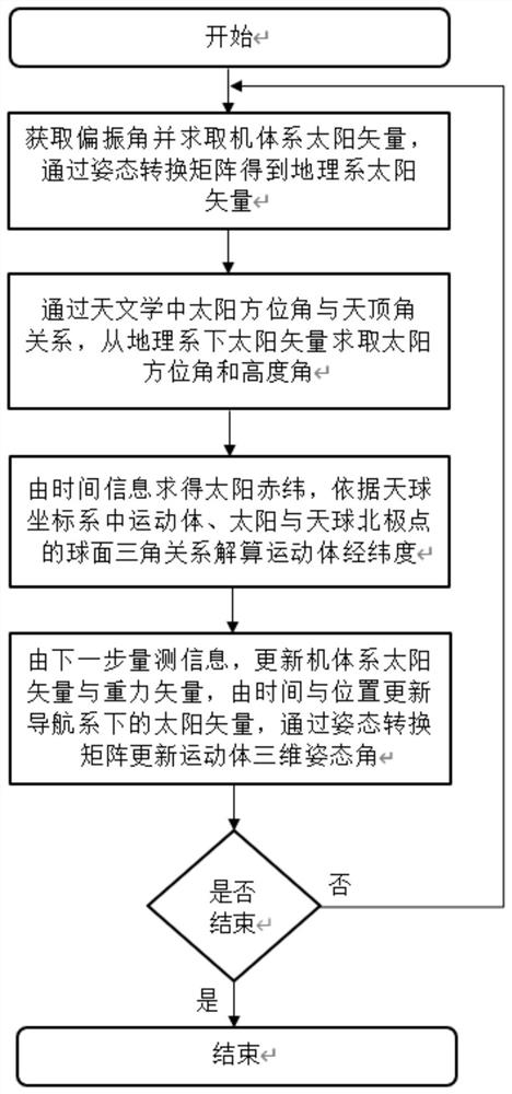
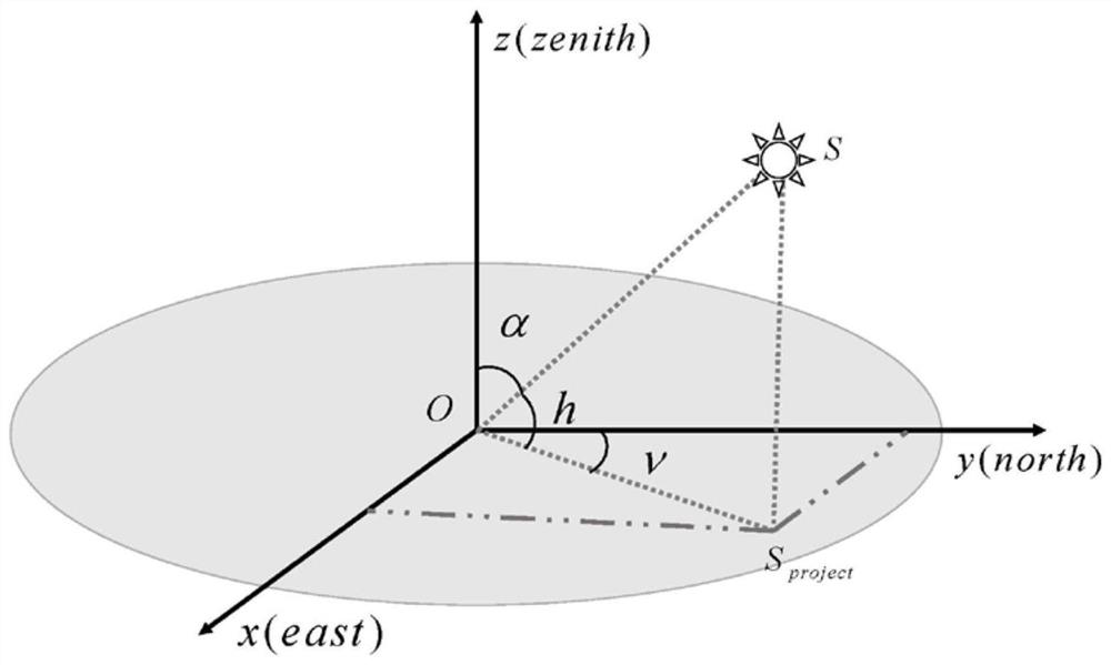
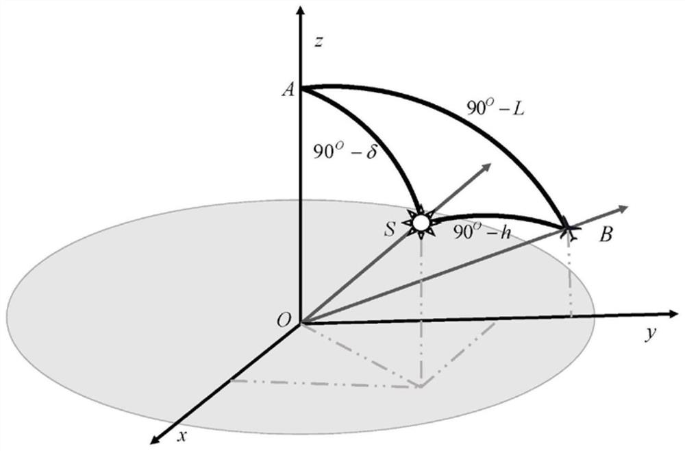
The invention relates to an iterative autonomous navigation and positioning method based on polarization pose information coupling. First, the polarization sensor measures the polarization angle and calculates the sun vector of the computer system, and converts it into the sun vector in the geographic coordinate system; then, from the geographic coordinate system The sun vector calculates the sun altitude and azimuth at this moment; calculates the sun's declination through time, and calculates the longitude and latitude of the moving body; uses the position and time to update the sun vector of the navigation system, and uses the new measurement information to update the sun vector under the machine system With the gravity vector, the three-dimensional attitude of the moving body is solved through the attitude transformation direction cosine matrix, and the two-step loop iteration of position update and attitude update is used to realize the concurrent calculation of the pose with polarization as the only external information source. This method uses polarization as the only external information source, and realizes the simultaneous calculation of position and attitude. It is applicable to the navigation of moving objects under satellite rejection and magnetic interference conditions, and the required sensors are low in cost, small in size, and easy to implement.

Description

technical field [0001] The invention relates to an iterative autonomous navigation and positioning method based on polarization pose information coupling. This method uses polarization as the only external information source, and realizes the independent position calculation and three-dimensional attitude calculation of the moving body under the conditions of GNSS rejection or failure and magnetic interference. The invention belongs to the field of autonomous positioning and navigation of moving bodies. Background technique [0002] At present, due to the mature technology and irreplaceable accuracy of satellite navigation, global satellite navigation systems (including GPS in the United States, BDS in China, GLONASS in Russia and GALILEO in the European Union) have become technologies that are widely relied on in the transportation and traffic fields. However, with the widespread use of satellite navigation technology, in recent years, satellite communication signals have ...

Claims


Application Information

Patent Timeline
Patent Type & Authority Patents(China)
IPC IPC(8): G01C21/02
CPCG01C21/025
Inventor 杨健张洁郭雷王岩王善澎
Owner BEIHANG UNIV
Learn More