Typhoon intensity remote sensing inversion method based on deep learning
A technology of remote sensing inversion and deep learning, applied in the field of remote sensing, can solve problems such as side effects, difficulty in finding the best channel combination for inversion of typhoon intensity, and uneven distribution of typhoon samples, achieving high inversion accuracy and solving side effects
- Summary
- Abstract
- Description
- Claims
- Application Information
AI Technical Summary
Problems solved by technology
Method used
Image
Examples
Embodiment Construction
[0027] In order to make the objects and advantages of the present invention clearer, the present invention will be specifically described below in conjunction with examples. It should be understood that the following words are only used to describe one or several specific implementation modes of the present invention, and do not strictly limit the protection scope of the specific claims of the present invention.
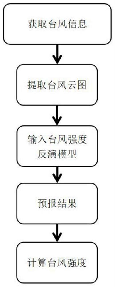
[0028] This embodiment takes the Sunflower 8 satellite as an example to illustrate the typhoon intensity remote sensing inversion method based on deep learning of the present invention. First, install python programming software on the user terminal, and need to be equipped with temsorflow-1.14.0, keras-2.2.4 dependencies Bag. Combine below figure 1 The present invention is described in detail:
[0029] Step 1) Determine the latitude and longitude of the typhoon center at the moment to be retrieved, and download the cloud image (spatial resolution 5km) of the Sunfl...
PUM
 Abstract
Description
Claims
Application Information
 - R&D
- Intellectual Property
- Life Sciences
- Materials
- Tech Scout
- Unparalleled Data Quality
- Higher Quality Content
- 60% Fewer Hallucinations
Browse by: Latest US Patents, China's latest patents, Technical Efficacy Thesaurus, Application Domain, Technology Topic, Popular Technical Reports.
© 2025 PatSnap. All rights reserved.Legal|Privacy policy|Modern Slavery Act Transparency Statement|Sitemap|About US| Contact US: help@patsnap.com


